Santana do Araguaia

Log in to your account

AroundUs is a community-driven map of interesting places, built by curious explorers like you. It grows with every review, story, and photo you share.
Connect to save your favorite spots, contribute locations, and create personalized routes.
Continue with Google
Continue with Apple
Continue with X
Continue with Facebook
Continue with email
By continuing, you accept our Terms and Conditions and our Privacy Policy
Create an account
Add to collection
Map
Suggest a change
Share

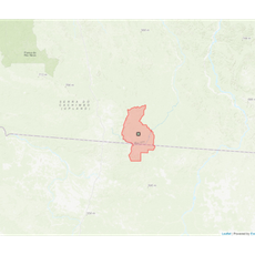
Santana do Araguaia, Municipality and administrative division in southern Pará, Brazil

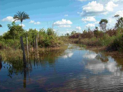
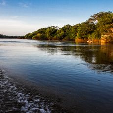
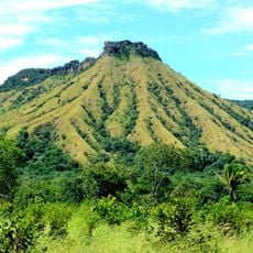
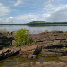
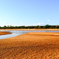
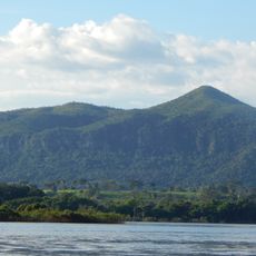
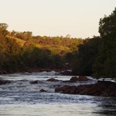
Santana do Araguaia is a municipality in southern Pará located near the Araguaia River, which forms a natural boundary in the region. The territory encompasses extensive areas where river landscapes and forest terrain shape the local geography.

The municipality was established on December 20, 1961, when the governor separated it from Conceição do Araguaia territory. This division created a new administrative entity in the southern part of the state.

The residents, known as araguaienses, maintain strong connections to local governance through digital platforms and community engagement initiatives.

The area is sparsely populated with considerable distances between settlements and limited urban infrastructure. Travel is easier during the dry season when roads and river crossings are more accessible.

The municipality sits at the southernmost boundary of Pará, forming a transition point between several states. This location makes it a geographical reference point for the broader region.

Location: Pará

Elevation above the sea: 160 m

Shares border with: Caseara, Cumaru do Norte, Pium, Santa Maria das Barreiras, Santa Terezinha, São Félix do Xingu, Vila Rica

GPS coordinates: -9.50500,-50.62500

Latest update: December 7, 2025 19:29

Photos
Reviews

Visited this place? Tap the stars to rate it and share your experience / photos with the community! Try now! You can cancel it anytime.

« Santana do Araguaia - Municipality and administrative division in southern Pará, Brazil » is provided by Around Us (aroundus.com). Images and texts are derived from Wikimedia project under a Creative Commons license. You are allowed to copy, distribute, and modify copies of this page, under the conditions set by the license, as long as this note is clearly visible.

Discover hidden gems everywhere you go!

From secret cafés to breathtaking viewpoints, skip the crowded tourist spots and find places that match your style. Our app makes it easy with voice search, smart filtering, route optimization, and insider tips from travelers worldwide. Download now for the complete mobile experience.

Around Us App Screenshot

A unique approach to discovering new places

Le Figaro

All the places worth exploring

France Info

A tailor-made excursion in just a few clicks

20 Minutes