Enable Location

We need your location to show you interesting places around you

Discover nearby places

Find interesting locations and hidden gems around you

Precise directions

Get accurate directions and distances to places

Your location is never shared with other users. It's only used when you tap the location button.

Mount Ossa

Log in to your account

Start exploring — it's free

Trusted by 60,659 travelers worldwide

Continue with Google
Continue with Apple
or

We will send you a code to connect

By continuing, you accept our Terms and Conditions and our Privacy Policy

Check your inbox

We've sent a pincode in your inbox. Please enter the code below.

Mount Ossa

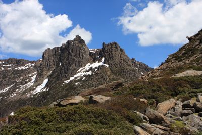
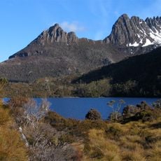
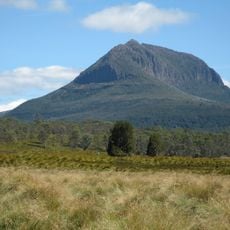
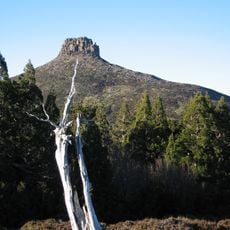
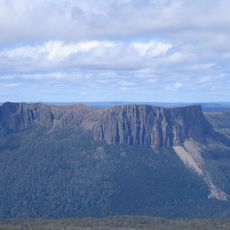
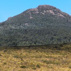
Mount Ossa, Mountain summit in Cradle Mountain-Lake St Clair National Park, Tasmania, Australia.

Description

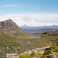
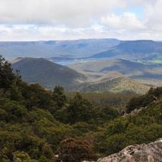
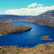
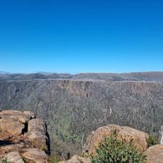
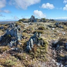
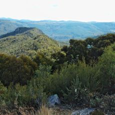
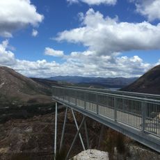
Mount Ossa is the highest peak in Tasmania's Pelion Range, located within Cradle Mountain-Lake St Clair National Park in the Central Highlands. From the summit, the view sweeps across forested valleys, alpine plateaus, and distant ranges that stretch toward the horizon.

History

Geologist Charles Gould named the peak in the 1860s, following the fashion of the time for classical Greek place names in Tasmania. Its status as the state's highest point was only confirmed through aerial survey methods decades later, when precise measurements resolved earlier uncertainty.

Culture

The peak sits on lands where Aboriginal peoples traveled and hunted for thousands of years, and you can feel the ancient connection to this high place when standing at the summit.

Practical

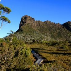
The climb begins at Pelion Gap where the trail is clearly marked and requires about three hours to reach the summit and return. The route crosses rocky ground and steep sections, so sturdy boots and basic fitness help make the walk safer and more comfortable.

Did you know?

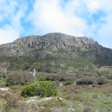
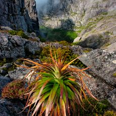
The rocky plateau near the summit supports alpine plants found nowhere else in Australia, adapted to the harsh weather and thin soil of this height. These slow-growing plants tell the story of a landscape shaped by exposure and cold, visible to hikers who look closely at the ground beneath their feet.

Location
Elevation above the sea
1,617 m
GPS coordinates
-41.87072,146.03297
Latest update
December 20, 2025 11:36

AroundUs brings together thousands of curated places, local tips, and hidden gems, enriched daily by 60,000 contributors worldwide. Discover all places nearby (Tasmania).

« Mount Ossa - Mountain summit in Cradle Mountain-Lake St Clair National Park, Tasmania, Australia » is provided by Around Us (aroundus.com). Images and texts are derived from Wikimedia project under a Creative Commons license. You are allowed to copy, distribute, and modify copies of this page, under the conditions set by the license, as long as this note is clearly visible.

Discover hidden gems everywhere you go!

From secret cafés to breathtaking viewpoints, skip the crowded tourist spots and find places that match your style. Our app makes it easy with voice search, smart filtering, route optimization, and insider tips from travelers worldwide. Download now for the complete mobile experience.

Around Us App Screenshot

A unique approach to discovering new places

Le Figaro

All the places worth exploring

France Info

A tailor-made excursion in just a few clicks

20 Minutes

Around Us
Travel Guide & Maps
Download

Send to your phone

QR Code
1

Open the camera app on your mobile.

2

Point at the QR code with your camera. A notification will appear.

3

Tap the notification to open the link.