Enable Location

We need your location to show you interesting places around you

Discover nearby places

Find interesting locations and hidden gems around you

Precise directions

Get accurate directions and distances to places

Your location is never shared with other users. It's only used when you tap the location button.

Mount Pelion East

Log in to your account

Start exploring — it's free

Trusted by 62,968 travelers worldwide

Continue with Google
Continue with Apple
or

We will send you a code to connect

By continuing, you accept our Terms and Conditions and our Privacy Policy

Check your inbox

We've sent a pincode in your inbox. Please enter the code below.

Mount Pelion East
Discussion Reviews 1 Photos
2.4k Popularity

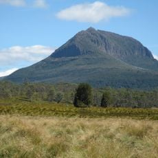
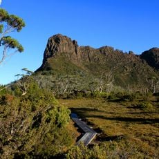
Mount Pelion East, Mountain summit in Cradle Mountain-Lake St Clair National Park, Tasmania, Australia

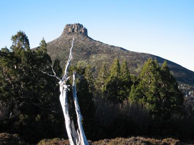
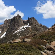
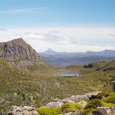
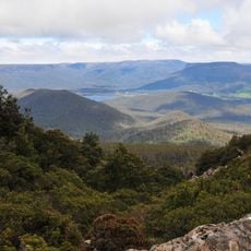
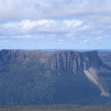
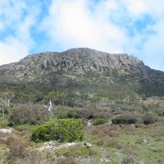
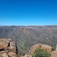
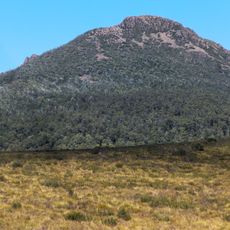
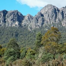
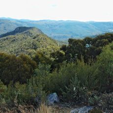
Mount Pelion East rises to 1,486 meters (4,876 feet) above sea level with a distinctive spire-like shape formed through glacial erosion of dolerite rock. The summit sits within the national park's high country and overlooks surrounding peaks and valleys from its exposed top.

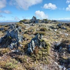
The mountain stands as a testament to Tasmania's geological evolution, with its dolerite composition dating back to the Jurassic period around 185 million years ago. These ancient rocks were later sculpted into their distinctive shape through ice age processes during more recent glacial cycles.

The mountain holds deep connections to Tasmanian Aboriginal communities who have maintained spiritual and cultural relationships with this land for generations. These ties shape how visitors experience and respect the place today.

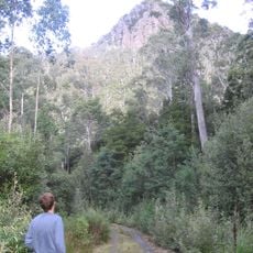
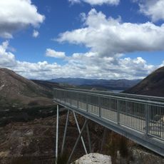
The summit can be accessed via a side track from the Overland Track, with the nearest base at Pelion Hut requiring advance booking from November to April. Visitors should be prepared for changing weather and windy conditions at the top, bringing warm layers for protection.

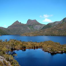
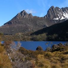
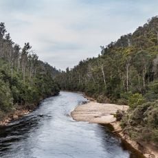
From this summit you get clear views of Mount Ossa, Tasmania's highest peak, which stands out impressively from this vantage point. The eastern slopes mark the boundary of the Murchison River catchment, revealing an important hydrological feature of the region.

The community of curious travelers

AroundUs brings together thousands of curated places, local tips, and hidden gems, enriched daily by 60,000 contributors worldwide.

Start exploring
GPS coordinates
-41.85723,146.06762
Latest update
December 13, 2025 11:48
Reviews
Share your experience

No review yet

Discussions
Start a discussion...

No discussion yet

« Mount Pelion East - Mountain summit in Cradle Mountain-Lake St Clair National Park, Tasmania, Australia » is provided by Around Us (aroundus.com). Images and texts are derived from Wikimedia project under a Creative Commons license. You are allowed to copy, distribute, and modify copies of this page, under the conditions set by the license, as long as this note is clearly visible.

Discover hidden gems everywhere you go!

From secret cafés to breathtaking viewpoints, skip the crowded tourist spots and find places that match your style. Our app makes it easy with voice search, smart filtering, route optimization, and insider tips from travelers worldwide. Download now for the complete mobile experience.

Around Us App Screenshot

A unique approach to discovering new places

Le Figaro

All the places worth exploring

France Info

A tailor-made excursion in just a few clicks

20 Minutes

Around Us
Travel Guide & Maps
Download

Send to your phone

QR Code
1

Open the camera app on your mobile.

2

Point at the QR code with your camera. A notification will appear.

3

Tap the notification to open the link.