Mole Creek Karst National Park
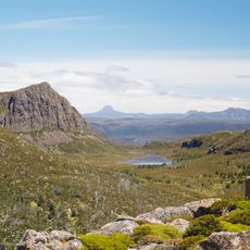
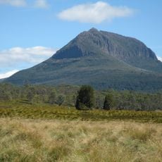
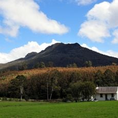
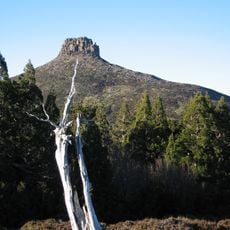
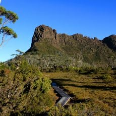
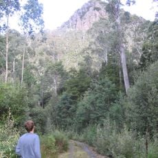
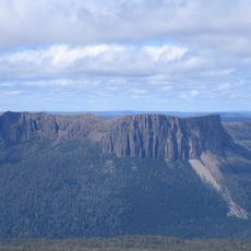
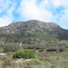
Mole Creek Karst National Park, Nature reserve in Tasmania, Australia
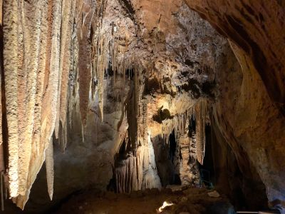
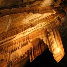
Mole Creek Karst National Park is a nature reserve in Tasmania with over 300 caves set in limestone bedrock. These underground systems contain flowing streams, hanging stalactites, rising stalagmites, and naturally formed stone columns.
The area was originally inhabited by Aboriginal peoples who established trade routes before becoming an official national park in 1939. This transition marked a shift from traditional land to a protected space accessible to the public.
Local guides share knowledge about the rock formations and natural processes as visitors walk through the underground passages. These tours connect people with the geological story of the landscape in a hands-on way.
To visit the caves, book a tour in advance and bring a park pass with you. The spring and autumn months offer the most comfortable conditions underground, where temperatures stay cool and steady.
Marakoopa Cave holds one of the largest glow-worm populations found in any publicly accessible Australian cave. These small luminescent insects create a soft, natural light display that fills the underground chambers in the darkness.
Location: Mayberry
Inception: August 16, 1939
Operator: Tasmania Parks & Wildlife Service
Address: 330 Mayberry Rd, Mayberry TAS 7304, Australia
Phone: +61363635182
Website: https://parks.tas.gov.au/explore-our-parks/mole-creek-karst-national-park
GPS coordinates: -41.58477,146.31888
Latest update: December 6, 2025 17:43
Tasmania draws visitors who want to experience both raw nature and deep history. This Australian island rewards exploration at every turn: gorges sculpted by water, beaches with white sand, mountains that rise into the clouds, and forests that look ancient and untouched. Mountain lakes and rivers...
Cradle Mountain
32.5 km
Mount Ossa
39.7 km
Cradle-Mountain-Lake-St.-Clair-Nationalpark
43.3 km
Walls of Jerusalem National Park
32 km
Liffey Falls
39.1 km
Central Plateau Conservation Area
36.4 km
Mount Roland Conservation Area
14.1 km
Mount Pelion West
39.5 km
Quamby Bluff
32.4 km
Victoria Bridge, Devonport
43.8 km
Mount Pelion East
36.8 km
The Acropolis
44.5 km
Mother Cummings Peak
19.9 km
Cathedral Mountain
37.9 km
Gunns Plains Cave
41.4 km
Devils@cradle
32.2 km
Ironstone Mountain
19.3 km
Artillery Knob
29.9 km
Quamby Bluff Forest Reserve
32.6 km
British Hotel
28.6 km
Devil Gullets Lookout
9.3 km
Brewery Knob
34.5 km
Round Mountain lookout
16.6 km
29 West Church Street, Deloraine
28.6 km
Mount Roland
14.4 km
Forth River, Tasmania
19.9 km
Sheffield church, Tasmania
22.3 km
Countryside Tasmania
28.5 kmVisited this place? Tap the stars to rate it and share your experience / photos with the community! Try now! You can cancel it anytime.
Discover hidden gems everywhere you go!
From secret cafés to breathtaking viewpoints, skip the crowded tourist spots and find places that match your style. Our app makes it easy with voice search, smart filtering, route optimization, and insider tips from travelers worldwide. Download now for the complete mobile experience.
A unique approach to discovering new places❞
— Le Figaro
All the places worth exploring❞
— France Info
A tailor-made excursion in just a few clicks❞
— 20 Minutes