Devil Gullets Lookout, Scenic viewpoint in Central Plateau, Tasmania, Australia.
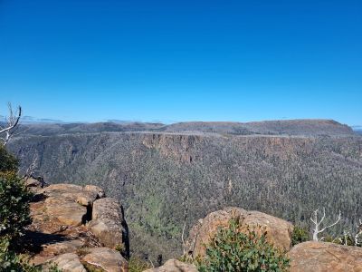
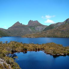
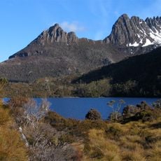
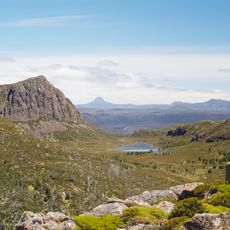
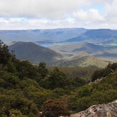
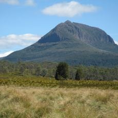
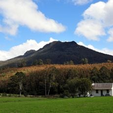
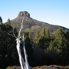
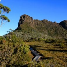
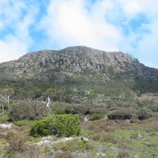
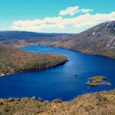
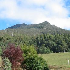
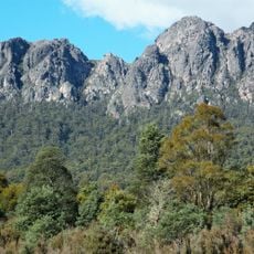
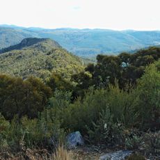
Devil Gullets Lookout is a scenic viewpoint situated on a dolerite cliff in Tasmania's Central Plateau, featuring a raised boardwalk platform at the edge of a sheer rock face. The location overlooks the Fisher River valley with views extending toward Cradle Mountain and the surrounding alpine terrain.
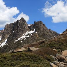
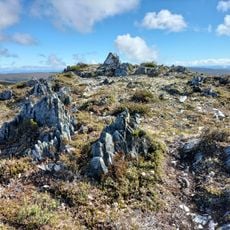
The landscape formed over millions of years ago when Tasmania separated from the ancient supercontinent of Gondwana and glacial activity shaped the plateau. Since that distant time, the terrain has remained relatively unchanged, preserving this ancient alpine environment.
The Central Plateau Conservation Area maintains this alpine region without human development, representing Tasmania's commitment to natural land preservation.
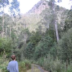
The viewpoint is accessible via a short raised boardwalk from the parking area, making it straightforward for most visitors. No facilities are available on-site, so bring water and weatherproof clothing as alpine conditions can change rapidly.
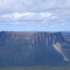
On clear days, visitors can see Mount Ossa, Tasmania's highest peak, and the dramatic rock formations of the Walls of Jerusalem in the distance. This combination of sweeping views across multiple notable landmarks makes each visit feel different depending on visibility and season.
Location: Central Plateau
Address: Devils Gullet Lookout Track, Central Plateau TAS 7304, Australia
Website: https://tasmania.com/things-to-do/best-views-and-lookouts/devils-gullet-lookout
GPS coordinates: -41.66801,146.32309
Latest update: December 6, 2025 19:05
Tasmania draws visitors who want to experience both raw nature and deep history. This Australian island rewards exploration at every turn: gorges sculpted by water, beaches with white sand, mountains that rise into the clouds, and forests that look ancient and untouched. Mountain lakes and rivers...
Cradle Mountain
31 km
Mount Ossa
33 km
Cradle-Mountain-Lake-St.-Clair-Nationalpark
37.3 km
Walls of Jerusalem National Park
23 km
Liffey Falls
36.8 km
Central Plateau Conservation Area
28.3 km
Mount Roland Conservation Area
23.3 km
Mount Pelion West
34 km
Quamby Bluff
31.2 km
Mole Creek Karst National Park
9.3 km
Victoria Bridge, Devonport
53 km
Mount Pelion East
29.9 km
The Acropolis
36.8 km
Mother Cummings Peak
17.6 km
Cathedral Mountain
30.2 km
Gunns Plains Cave
49.2 km
Devils@cradle
33.6 km
Ironstone Mountain
13.7 km
Artillery Knob
28.7 km
Quamby Bluff Forest Reserve
31.2 km
British Hotel
31.8 km
Brewery Knob
34.2 km
Mount Roland
23.5 km
Round Mountain lookout
23.9 km
29 West Church Street, Deloraine
31.8 km
Forth River, Tasmania
27 km
Sheffield church, Tasmania
31.5 km
Countryside Tasmania
36.1 kmVisited this place? Tap the stars to rate it and share your experience / photos with the community! Try now! You can cancel it anytime.
Discover hidden gems everywhere you go!
From secret cafés to breathtaking viewpoints, skip the crowded tourist spots and find places that match your style. Our app makes it easy with voice search, smart filtering, route optimization, and insider tips from travelers worldwide. Download now for the complete mobile experience.
A unique approach to discovering new places❞
— Le Figaro
All the places worth exploring❞
— France Info
A tailor-made excursion in just a few clicks❞
— 20 Minutes