Chest opened
+${chestReward.xp} XP
Explorer
NOUVEAU ×${chestReward.collectible.quantity}
tapez pour fermer

See the monuments around you in AR Open chests in the app

Around Us is built for your phone — point your camera at the streets and discover the monuments and places around you in augmented reality. Around Us is built for your phone — chests unlock when you walk, explore and capture nearby places.

Enable Location

We need your location to show you interesting places around you

Discover nearby places

Find interesting locations and hidden gems around you

Precise directions

Get accurate directions and distances to places

Your location is never shared with other users. It's only used when you tap the location button.

Log in to your account

Start exploring — it's free

Trusted by 81,220 travelers worldwide

Continue with Google
Continue with Apple
or

We will send you a code to connect

By continuing, you accept our Terms and Conditions and our Privacy Policy

Check your inbox

We've sent a pincode in your inbox. Please enter the code below.

Henderson Field
Discussion Reviews Photo
36.8k Popularity

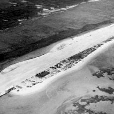
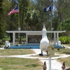
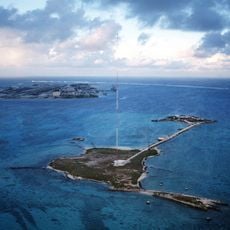
Henderson Field, Emergency landing airfield on Sand Island, Midway Atoll, United States.

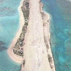
Henderson Field is an emergency airfield on Sand Island in the Midway Atoll with a single runway for aircraft needing to land unexpectedly. The facility sits just above sea level and is managed by the Department of the Interior.

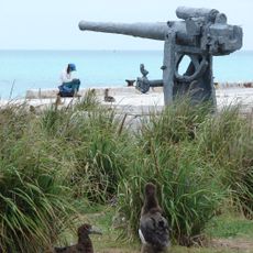
The airfield was built in 1941 and named after Major Lofton R. Henderson, who died during the Battle of Midway in 1942. The location served as a base for aircraft operations throughout the Pacific War.

The airfield marks the location where American forces stationed aircraft that participated in the Pacific theater during World War II.

Flight operations occur mainly at night between November and June to protect nesting albatrosses in the area. Visitors should expect these seasonal restrictions when planning to see aircraft activity.

The airfield serves as a constant emergency diversion point for aircraft crossing the Pacific under ETOPS regulations. This role makes it a critical safety location even though it rarely sees active use.

The community of curious travelers

AroundUs brings together thousands of curated places, local tips, and hidden gems, enriched daily by 60,000 contributors worldwide.
Start exploring
Location
Elevation above the sea
5 m
Operator
US Department of the Interior
GPS coordinates
28.20139,-177.38139
Latest update
December 17, 2025 10:40
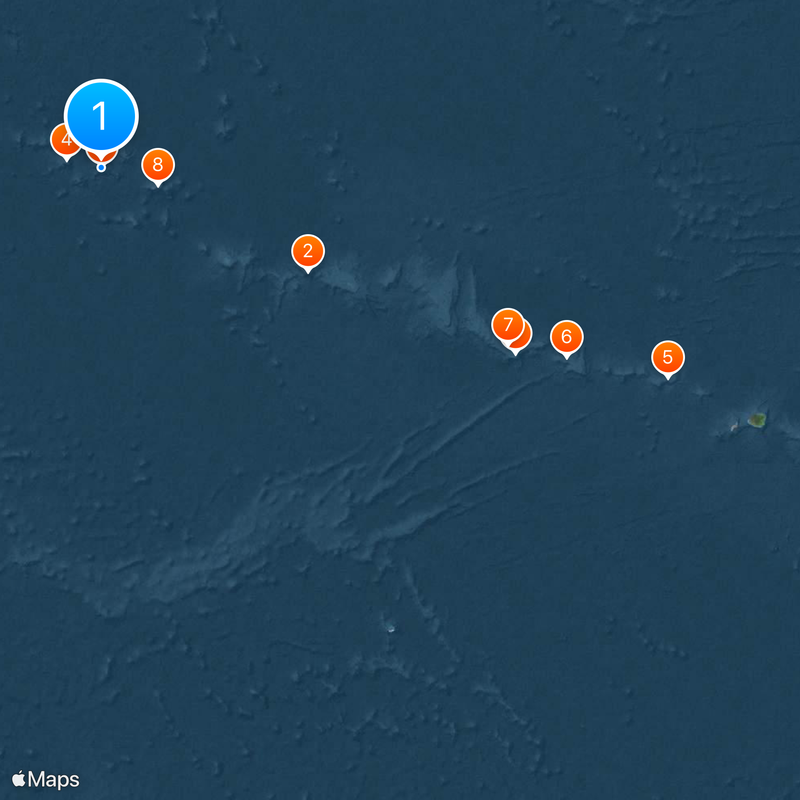
Around this place
Papahānaumokuākea Marine National Monument
United States of America

Papahānaumokuākea Marine National Monument

14025.5 km
French Frigate Shoals
United States of America

French Frigate Shoals

1238.2 km
Kure Atoll
United States of America

Kure Atoll

96.3 km
Nihoa
United States of America

Nihoa

1652.1 km
Necker Island
United States of America

Necker Island

1369.4 km
Tern Island
United States of America

Tern Island

1209.5 km
Pearl and Hermes Atoll
United States of America

Pearl and Hermes Atoll

157 km
Midway Atoll National Wildlife Refuge
United States of America

Midway Atoll National Wildlife Refuge

3.5 km
World War II Facilities at Midway
United States of America

World War II Facilities at Midway

3.1 km
Tanager Peak
United States of America

Tanager Peak

1652.7 km
United States of America

Midway Atoll

1.9 km
United States of America

Hawaiian Islands National Wildlife Refuge

999 km
Sand Island
United States of America

Sand Island

1509.2 km
Kamalino Beach
United States of America

Kamalino Beach

1865.7 km
Puʻuwai Beach
United States of America

Puʻuwai Beach

1866 km
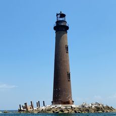
Sand Island Light
United States of America

Sand Island Light

1.2 km
United States of America

Pacific Remote Islands Marine National Monument

1512.3 km
United States of America

Keawanui Beach

1870.4 km
United States of America

Kiʻekiʻe Beach

1865.6 km
United States of America

Johnston Atoll National Wildlife Refuge

1512.2 km
United States of America

Kauwaha Beach

1868.5 km
Nonopapa Beach
United States of America

Nonopapa Beach

1865.6 km
United States of America

Northwestern Hawaiian Islands Marine National Monument

3 km

Gin Island

1226.9 km

Round Island

1216.6 km
United States of America

Derby's Beach

1651.9 km
United States of America

Lookout Platform

1651.5 km
United States of America

Anchor

2.1 km
Show the full map
Reviews
Share your experience

No review yet

Discussions
Start a discussion...

No discussion yet

« Henderson Field - Emergency landing airfield on Sand Island, Midway Atoll, United States » is provided by Around Us (aroundus.com). Images and texts are derived from Wikimedia project under a Creative Commons license. You are allowed to copy, distribute, and modify copies of this page, under the conditions set by the license, as long as this note is clearly visible.

Discover hidden gems everywhere you go!

From secret cafés to breathtaking viewpoints, skip the crowded tourist spots and find places that match your style. Our app makes it easy with voice search, smart filtering, route optimization, and insider tips from travelers worldwide. Download now for the complete mobile experience.

Around Us App Screenshot

A unique approach to discovering new places

Le Figaro

All the places worth exploring

France Info

A tailor-made excursion in just a few clicks

20 Minutes

Around Us
Travel Guide & Maps
Download

Send to your phone

QR Code
1

Open the camera app on your mobile.

2

Point at the QR code with your camera. A notification will appear.

3

Tap the notification to open the link.