Enable Location

We need your location to show you interesting places around you

Discover nearby places

Find interesting locations and hidden gems around you

Precise directions

Get accurate directions and distances to places

Your location is never shared with other users. It's only used when you tap the location button.

Midway Atoll National Wildlife Refuge

Log in to your account

Start exploring — it's free

Trusted by 63,970 travelers worldwide

Continue with Google
Continue with Apple
or

We will send you a code to connect

By continuing, you accept our Terms and Conditions and our Privacy Policy

Check your inbox

We've sent a pincode in your inbox. Please enter the code below.

Midway Atoll National Wildlife Refuge
Discussion Reviews 1 Photos
3.2k Popularity

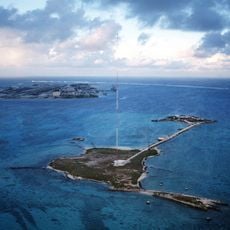
Midway Atoll National Wildlife Refuge, National Wildlife Refuge in Papahānaumokuākea Marine National Monument, United States.

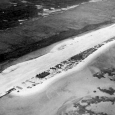
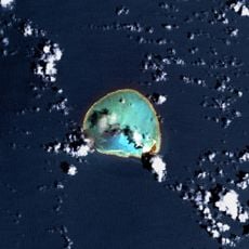
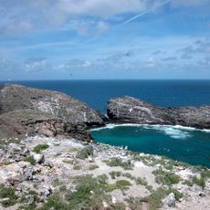
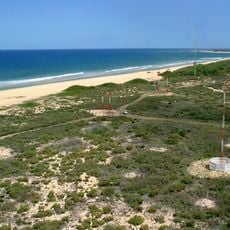
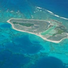
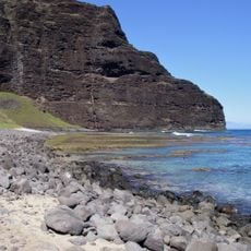
Midway Atoll National Wildlife Refuge consists of three small islands surrounded by coral reefs that shelter millions of seabirds, sea turtles, and marine mammals. The islands sit within a larger marine ecosystem that supports diverse aquatic and terrestrial species.

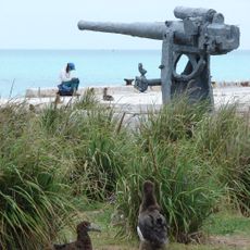
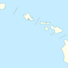
The United States claimed Midway Atoll in 1859, establishing it as their first territorial possession beyond the continental mainland. The atoll later served strategic military purposes during the 20th century before being designated as a protected refuge.

The atoll holds spiritual importance in Hawaiian culture as Kuaihelani, linking the natural world with ancestral beliefs and practices. Visitors can sense this connection through sacred sites and traditional places woven into the landscape.

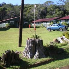
Visiting is severely restricted and limited to official research and conservation activities, with most trips requiring advance arrangement and special authorization. Conditions can change quickly on the remote atoll, so visitors should prepare for variable weather and ocean conditions.

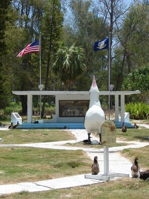
The atoll hosts the world's largest Laysan albatross colony, supporting approximately two million birds representing nineteen different species. These vast bird gatherings shape the landscape and make the atoll one of the most important places for seabird populations worldwide.

The community of curious travelers

AroundUs brings together thousands of curated places, local tips, and hidden gems, enriched daily by 60,000 contributors worldwide.

Start exploring
Location
GPS coordinates
28.23133,-177.36950
Latest update
December 12, 2025 09:04
Around this place
Papahānaumokuākea Marine National Monument
United States of America

Papahānaumokuākea Marine National Monument

626.1 km
French Frigate Shoals
United States of America

French Frigate Shoals

1238.4 km
Kure Atoll
United States of America

Kure Atoll

96.7 km
Nā Pali Coast State Park
United States of America

Nā Pali Coast State Park

1905.7 km
Waimea Canyon State Park
United States of America

Waimea Canyon State Park

1909.4 km
Kalalau Trail
United States of America

Kalalau Trail

1907 km
Nihoa
United States of America

Nihoa

1651.9 km
Hanakapiai Beach
United States of America

Hanakapiai Beach

1908.7 km
Necker Island
United States of America

Necker Island

1369.4 km
Tern Island
United States of America

Tern Island

1209.6 km
WWVH
United States of America

WWVH

1903.4 km
Pearl and Hermes Atoll
United States of America

Pearl and Hermes Atoll

156.9 km
Polihale State Park
United States of America

Polihale State Park

1899.7 km
Haʻena State Park
United States of America

Haʻena State Park

1909.3 km
Hanakapiai Falls
United States of America

Hanakapiai Falls

1910 km
United States of America

Makana

1909.9 km
Limahuli Garden and Preserve
United States of America

Limahuli Garden and Preserve

1910.2 km
World War II Facilities at Midway
United States of America

World War II Facilities at Midway

4 km
Koke'e State Park
United States of America

Koke'e State Park

1906.5 km
Civilian Conservation Corps Camp in Koke'e State Park
United States of America

Civilian Conservation Corps Camp in Koke'e State Park

1906.1 km
Camp Sloggett
United States of America

Camp Sloggett

1907.3 km
Tanager Peak
United States of America

Tanager Peak

1652.5 km
Nualolo Kai Beach
United States of America

Nualolo Kai Beach

1901.3 km
Sand Island
United States of America

Sand Island

1511.3 km
Kahuama‘a Flat
United States of America

Kahuama‘a Flat

1907.5 km
Miloliʻi Beach
United States of America

Miloliʻi Beach

1900 km
Sand Island Light
United States of America

Sand Island Light

2.3 km
Maniniholo Dry Cave
United States of America

Maniniholo Dry Cave

1911.3 km
Show the full map
Reviews
Share your experience

No review yet

Discussions
Start a discussion...

No discussion yet

« Midway Atoll National Wildlife Refuge - National Wildlife Refuge in Papahānaumokuākea Marine National Monument, United States » is provided by Around Us (aroundus.com). Images and texts are derived from Wikimedia project under a Creative Commons license. You are allowed to copy, distribute, and modify copies of this page, under the conditions set by the license, as long as this note is clearly visible.

Discover hidden gems everywhere you go!

From secret cafés to breathtaking viewpoints, skip the crowded tourist spots and find places that match your style. Our app makes it easy with voice search, smart filtering, route optimization, and insider tips from travelers worldwide. Download now for the complete mobile experience.

Around Us App Screenshot

A unique approach to discovering new places

Le Figaro

All the places worth exploring

France Info

A tailor-made excursion in just a few clicks

20 Minutes

Around Us
Travel Guide & Maps
Download

Send to your phone

QR Code
1

Open the camera app on your mobile.

2

Point at the QR code with your camera. A notification will appear.

3

Tap the notification to open the link.