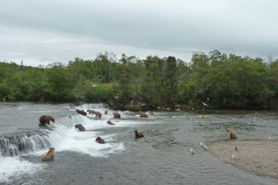
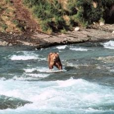
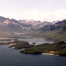
Brooks Falls, Waterfall in Katmai National Park, Alaska.
Brooks Falls is a waterfall in Katmai National Park that drops 1.8 meters over volcanic rock, splitting into several channels as it descends. Salmon navigate through these channels each year during their upstream migration to spawn.
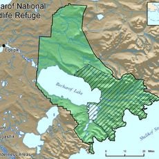
The area gained protected status in 1980 when Katmai National Park was established to safeguard the region's natural features and animal populations. This designation fundamentally changed how the site has been managed and monitored since then.
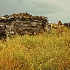
The falls have long been central to the life of the local Native communities, who developed ways to harvest the passing salmon without disrupting the ecosystem. People from the region still view this location as part of their cultural connection to the land and waters.
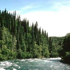
The only way to reach the falls is by floatplane or boat, as no road access exists to this remote part of the park. Visitors should prepare for rugged conditions and exercise caution, especially during peak bear season.
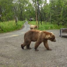
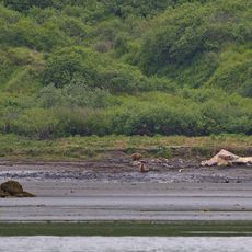
The location draws dozens of bears during summer months as they gather to feed on the salmon, offering a rare glimpse of predators hunting in their natural setting. Such concentrations of bears hunting together are uncommon elsewhere in the world.
Location: Alaska
Height: 1.8 m
Website: https://nps.gov/katm/learn/photosmultimedia/brown-bear-salmon-cam-brooks-falls.htm
GPS coordinates: 58.55500,-155.79154
Latest update: December 6, 2025 16:03
Alaska offers landscapes that stretch far from the cities, in areas where nature is in control. You will find glaciers coming down from the mountains, large volcanoes, sandy dunes, hot springs emerging from the ground, and waterfalls rushing down the cliffs. Each area shows how the land was shaped...
Novarupta
49 km
Mount Katmai
57.6 km
Fourpeaked Mountain
127 km
Fure's Cabin
24.7 km
McNeil River
93.9 km
Alagnak River
65.7 km
Mount Griggs
45.8 km
Ukinrek Maars
90.9 km
Trident Volcano
53.8 km
Naknek River
54.9 km
Becharof National Wildlife Refuge
67.4 km
Mount Martin
49.9 km
Mount Mageik
51 km
Mount Denison
79.5 km
Amalik Bay Archeological District
94.2 km
Mount Kukak
84.2 km
Old Savonoski Site
31.6 km
Mount Steller
82.7 km
Snowy Mountain
69 km
Brooks River Archeological District
746 m
Elevation of Holy Cross Church
72.4 km
Brooks Camp Boat House
935 m
Fourpeaked Glacier
134.1 km
Brooks River Historic Ranger Station
922 m
St. John the Baptist Chapel
73.1 km
Savonoski River
52.9 km
Brooks Camp Visitor Center
784 m
Little Beach
100.9 kmVisited this place? Tap the stars to rate it and share your experience / photos with the community! Try now! You can cancel it anytime.
Discover hidden gems everywhere you go!
From secret cafés to breathtaking viewpoints, skip the crowded tourist spots and find places that match your style. Our app makes it easy with voice search, smart filtering, route optimization, and insider tips from travelers worldwide. Download now for the complete mobile experience.
A unique approach to discovering new places❞
— Le Figaro
All the places worth exploring❞
— France Info
A tailor-made excursion in just a few clicks❞
— 20 Minutes