Chest opened
+${chestReward.xp} XP
Explorer
NOUVEAU ×${chestReward.collectible.quantity}
tapez pour fermer

See the monuments around you in AR Open chests in the app

Around Us is built for your phone — point your camera at the streets and discover the monuments and places around you in augmented reality. Around Us is built for your phone — chests unlock when you walk, explore and capture nearby places.

Enable Location

We need your location to show you interesting places around you

Discover nearby places

Find interesting locations and hidden gems around you

Precise directions

Get accurate directions and distances to places

Your location is never shared with other users. It's only used when you tap the location button.

Ukinrek Maars

Log in to your account

Start exploring — it's free

Trusted by 85,422 travelers worldwide

Continue with Google
Continue with Apple
or

We will send you a code to connect

By continuing, you accept our Terms and Conditions and our Privacy Policy

Check your inbox

We've sent a pincode in your inbox. Please enter the code below.

Ukinrek Maars
Discussion Reviews 1 Photos
2.9k Popularity

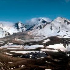
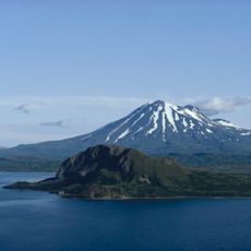
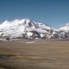
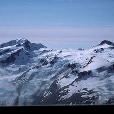
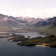
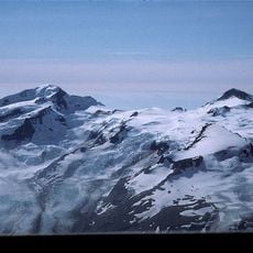
Ukinrek Maars, Volcanic crater system in Lake and Peninsula Borough, Alaska

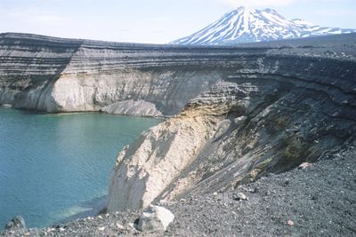
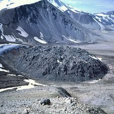
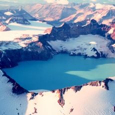
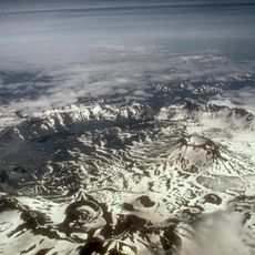
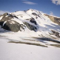
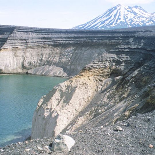
Ukinrek Maars is a volcanic crater system in Lake and Peninsula Borough, Alaska, consisting of two crater formations of different sizes. The eastern crater measures approximately 300 meters across, while the western crater is smaller and contains a roughly 49-meter-high lava dome that sits within its crater lake.

This crater system formed during an intense volcanic eruption that lasted ten days in March and April 1977. This was the first recorded volcanic activity at this location and represented a major geological event for the region.

The name Ukinrek comes from an indigenous language and means Two Holes, directly describing the two crater formations. Local communities have long used this name to reference the distinctive dual craters in their territory.

This site is located in a remote region of Alaska and is difficult to access, so careful planning is essential before visiting. Visitors should prepare for rugged conditions and limited infrastructure, and seek local guides or expert assistance.

The eruption ejected roughly 26 million cubic meters of tephra and produced around 900,000 cubic meters of lava. These massive volumes of volcanic material created clearly visible layers in the surrounding landscape that reveal the power of this sudden event.

The community of curious travelers

AroundUs brings together thousands of curated places, local tips, and hidden gems, enriched daily by 60,000 contributors worldwide.
Start exploring
Elevation above the sea
91 m
GPS coordinates
57.83170,-156.51000
Latest update
August 30, 2026 12:41
Around this place
Novarupta
United States of America

Novarupta

57.8 mi
Mount Katmai
United States of America

Mount Katmai

64.7 mi
Brooks Falls
United States of America

Brooks Falls

56.5 mi
Aniakchak National Monument and Preserve
United States of America

Aniakchak National Monument and Preserve

87.7 mi
Fure's Cabin
United States of America

Fure's Cabin

70.1 mi
Mount Chiginagak
United States of America

Mount Chiginagak

51.5 mi
Mount Griggs
United States of America

Mount Griggs

63 mi
Trident Volcano
United States of America

Trident Volcano

58.6 mi
Naknek River
United States of America

Naknek River

59.3 mi
Becharof National Wildlife Refuge
United States of America

Becharof National Wildlife Refuge

15.1 mi
United States of America

Becharof Wilderness

32 mi
Mount Martin
United States of America

Mount Martin

48.3 mi
Mount Mageik
United States of America

Mount Mageik

52.4 mi
Mount Denison
United States of America

Mount Denison

85.4 mi
Amalik Bay Archeological District
United States of America

Amalik Bay Archeological District

78.4 mi
Old Savonoski Site
United States of America

Old Savonoski Site

64.7 mi
Mount Steller
United States of America

Mount Steller

87.8 mi
Snowy Mountain
United States of America

Snowy Mountain

75.2 mi
Brooks River Archeological District
United States of America

Brooks River Archeological District

56.3 mi
Ugashik River
United States of America

Ugashik River

32.1 mi
Elevation of Holy Cross Church
United States of America

Elevation of Holy Cross Church

63.7 mi
Brooks Camp Boat House
United States of America

Brooks Camp Boat House

56.9 mi
Brooks River Historic Ranger Station
United States of America

Brooks River Historic Ranger Station

56.8 mi
St. John the Baptist Chapel
United States of America

St. John the Baptist Chapel

64.6 mi
St. Nicholas Church
United States of America

St. Nicholas Church

75.4 mi
Savonoski River
United States of America

Savonoski River

78.3 mi
Brooks Camp Visitor Center
United States of America

Brooks Camp Visitor Center

56.8 mi
Brooks Camp Campground
United States of America

Brooks Camp Campground

56.8 mi
Show the full map
Reviews
Share your experience

No review yet

Discussions
Start a discussion...

No discussion yet

« Ukinrek Maars - Volcanic crater system in Lake and Peninsula Borough, Alaska » is provided by Around Us (aroundus.com). Images and texts are derived from Wikimedia project under a Creative Commons license. You are allowed to copy, distribute, and modify copies of this page, under the conditions set by the license, as long as this note is clearly visible.

Discover hidden gems everywhere you go!

From secret cafés to breathtaking viewpoints, skip the crowded tourist spots and find places that match your style. Our app makes it easy with voice search, smart filtering, route optimization, and insider tips from travelers worldwide. Download now for the complete mobile experience.
Around Us App Screenshot

A unique approach to discovering new places

Le Figaro

All the places worth exploring

France Info

A tailor-made excursion in just a few clicks

20 Minutes

Around Us
Travel Guide & Maps
Download

Send to your phone

QR Code
1

Open the camera app on your mobile.

2

Point at the QR code with your camera. A notification will appear.

3

Tap the notification to open the link.