Aniakchak National Monument and Preserve

Log in to your account

AroundUs is a community-driven map of interesting places, built by curious explorers like you. It grows with every review, story, and photo you share.
Connect to save your favorite spots, contribute locations, and create personalized routes.
Continue with Google
Continue with Apple
Continue with X
Continue with Facebook
Continue with email
By continuing, you accept our Terms and Conditions and our Privacy Policy
Create an account

Aniakchak National Monument and Preserve

Add to collection
Map
Suggest a change
Share

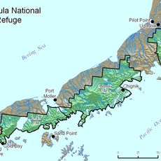
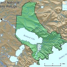
Aniakchak National Monument and Preserve, National monument and preserve in Lake and Peninsula, United States

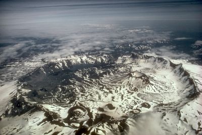
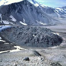
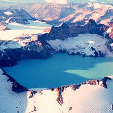
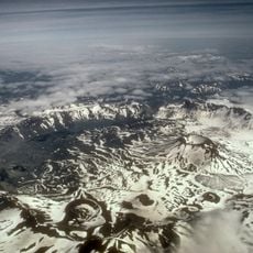
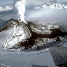
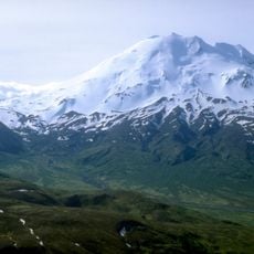
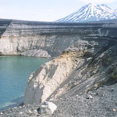
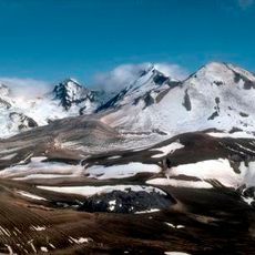
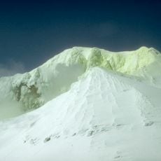
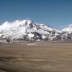
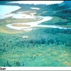
Aniakchak National Monument and Preserve protects a vast volcanic caldera in southwestern Alaska surrounded by tundra and coastal features. The crater spans 6 miles across and drops 2,500 feet deep, containing active lava flows, crater lakes, and geothermal springs within its walls.

The caldera formed from a massive eruption roughly 3,500 years ago that reshaped the entire landscape of the region. The National Park Service designated it a protected monument in 1978 to preserve this rare geological feature.

Dena'ina and Alutiiq peoples have inhabited this region for generations, with their connection to the land evident in archaeological sites scattered along the coast. The landscape bears traces of centuries of habitation through the remains of ancient settlements.

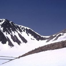
This site requires chartered flights or helicopter access from King Salmon, as no roads connect to the location. Weather conditions in this remote region frequently change, so visitors should allow flexibility in their travel schedule.

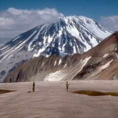
This location ranks among the least visited sites in the entire U.S. National Park System, typically receiving fewer than 100 visitors each year. The extreme remoteness means travelers who come here experience the crater in nearly complete solitude.

Location: Lake and Peninsula

Operator: United States National Park Service

Website: https://nps.gov/ania

GPS coordinates: 56.90178,-158.10672

Latest update: December 8, 2025 19:58

Photos
Around this place
Novarupta
United States of America

Novarupta

232.3 km
Mount Katmai
United States of America

Mount Katmai

242.5 km
Brooks Falls
United States of America

Brooks Falls

229.8 km
Mount Aniakchak
United States of America

Mount Aniakchak

6.2 km
Mount Veniaminof
United States of America

Mount Veniaminof

111.3 km
Mount Chiginagak
United States of America

Mount Chiginagak

72.3 km
Mount Griggs
United States of America

Mount Griggs

241.4 km
Alaska Peninsula National Wildlife Refuge
United States of America

Alaska Peninsula National Wildlife Refuge

114.4 km
Ukinrek Maars
United States of America

Ukinrek Maars

141.1 km
Trident Volcano
United States of America

Trident Volcano

232.7 km
Naknek River
United States of America

Naknek River

215 km
Becharof National Wildlife Refuge
United States of America

Becharof National Wildlife Refuge

165.3 km
United States of America

Becharof Wilderness

185.5 km
Mount Martin
United States of America

Mount Martin

216.5 km
Mount Mageik
United States of America

Mount Mageik

223 km
Mount Dana
United States of America

Mount Dana

238.2 km
Brooks River Archeological District
United States of America

Brooks River Archeological District

229.6 km
Ugashik River
United States of America

Ugashik River

91.9 km
Elevation of Holy Cross Church
United States of America

Elevation of Holy Cross Church

212.3 km
Brooks Camp Boat House
United States of America

Brooks Camp Boat House

230.5 km
St. Nicholas Chapel
United States of America

St. Nicholas Chapel

228.8 km
Brooks River Historic Ranger Station
United States of America

Brooks River Historic Ranger Station

230.5 km
St. John the Baptist Chapel
United States of America

St. John the Baptist Chapel

213.5 km
Transfiguration of Our Lord Chapel
United States of America

Transfiguration of Our Lord Chapel

228.9 km
St. Nicholas Church
United States of America

St. Nicholas Church

30.8 km
Brooks Camp Visitor Center
United States of America

Brooks Camp Visitor Center

230.3 km
Brooks Camp Campground
United States of America

Brooks Camp Campground

230.4 km
Pirate Cove
United States of America

Pirate Cove

221.3 km
Show the full map
Reviews

Visited this place? Tap the stars to rate it and share your experience / photos with the community! Try now! You can cancel it anytime.

« Aniakchak National Monument and Preserve - National monument and preserve in Lake and Peninsula, United States » is provided by Around Us (aroundus.com). Images and texts are derived from Wikimedia project under a Creative Commons license. You are allowed to copy, distribute, and modify copies of this page, under the conditions set by the license, as long as this note is clearly visible.

Discover hidden gems everywhere you go!

From secret cafés to breathtaking viewpoints, skip the crowded tourist spots and find places that match your style. Our app makes it easy with voice search, smart filtering, route optimization, and insider tips from travelers worldwide. Download now for the complete mobile experience.

Around Us App Screenshot

A unique approach to discovering new places

Le Figaro

All the places worth exploring

France Info

A tailor-made excursion in just a few clicks

20 Minutes