Chest opened
+${chestReward.xp} XP
Explorer
NOUVEAU ×${chestReward.collectible.quantity}
tapez pour fermer

See the monuments around you in AR Open chests in the app

Around Us is built for your phone — point your camera at the streets and discover the monuments and places around you in augmented reality. Around Us is built for your phone — chests unlock when you walk, explore and capture nearby places.

•

Enable Location

We need your location to show you interesting places around you

Discover nearby places

Find interesting locations and hidden gems around you

Precise directions

Get accurate directions and distances to places

Your location is never shared with other users. It's only used when you tap the location button.

Mount Chiginagak

Log in to your account

Start exploring — it's free

Trusted by 92,643 travelers worldwide

Continue with Google
Continue with Apple
or

We will send you a code to connect

By continuing, you accept our Terms and Conditions and our Privacy Policy

Check your inbox

We've sent a pincode in your inbox. Please enter the code below.

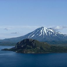
Mount Chiginagak, Stratovolcano in Lake and Peninsula Borough, United States

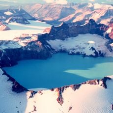
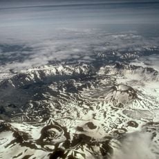
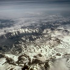
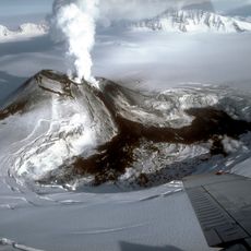
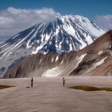
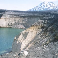
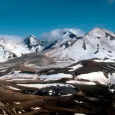
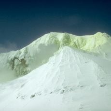
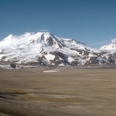
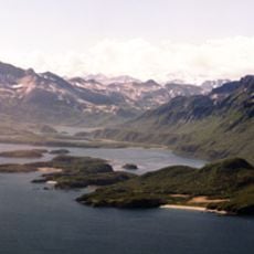
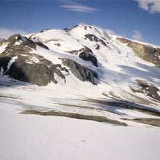
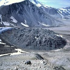
Mount Chiginagak is a stratovolcano on the Alaska Peninsula, about 15 km northwest of Chiginagak Bay. Its summit area holds a 400 m wide, 105 m deep acid crater lake that formed between November 2004 and May 2005. Fumaroles vent at 1,600 m on the northeast flank, and hot-spring travertine deposits lie at the northwest base near Volcano Creek.

Mount Chiginagak's most recent products are an unglaciated lava flow and an overlying pyroclastic-flow deposit extending east from the summit, probably from a lava dome at 1,687 m on the southeast flank. Brief ash eruptions were reported in July 1971 and August 1998. The volcano lies about 600 km from Anchorage and is not permanently monitored.

The volcano lies about 600 km from Anchorage, so no permanent monitoring network is installed on it; the 2005 acid flood was reconstructed afterwards from satellite images and field evidence. About 15 other volcanoes worldwide are known to hold acid crater lakes, among them Poás and Rincón de la Vieja in Costa Rica.

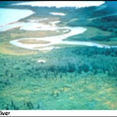
The volcano lies about 600 km from Anchorage and is not permanently monitored, so check conditions before any approach. The summit crater lake drains through an outlet cave into Indecision Creek, which carries a strong sulphur smell, yellow colour and pH of 1.3; avoid its water.

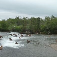
A crater lake formed between 2004 and 2005 from snowmelt and rainwater, eventually reaching about 400 meters across with highly acidic water. When this water drained away, it significantly altered local salmon migration patterns, revealing how volcanic activity directly affects wildlife below.

The community of curious travelers

AroundUs brings together thousands of curated places, local tips, and hidden gems, enriched daily by 92,643 contributors worldwide.

Start exploring
Elevation above the sea
2,134 m
GPS coordinates
57.13361,-156.99139
Latest update
October 24, 2026 19:33
Around this place
Novarupta
United States of America

Novarupta

103.5 mi
Mount Katmai
United States of America

Mount Katmai

109.3 mi
Brooks Falls
United States of America

Brooks Falls

107.8 mi
Mount Aniakchak
United States of America

Mount Aniakchak

46.4 mi
Aniakchak National Monument and Preserve
United States of America

Aniakchak National Monument and Preserve

45 mi
Mount Veniaminof
United States of America

Mount Veniaminof

111.9 mi
Fure's Cabin
United States of America

Fure's Cabin

120.9 mi
Mount Griggs
United States of America

Mount Griggs

109.6 mi
Alaska Peninsula National Wildlife Refuge
United States of America

Alaska Peninsula National Wildlife Refuge

109.6 mi
Ukinrek Maars
United States of America

Ukinrek Maars

51.5 mi
Trident Volcano
United States of America

Trident Volcano

103.3 mi
Naknek River
United States of America

Naknek River

107.7 mi
Becharof National Wildlife Refuge
United States of America

Becharof National Wildlife Refuge

78.6 mi
United States of America

Becharof Wilderness

73.6 mi
Mount Martin
United States of America

Mount Martin

93.7 mi
Mount Mageik
United States of America

Mount Mageik

97.6 mi
Amalik Bay Archeological District
United States of America

Amalik Bay Archeological District

116 mi
Old Savonoski Site
United States of America

Old Savonoski Site

113.7 mi
Snowy Mountain
United States of America

Snowy Mountain

118.9 mi
Brooks River Archeological District
United States of America

Brooks River Archeological District

107.6 mi
Ugashik River
United States of America

Ugashik River

32.2 mi
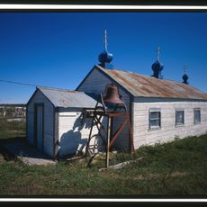
Elevation of Holy Cross Church
United States of America

Elevation of Holy Cross Church

109.4 mi
Brooks Camp Boat House
United States of America

Brooks Camp Boat House

108.2 mi
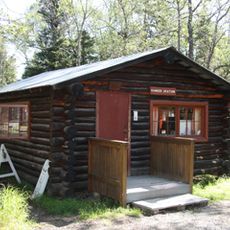
Brooks River Historic Ranger Station
United States of America

Brooks River Historic Ranger Station

108.1 mi
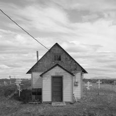
St. John the Baptist Chapel
United States of America

St. John the Baptist Chapel

110.3 mi
St. Nicholas Church
United States of America

St. Nicholas Church

27.5 mi
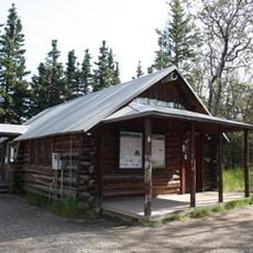
Brooks Camp Visitor Center
United States of America

Brooks Camp Visitor Center

108.1 mi
Brooks Camp Campground
United States of America

Brooks Camp Campground

108.1 mi
Show the full map
Reviews
Share your experience

No review yet

Discussions
Start a discussion...

No discussion yet

« Mount Chiginagak - Stratovolcano in Lake and Peninsula Borough, United States » is provided by Around Us (aroundus.com). Images and texts are derived from Wikimedia project under a Creative Commons license. You are allowed to copy, distribute, and modify copies of this page, under the conditions set by the license, as long as this note is clearly visible.

Discover hidden gems everywhere you go!

From secret cafés to breathtaking viewpoints, skip the crowded tourist spots and find places that match your style. Our app makes it easy with voice search, smart filtering, route optimization, and insider tips from travelers worldwide. Download now for the complete mobile experience.
Around Us App Screenshot
❝

A unique approach to discovering new places❞

— Le Figaro

❝

All the places worth exploring❞

— France Info

❝

A tailor-made excursion in just a few clicks❞

— 20 Minutes

Around Us
Travel Guide & Maps
Download

Send to your phone

QR Code
1

Open the camera app on your mobile.

2

Point at the QR code with your camera. A notification will appear.

3

Tap the notification to open the link.