Chest opened
+${chestReward.xp} XP
Explorer
NOUVEAU ×${chestReward.collectible.quantity}
tapez pour fermer
Chest locked

Open chests in the app

Around Us is built for your phone — chests unlock when you walk, explore and capture nearby places.

Enable Location

We need your location to show you interesting places around you

Discover nearby places

Find interesting locations and hidden gems around you

Precise directions

Get accurate directions and distances to places

Your location is never shared with other users. It's only used when you tap the location button.

Anchor Point

Log in to your account

Start exploring — it's free

Trusted by 72,874 travelers worldwide

Continue with Google
Continue with Apple
or

We will send you a code to connect

By continuing, you accept our Terms and Conditions and our Privacy Policy

Check your inbox

We've sent a pincode in your inbox. Please enter the code below.

Discussion Reviews 1 Photos
13k Popularity

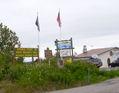
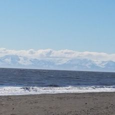
Anchor Point, Census-designated place in Kenai Peninsula Borough, Alaska.

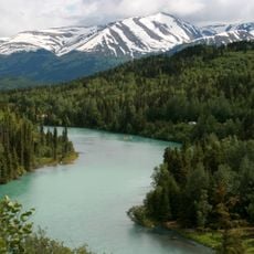
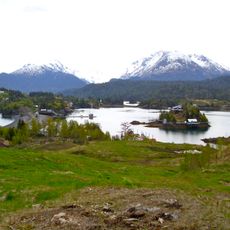
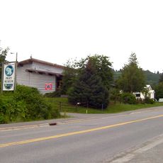
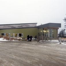
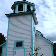
Anchor Point is a small community situated along the Sterling Highway on the eastern shore of Cook Inlet near the Anchor River. The settlement sits at roughly 36 meters elevation and serves as a local hub with basic services and residential areas.

The place takes its name from 1778, when Captain James Cook's expedition reportedly lost an anchor while exploring and mapping the Alaskan coast. This incident became the defining event that gave the location its lasting identity.

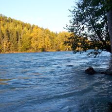
The Anchor River State Recreation Area shapes how locals and visitors spend their time, with fishing and nature watching woven into the rhythm of daily life. The place has become a gathering point for people seeking outdoor experiences near the water.

The place is accessible via the Sterling Highway and has a local school for younger students, though high school attendees travel to Homer. Plan ahead due to limited amenities and harsh weather conditions that can affect travel and activities.

This location marks the westernmost point of the North American continental highway system, where the Sterling Highway reaches its end. Road travelers often visit specifically to reach this final endpoint of a major travel route.

The community of curious travelers

AroundUs brings together thousands of curated places, local tips, and hidden gems, enriched daily by 60,000 contributors worldwide.

Start exploring
Elevation above the sea
36 m
Part of
Kenai Peninsula
GPS coordinates
59.77747,-151.77022
Latest update
December 7, 2025 20:42
Around this place
Kenai Fjords National Park
United States of America

Kenai Fjords National Park

100.9 km
Mount Redoubt
United States of America

Mount Redoubt

95.6 km
Kenai River
United States of America

Kenai River

101 km
Mount Iliamna
United States of America

Mount Iliamna

79 km
Salty Dawg Saloon
United States of America

Salty Dawg Saloon

27.7 km
Kenai National Wildlife Refuge
United States of America

Kenai National Wildlife Refuge

93.9 km
Tustumena Glacier
United States of America

Tustumena Glacier

82.5 km
Kachemak Bay State Park
United States of America

Kachemak Bay State Park

41.6 km
Kasilof River
United States of America

Kasilof River

66.3 km
Pratt Museum
United States of America

Pratt Museum

19.3 km
Holy Transfiguration of Our Lord Chapel
United States of America

Holy Transfiguration of Our Lord Chapel

30.9 km
Yukon Island Main Site
United States of America

Yukon Island Main Site

33 km
United States of America

Grewingk Glacier

50.9 km
Coral Seymour Ballpark
United States of America

Coral Seymour Ballpark

92.5 km
United States of America

McCarty Glacier

86.8 km
Homer Public Library
United States of America

Homer Public Library

20 km
United States of America

Mount Eleanor

89.3 km
St. Nicholas Chapel
United States of America

St. Nicholas Chapel

38.8 km
Soldotna Post Office
United States of America

Soldotna Post Office

88.7 km
Sts. Sergius and Herman of Valaam Church
United States of America

Sts. Sergius and Herman of Valaam Church

47.8 km
Sts. Sergius and Herman of Valaam Chapel
United States of America

Sts. Sergius and Herman of Valaam Chapel

47.7 km
Thorn-Stingley House
United States of America

Thorn-Stingley House

20.2 km
Andrew Berg Cabin
United States of America

Andrew Berg Cabin

74 km
Kenai Beach
United States of America

Kenai Beach

90.5 km
Yalik Glacier
United States of America

Yalik Glacier

61.6 km
Kenai National Wildlife Refuge Visitor Center
United States of America

Kenai National Wildlife Refuge Visitor Center

85.7 km
Pratt Museum and Park
United States of America

Pratt Museum and Park

19.3 km
Dekanat Kenai
United States of America

Dekanat Kenai

91 km
Show the full map
Reviews
Share your experience

No review yet

Discussions
Start a discussion...

No discussion yet

« Anchor Point - Census-designated place in Kenai Peninsula Borough, Alaska » is provided by Around Us (aroundus.com). Images and texts are derived from Wikimedia project under a Creative Commons license. You are allowed to copy, distribute, and modify copies of this page, under the conditions set by the license, as long as this note is clearly visible.

Discover hidden gems everywhere you go!

From secret cafés to breathtaking viewpoints, skip the crowded tourist spots and find places that match your style. Our app makes it easy with voice search, smart filtering, route optimization, and insider tips from travelers worldwide. Download now for the complete mobile experience.

Around Us App Screenshot

A unique approach to discovering new places

Le Figaro

All the places worth exploring

France Info

A tailor-made excursion in just a few clicks

20 Minutes

Around Us
Travel Guide & Maps
Download

Send to your phone

QR Code
1

Open the camera app on your mobile.

2

Point at the QR code with your camera. A notification will appear.

3

Tap the notification to open the link.