Chest opened
+${chestReward.xp} XP
Explorer
NOUVEAU ×${chestReward.collectible.quantity}
tapez pour fermer
Chest locked

Open chests in the app

Around Us is built for your phone — chests unlock when you walk, explore and capture nearby places.

Enable Location

We need your location to show you interesting places around you

Discover nearby places

Find interesting locations and hidden gems around you

Precise directions

Get accurate directions and distances to places

Your location is never shared with other users. It's only used when you tap the location button.

Marieta Islands

Log in to your account

Start exploring — it's free

Trusted by 72,902 travelers worldwide

Continue with Google
Continue with Apple
or

We will send you a code to connect

By continuing, you accept our Terms and Conditions and our Privacy Policy

Check your inbox

We've sent a pincode in your inbox. Please enter the code below.

Marieta Islands
Discussion Reviews 2 Photos
54.5k Popularity

Marieta Islands, Volcanic island group in Nayarit, Mexico.

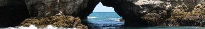
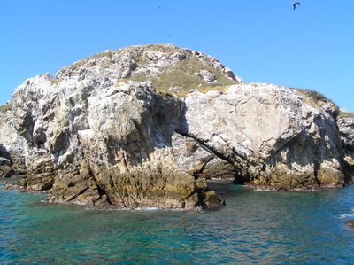
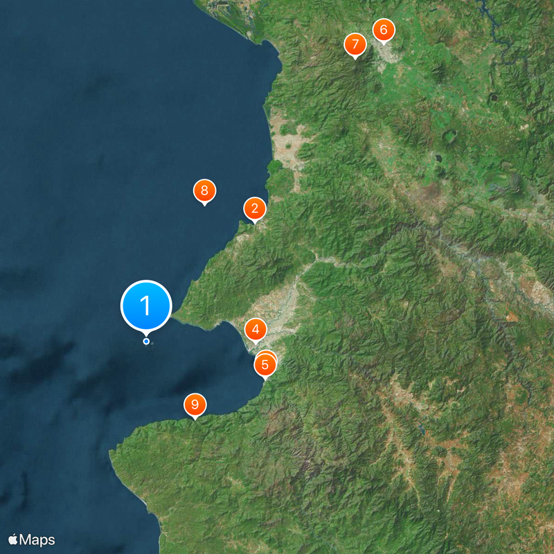
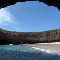
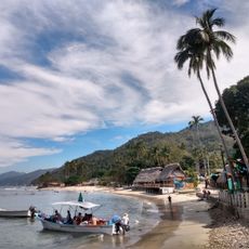
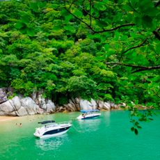
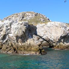
The Marieta Islands are a volcanic island group off the coast of Nayarit, Mexico, about eight kilometers from Punta de Mita. The two main landforms, Isla Larga and Isla Redonda, consist of jagged rock with caves, arches and a circular opening that leads to an interior beach.

In the early 20th century, military forces used the uninhabited islands as targets for bombing practice. French marine explorer Jacques Cousteau's campaign in the 1960s led to the area being placed under protection.

The name Playa del Amor refers to the hidden beach tourists can reach through a natural tunnel. The natural rock formations create nesting sites where visitors can watch bird colonies incubating and raising their young.

Access to the area requires a permit available only through licensed tour operators. Authorities limit daily visitors to roughly 116 people at the hidden beach to preserve the protected ecosystem.

The circular opening above Playa del Amor probably formed through military explosions in the first half of the 20th century. Visitors swim through the tunnel at high tide when water levels are sufficient to allow passage.

The community of curious travelers

AroundUs brings together thousands of curated places, local tips, and hidden gems, enriched daily by 60,000 contributors worldwide.

Start exploring
Location
GPS coordinates
20.69900,-105.58500
Latest update
December 14, 2025 17:33
Reviews
Share your experience

No review yet

Discussions
Start a discussion...

No discussion yet

« Marieta Islands - Volcanic island group in Nayarit, Mexico » is provided by Around Us (aroundus.com). Images and texts are derived from Wikimedia project under a Creative Commons license. You are allowed to copy, distribute, and modify copies of this page, under the conditions set by the license, as long as this note is clearly visible.

Discover hidden gems everywhere you go!

From secret cafés to breathtaking viewpoints, skip the crowded tourist spots and find places that match your style. Our app makes it easy with voice search, smart filtering, route optimization, and insider tips from travelers worldwide. Download now for the complete mobile experience.

Around Us App Screenshot

A unique approach to discovering new places

Le Figaro

All the places worth exploring

France Info

A tailor-made excursion in just a few clicks

20 Minutes

Around Us
Travel Guide & Maps
Download

Send to your phone

QR Code
1

Open the camera app on your mobile.

2

Point at the QR code with your camera. A notification will appear.

3

Tap the notification to open the link.