Boca de la Sierra, Mountain village in Los Cabos, Mexico.
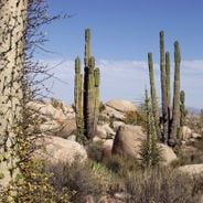
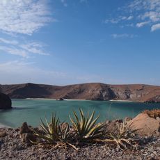
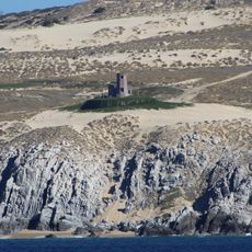
Boca de la Sierra is a mountain village in Los Cabos positioned at 310 meters elevation, surrounded by granite peaks from two major ranges. The Sierra de la Victoria and Sierra de La Laguna chains dominate the landscape, creating steep valleys and deep canyons throughout the region.
The village developed as a settlement along the natural passage through San Bernardo Canyon, one of seven major canyons that shape the region. This geographic gateway made it a natural meeting point between the highlands and the valleys below.
Residents maintain farming practices passed down through generations and welcome visitors through guided hikes and outdoor explorations. These activities have become woven into daily village life, keeping traditional knowledge alive while opening the place to travelers.
From San José del Cabo, the drive takes about 50 minutes on the Transpeninsular highway, passing through Miraflores before arriving. The terrain is mountainous with trails and paths that require sturdy footwear for comfortable exploration.
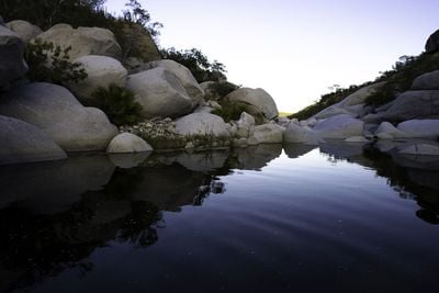
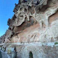
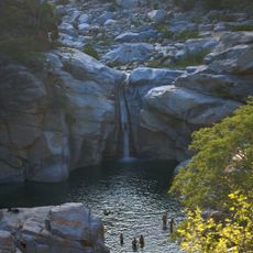
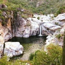
The place features natural pools cascading down the mountainside, creating places to swim and cool off. A stone path running through a central lake divides the water into separate sections for different uses.
Location: Baja California Sur
Location: Los Cabos, México
GPS coordinates: 23.38544,-109.81683
Latest update: December 6, 2025 19:04
Baja California is a Mexican peninsula that offers striking contrasts in its landscapes. Desert valleys meet sandy beaches, while marine reserves protect coastal waters. The region holds ancient cave paintings, volcanic peaks, and colonial-era buildings that tell stories of human settlement. Canyons...
Cabo Pulmo National Park
42.5 km
Arch of Cabo San Lucas
57.3 km
Playa Balandra
116.2 km
Balandra
115.6 km
Our Lady of Peace Cathedral, Baja California Sur
100.1 km
Arena Sonora
222.5 km
Parque Nacional Cabo Pulmo
40.3 km
La Perla de La Paz
100.3 km
Baja California Sur Regional Museum
99.7 km
Estadio Alfredo Díaz Angulo
289.5 km
Trópico de Cáncer
13.5 km
Isla Espíritu Santo
131.1 km
Iglesia de Guadalupe de Cabo San Lucas
55.3 km
Iglesia Santa Anita
25.5 km
Museo Ruta de Plata
55.1 km
Playa Punta Lobos
42.4 km
San Lucas Church
56.9 km
Iglesia Nuestra Señora de Fatima de Caduaño
6.9 km
Cabo Pulmo Beach
40.3 km
Cerro de la Calavera
101.9 km
Zorra Canyon Waterfall
12.8 km
Área de Protección de Flora y Fauna Balandra
115.2 km
Playa Coromuel
102.8 km
Reserva de la Biósfera Sierra La Laguna
20.9 km
Faro Cabo Falso
58.9 km
Templo del Sagrado Corazón de Jesús de San José del Cabo
38.6 km
Playa Los Cerritos
37 km
Capilla Santa Cruz
25.5 kmVisited this place? Tap the stars to rate it and share your experience / photos with the community! Try now! You can cancel it anytime.
Discover hidden gems everywhere you go!
From secret cafés to breathtaking viewpoints, skip the crowded tourist spots and find places that match your style. Our app makes it easy with voice search, smart filtering, route optimization, and insider tips from travelers worldwide. Download now for the complete mobile experience.
A unique approach to discovering new places❞
— Le Figaro
All the places worth exploring❞
— France Info
A tailor-made excursion in just a few clicks❞
— 20 Minutes