Guasave, Administrative division in Sinaloa, Mexico.
Description
Guasave is an administrative division in Sinaloa in northwestern Mexico. It sits about 62 kilometers southeast of Los Mochis and about 150 kilometers northeast of Culiacan, the state capital.
History
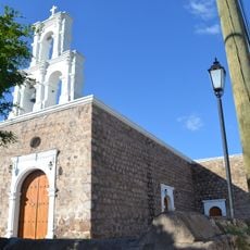
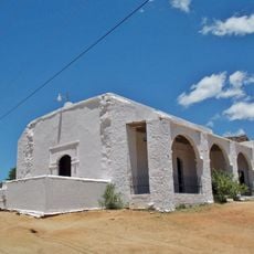
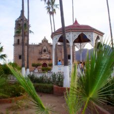
The region was founded in 1595 by Hernando de Villafañe and grew from a Jesuit mission established in 1590 as San Pedro y Pablo. This early spiritual presence shaped how the settlement developed over many generations.
Culture
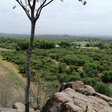
The area is known for farming and is called the Agricultural Heart of Mexico because of how central this work is to local life. Irrigation systems and crops shape the landscape and how people spend their days.
Practical
Mexican Highway 15 runs north to south through the region and connects it with nearby areas. Campo Cuatro Milpas Airport offers flight connections for those arriving or leaving by air.
Did you know?
In the 1940s, archaeologist Gordon Ekholm found artifacts from the ancient Capacha culture during excavations, including painted pottery and alabaster vessels. These discoveries reveal that the area had people living here long before Spanish arrival.
AroundUs brings together thousands of curated places, local tips, and hidden gems, enriched daily by 60,000 contributors worldwide. Discover all places nearby (Guasave).
Copper Canyon Adventure Park
235 km
Playa Balandra
223.1 km
Cathedral Basilica of Our Lady of the Rosary
139.1 km
Jardín Botánico Culiacán
138.9 km
Bacubirito Meteorite
104.9 km
Balandra
224.1 km
Our Lady of Peace Cathedral, Baja California Sur
233.3 km
Piedra Volada
235.6 km
Sierra de Alamos - Río Cuchujaqui
166.7 km
Iglesia de la Purísima Concepción
173.5 km
Museo El Fuerte
102.6 km
Teleférico de las Barrancas del Cobre
234.9 km
La Perla de La Paz
233.7 km
Baja California Sur Regional Museum
233.1 km
Estadio Alfredo Díaz Angulo
47.3 km
Álamos city hall
173.4 km
Plaza de Armas of Alamos
173.5 km
Capilla de Zapopan
174 km
Customs Museum of Sonora
173.5 km
Biblioteca Doctor Alfonso Ortiz Tirado
173.4 km
Temple of Saint Joseph
179.4 km
Isla Espíritu Santo
213.9 km
Mirador Cerro de Gallego
201.7 km
Cerro de la Calavera
230.4 km
Área de Protección de Flora y Fauna Balandra
223.6 km
Historic centre of Alamos
173.3 km
Playa Coromuel
229.8 km
Cerro De La Mask
104.4 kmDiscover hidden gems everywhere you go!
From secret cafés to breathtaking viewpoints, skip the crowded tourist spots and find places that match your style. Our app makes it easy with voice search, smart filtering, route optimization, and insider tips from travelers worldwide. Download now for the complete mobile experience.
A unique approach to discovering new places❞
— Le Figaro
All the places worth exploring❞
— France Info
A tailor-made excursion in just a few clicks❞
— 20 Minutes