Chest opened
+${chestReward.xp} XP
Explorer
NOUVEAU ×${chestReward.collectible.quantity}
tapez pour fermer
Chest locked

Open chests in the app

Around Us is built for your phone — chests unlock when you walk, explore and capture nearby places.

Enable Location

We need your location to show you interesting places around you

Discover nearby places

Find interesting locations and hidden gems around you

Precise directions

Get accurate directions and distances to places

Your location is never shared with other users. It's only used when you tap the location button.

Palos Verdes Peninsula

Log in to your account

Start exploring — it's free

Trusted by 72,883 travelers worldwide

Continue with Google
Continue with Apple
or

We will send you a code to connect

By continuing, you accept our Terms and Conditions and our Privacy Policy

Check your inbox

We've sent a pincode in your inbox. Please enter the code below.

Palos Verdes Peninsula
Discussion Reviews 2 Photos
65.6k Popularity

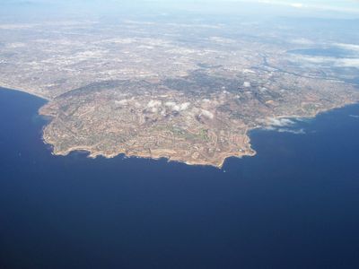
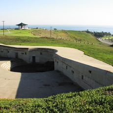
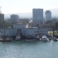
Palos Verdes Peninsula, Coastal peninsula in Los Angeles County, California.

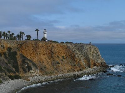
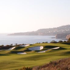
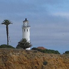
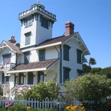
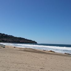
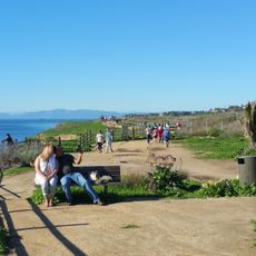
Palos Verdes Peninsula is a peninsula in Los Angeles County, California, that juts into the Pacific Ocean and is shaped by steep cliffs. From the edge of the rock face, wide views open toward the water and Santa Catalina Island in the distance.

Frank Vanderlip acquired the entire area in 1913 and afterward initiated the development of residential neighborhoods. The settlements grew slowly and followed a plan that connected open land with small communities.

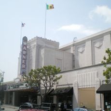
The peninsula encompasses four distinct municipalities: Palos Verdes Estates, Rancho Palos Verdes, Rolling Hills, and Rolling Hills Estates, each maintaining specific architectural standards.

Hiking paths run along the coast and through nature reserves, with some sections featuring steep climbs or uneven surfaces. Reaching the different access points is easiest by car, as public transport options are limited.

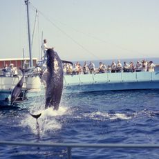
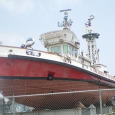
Research teams work along the underwater coast to restore damaged reefs and create habitats for marine species. The projects often run below the sight line of visitors, yet the rebuilt ecosystem enriches the entire coastal area.

The community of curious travelers

AroundUs brings together thousands of curated places, local tips, and hidden gems, enriched daily by 60,000 contributors worldwide.

Start exploring
GPS coordinates
33.75865,-118.34584
Latest update
December 14, 2025 17:08
Around this place
Vincent Thomas Bridge
United States of America

Vincent Thomas Bridge

6.9 km
Marineland of the Pacific
United States of America

Marineland of the Pacific

5.4 km
USS Iowa Museum
United States of America

USS Iowa Museum

6.6 km
The Sunken City
United States of America

The Sunken City

7.9 km
Wayfarers Chapel
United States of America

Wayfarers Chapel

3.4 km
Fort MacArthur
United States of America

Fort MacArthur

6.9 km
Trump National Golf Club
United States of America

Trump National Golf Club

3.3 km
Korean Bell of Friendship
United States of America

Korean Bell of Friendship

7.3 km
SS Lane Victory
United States of America

SS Lane Victory

8.2 km
South Coast Botanic Garden
United States of America

South Coast Botanic Garden

2.8 km
Point Vicente Light
United States of America

Point Vicente Light

6.3 km
Cabrillo Marine Aquarium
United States of America

Cabrillo Marine Aquarium

7.7 km
Cabrillo Beach
United States of America

Cabrillo Beach

7.8 km
Western Museum of Flight
United States of America

Western Museum of Flight

4.8 km
Point Fermin Light
United States of America

Point Fermin Light

7.6 km
Warner Grand Theater
United States of America

Warner Grand Theater

5.5 km
Los Angeles Maritime Museum
United States of America

Los Angeles Maritime Museum

6.6 km
RAT Beach
United States of America

RAT Beach

6.7 km
Ralph J. Scott
United States of America

Ralph J. Scott

7.2 km
Municipal Warehouse No. 1
United States of America

Municipal Warehouse No. 1

8.1 km
Norwegian Seamen's Church, San Pedro
United States of America

Norwegian Seamen's Church, San Pedro

6.6 km
Harbor View House
United States of America

Harbor View House

6.5 km
Point Vicente Interpretive Center
United States of America

Point Vicente Interpretive Center

6.3 km
San Pedro Municipal Ferry Building
United States of America

San Pedro Municipal Ferry Building

6.7 km
José Dolores Sepúlveda Adobe
United States of America

José Dolores Sepúlveda Adobe

4.3 km
Harbor Beacon Park & Ride
United States of America

Harbor Beacon Park & Ride

6.2 km
Lomita Railroad Museum
United States of America

Lomita Railroad Museum

5.1 km
American Trona Corporation Building
United States of America

American Trona Corporation Building

7.2 km
Show the full map
Reviews
Share your experience

No review yet

Discussions
Start a discussion...

No discussion yet

« Palos Verdes Peninsula - Coastal peninsula in Los Angeles County, California » is provided by Around Us (aroundus.com). Images and texts are derived from Wikimedia project under a Creative Commons license. You are allowed to copy, distribute, and modify copies of this page, under the conditions set by the license, as long as this note is clearly visible.

Discover hidden gems everywhere you go!

From secret cafés to breathtaking viewpoints, skip the crowded tourist spots and find places that match your style. Our app makes it easy with voice search, smart filtering, route optimization, and insider tips from travelers worldwide. Download now for the complete mobile experience.

Around Us App Screenshot

A unique approach to discovering new places

Le Figaro

All the places worth exploring

France Info

A tailor-made excursion in just a few clicks

20 Minutes

Around Us
Travel Guide & Maps
Download

Send to your phone

QR Code
1

Open the camera app on your mobile.

2

Point at the QR code with your camera. A notification will appear.

3

Tap the notification to open the link.