North University Park Historic District

Log in to your account

AroundUs is a community-driven map of interesting places, built by curious explorers like you. It grows with every review, story, and photo you share.
Connect to save your favorite spots, contribute locations, and create personalized routes.
Continue with Google
Continue with Apple
Continue with X
Continue with Facebook
Continue with email
By continuing, you accept our Terms and Conditions and our Privacy Policy
Create an account
Add to collection
Map
Suggest a change
Share

North University Park Historic District, Victorian residential district in North University Park, Los Angeles, United States.

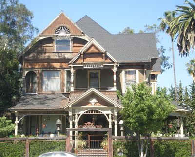
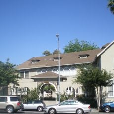
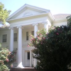
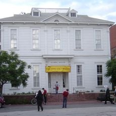
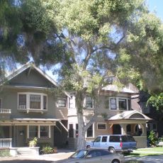
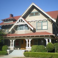
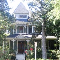
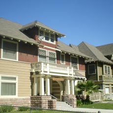
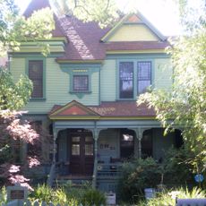
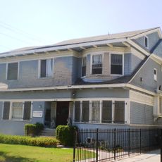
North University Park Historic District is a residential neighborhood containing 66 one and two-story homes between South Hoover Street, West Adams Boulevard, 28th Street, and Magnolia Avenue. The buildings display Queen Anne, American Foursquare, English Revival, Mediterranean Revival, and Craftsman architectural styles throughout the area.

The area was originally agricultural land before a streetcar line opened in November 1891, connecting the neighborhood to downtown Los Angeles. This transportation link triggered the transformation into a residential district with homes built during that era.

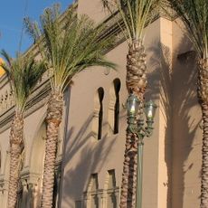
The streets display original early 1900s landscaping with Morton Bay fig trees and Canary Island Date palms still rooted throughout the neighborhood. These plants reflect the deliberate choices of residents who shaped the district's appearance over generations.

The district is best explored on foot, with most homes visible from public streets and sidewalks. Walking through the neighborhood at a relaxed pace allows you to observe the different architectural details and landscaping features that define each block.

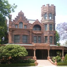
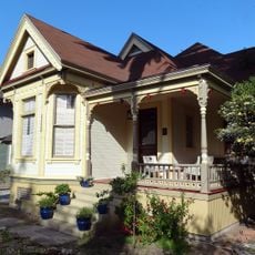
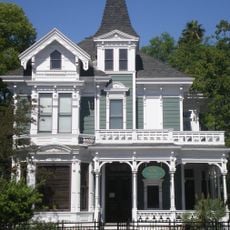
The William W. Cockins House built in 1894 now serves educational purposes for the University of Southern California while keeping its original Queen Anne Victorian design intact. This building demonstrates how historic homes in the area have been preserved and adapted for modern uses.

Location: Los Angeles

GPS coordinates: 34.03028,-118.28444

Latest update: December 12, 2025 09:00

Photos
Around this place
Shrine Auditorium
United States of America

Shrine Auditorium

814 m
Natural History Museum Los Angeles County
United States of America

Natural History Museum Los Angeles County

1.5 km
Galen Center
United States of America

Galen Center

1.1 km
Grand Olympic Auditorium
United States of America

Grand Olympic Auditorium

1.6 km
Bob Hope Patriotic Hall
United States of America

Bob Hope Patriotic Hall

1.4 km
Stimson House
United States of America

Stimson House

873 m
Casa de Rosas
United States of America

Casa de Rosas

233 m
Uytengsu Aquatics Center
United States of America

Uytengsu Aquatics Center

806 m
Exposition Park Rose Garden
United States of America

Exposition Park Rose Garden

1.5 km
ONE National Gay & Lesbian Archives
United States of America

ONE National Gay & Lesbian Archives

279 m
USC Fisher Museum of Art
United States of America

USC Fisher Museum of Art

1.3 km
Velaslavasay Panorama
United States of America

Velaslavasay Panorama

456 m
Campus of the University of Southern California
United States of America

Campus of the University of Southern California

1.1 km
Second Church of Christ, Scientist
United States of America

Second Church of Christ, Scientist

675 m
Zumberge Hall
United States of America

Zumberge Hall

1.2 km
Space Shuttle Endeavour
United States of America

Space Shuttle Endeavour

1.6 km
John B. Kane Residence
United States of America

John B. Kane Residence

753 m
St. James Park Historic District
United States of America

St. James Park Historic District

533 m
Widney Hall
United States of America

Widney Hall

1.2 km
Twentieth Street Historic District
United States of America

Twentieth Street Historic District

803 m
Leavey Library
United States of America

Leavey Library

956 m
Van Buren Place Historic District
United States of America

Van Buren Place Historic District

1.1 km
Forthmann House
United States of America

Forthmann House

123 m
Miller and Herriott House
United States of America

Miller and Herriott House

83 m
Menlo Avenue-West Twenty-ninth Street Historic District
United States of America

Menlo Avenue-West Twenty-ninth Street Historic District

411 m
Machell-Seaman House
United States of America

Machell-Seaman House

497 m
Birthplace of Adlai E. Stevenson II
United States of America

Birthplace of Adlai E. Stevenson II

115 m
Wallis Annenberg Hall
United States of America

Wallis Annenberg Hall

1.1 km
Show the full map
Reviews

Visited this place? Tap the stars to rate it and share your experience / photos with the community! Try now! You can cancel it anytime.

« North University Park Historic District - Victorian residential district in North University Park, Los Angeles, United States » is provided by Around Us (aroundus.com). Images and texts are derived from Wikimedia project under a Creative Commons license. You are allowed to copy, distribute, and modify copies of this page, under the conditions set by the license, as long as this note is clearly visible.

Discover hidden gems everywhere you go!

From secret cafés to breathtaking viewpoints, skip the crowded tourist spots and find places that match your style. Our app makes it easy with voice search, smart filtering, route optimization, and insider tips from travelers worldwide. Download now for the complete mobile experience.

Around Us App Screenshot

A unique approach to discovering new places

Le Figaro

All the places worth exploring

France Info

A tailor-made excursion in just a few clicks

20 Minutes