·

Enable Location

We need your location to show you interesting places around you

Discover nearby places

Find interesting locations and hidden gems around you

Precise directions

Get accurate directions and distances to places

Your location is never shared with other users. It's only used when you tap the location button.

Santiago Peak

Log in to your account

Start exploring — it's free

Trusted by 62,655 travelers worldwide

Continue with Google
Continue with Apple
or

We will send you a code to connect

By continuing, you accept our Terms and Conditions and our Privacy Policy

Check your inbox

We've sent a pincode in your inbox. Please enter the code below.

Santiago Peak

Santiago Peak, Mountain summit in Cleveland National Forest, California.

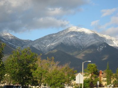
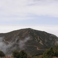
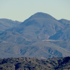
Santiago Peak is a mountain summit in Cleveland National Forest with an elevation of 1,734 meters (5,690 feet), forming the southern portion of the Saddleback formation between Orange County and Riverside County. The peak sits within the Santa Ana Mountains and stands out visibly from the surrounding valleys and plains.

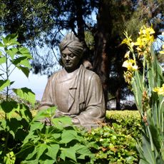
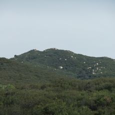
The Acjachemen, the Native American people of this region, called the mountain Kalawpa and used it as a key landmark during early California exploration and settlement. The peak retained its local importance through the Spanish colonial period and into the American era that followed.

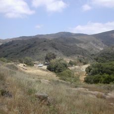
The mountain connects to Santiago Creek, which begins on its southwestern slope and holds importance for local outdoor recreation communities.

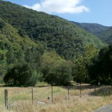
The Holy Jim Trail reaches the summit on a roughly 26-kilometer round-trip route across varying terrain. The hike requires good stamina and is best tackled during cooler weather, as forest sections offer some sun protection along the way.

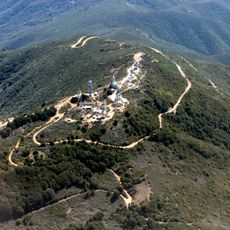
Multiple telecommunications towers crown the summit, enabling radio coverage across several counties for commercial and governmental purposes. This technological infrastructure is visible from the peak and supports the region's modern connectivity.

The community of curious travelers

AroundUs brings together thousands of curated places, local tips, and hidden gems, enriched daily by 60,000 contributors worldwide.

Start exploring
Location
Elevation above the sea
1,734 m
GPS coordinates
33.71055,-117.53423
Latest update
December 7, 2025 20:21
Around this place
Show the full map
« Santiago Peak - Mountain summit in Cleveland National Forest, California » is provided by Around Us (aroundus.com). Images and texts are derived from Wikimedia project under a Creative Commons license. You are allowed to copy, distribute, and modify copies of this page, under the conditions set by the license, as long as this note is clearly visible.

Discover hidden gems everywhere you go!

From secret cafés to breathtaking viewpoints, skip the crowded tourist spots and find places that match your style. Our app makes it easy with voice search, smart filtering, route optimization, and insider tips from travelers worldwide. Download now for the complete mobile experience.

Around Us App Screenshot

A unique approach to discovering new places

Le Figaro

All the places worth exploring

France Info

A tailor-made excursion in just a few clicks

20 Minutes

Around Us
Travel Guide & Maps
Download

Send to your phone

QR Code
1

Open the camera app on your mobile.

2

Point at the QR code with your camera. A notification will appear.

3

Tap the notification to open the link.