Enable Location

We need your location to show you interesting places around you

Discover nearby places

Find interesting locations and hidden gems around you

Precise directions

Get accurate directions and distances to places

Your location is never shared with other users. It's only used when you tap the location button.

Log in to your account

Start exploring — it's free

Trusted by 67,914 travelers worldwide

Continue with Google
Continue with Apple
or

We will send you a code to connect

By continuing, you accept our Terms and Conditions and our Privacy Policy

Check your inbox

We've sent a pincode in your inbox. Please enter the code below.

Seven Oaks Reservoir
Discussion Reviews Photo
1.5k Popularity

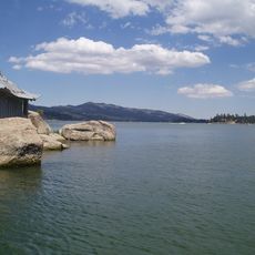
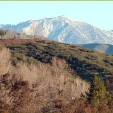
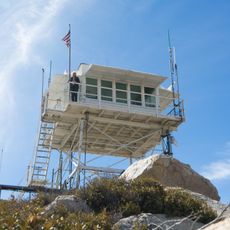
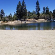
Seven Oaks Reservoir, body of water

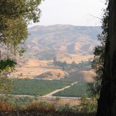
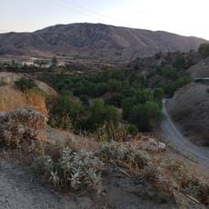
Seven Oaks Reservoir is a large water basin along the Santa Ana River, about 8 miles northeast of Redlands. The lake, formed by a dam, stores water for flood control and releases it gradually back into the river.

The project was approved in 1986 and the dam was completed in 1999, where it has been in operation since. The structure is part of a system designed to protect communities from flood damage during heavy rain events.

The reservoir sits in an area where water management is deeply rooted in local life. The structure shows how people work with nature to protect their communities from the dangers of flooding.

The area is accessible by roads leading to viewing areas, and visitors should stay on designated paths and respect fencing. The surroundings offer spots to observe the structure and river, though there are no extensive public facilities on-site.

The dam works closely with Prado Dam, about 40 miles downstream, to coordinate water flow across a wide area. This coordination shows how multiple structures work together to provide flood protection for an entire region.

The community of curious travelers

AroundUs brings together thousands of curated places, local tips, and hidden gems, enriched daily by 60,000 contributors worldwide.

Start exploring
Location
GPS coordinates
34.11778,-117.09778
Latest update
February 9, 2026 08:19
Around this place
Big Bear Lake
United States of America

Big Bear Lake

17.7 km
CEDU
United States of America

CEDU

8 km
Lake Arrowhead Reservoir
United States of America

Lake Arrowhead Reservoir

17.5 km
Morey Mansion
United States of America

Morey Mansion

13.4 km
Kimberly Crest
United States of America

Kimberly Crest

11.3 km
Lake Arrowhead Village Beach
United States of America

Lake Arrowhead Village Beach

17.3 km
San Timoteo Canyon
United States of America

San Timoteo Canyon

13.9 km
Reche Canyon
United States of America

Reche Canyon

18.9 km
San Bernardino County Court House
United States of America

San Bernardino County Court House

17.9 km
Barton Villa
United States of America

Barton Villa

13.3 km
Mill Creek Zanja
United States of America

Mill Creek Zanja

6.6 km
Redlands Santa Fe Depot District
United States of America

Redlands Santa Fe Depot District

10.3 km
A. K. Smiley Public Library
United States of America

A. K. Smiley Public Library

10.6 km
Smiley Park Historic District
United States of America

Smiley Park Historic District

10.8 km
Auerbacher Home
United States of America

Auerbacher Home

11.8 km
Beverly Ranch
United States of America

Beverly Ranch

11.7 km
Norman F. Feldheym Library
United States of America

Norman F. Feldheym Library

18.2 km
Fort Benson
United States of America

Fort Benson

18.6 km
Highland Historic District
United States of America

Highland Historic District

10.2 km
Henry Washington Survey Marker
United States of America

Henry Washington Survey Marker

15.6 km
Arboreto Heaps Peak
United States of America

Arboreto Heaps Peak

13.6 km
Lincoln Memorial Shrine
United States of America

Lincoln Memorial Shrine

10.6 km
San Bernardino History and Railroad Museum
United States of America

San Bernardino History and Railroad Museum

19.6 km
Rathaus von San Bernardino
United States of America

Rathaus von San Bernardino

18 km
Mountain History Museum
United States of America

Mountain History Museum

19.1 km
Yucaipa Regional Park
United States of America

Yucaipa Regional Park

8.6 km
Keller Peak Lookout
United States of America

Keller Peak Lookout

9.8 km
Tavern Bay Beach
United States of America

Tavern Bay Beach

18.1 km
Show the full map
Reviews
Share your experience

No review yet

Discussions
Start a discussion...

No discussion yet

« Seven Oaks Reservoir - body of water » is provided by Around Us (aroundus.com). Images and texts are derived from Wikimedia project under a Creative Commons license. You are allowed to copy, distribute, and modify copies of this page, under the conditions set by the license, as long as this note is clearly visible.

Discover hidden gems everywhere you go!

From secret cafés to breathtaking viewpoints, skip the crowded tourist spots and find places that match your style. Our app makes it easy with voice search, smart filtering, route optimization, and insider tips from travelers worldwide. Download now for the complete mobile experience.

Around Us App Screenshot

A unique approach to discovering new places

Le Figaro

All the places worth exploring

France Info

A tailor-made excursion in just a few clicks

20 Minutes

Around Us
Travel Guide & Maps
Download

Send to your phone

QR Code
1

Open the camera app on your mobile.

2

Point at the QR code with your camera. A notification will appear.

3

Tap the notification to open the link.