Enable Location

We need your location to show you interesting places around you

Discover nearby places

Find interesting locations and hidden gems around you

Precise directions

Get accurate directions and distances to places

Your location is never shared with other users. It's only used when you tap the location button.

Sierra de San Pedro Mártir National Park

Log in to your account

Join the adventure

Create your free account and start exploring (like 60k+ others)

We will send you a code to connect

or
Continue with Google
Continue with Apple
By continuing, you accept our Terms and Conditions and our Privacy Policy

Check your inbox

We've sent a pincode in your inbox. Please enter the code below.

Sierra de San Pedro Mártir National Park

Sierra de San Pedro Mártir National Park, Mountain national park in northern Baja California, Mexico.

Description

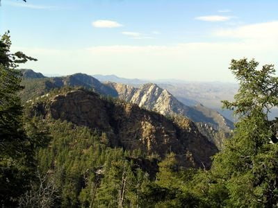
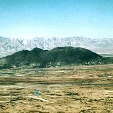
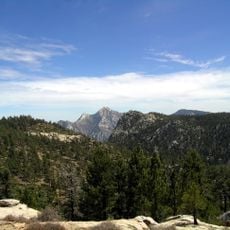
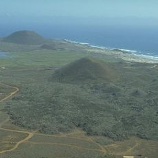
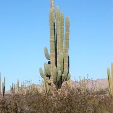
Sierra de San Pedro Mártir National Park covers over 72,900 hectares of pine forest, granite outcrops and peaks across northern Baja California. The highest point, Picacho del Diablo, rises to 3096 meters (10,157 feet), forming the apex of a rugged chain that extends across valleys and high plateaus.

History

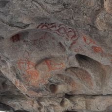
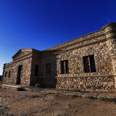
Dominican missionaries founded Mission San Pedro Mártir de Verona in the area during the 18th century. Its ruins remain visible in the southern section, where stone walls stand among the trees.

Culture

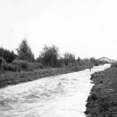
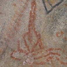
This region once formed part of the territories known to the Kiliwa, long before authorities declared protection in 1947. Today only a handful of trails wind through the high elevations, where hikers sometimes come across stone remains from an earlier era.

Practical

Visitors must register at the entrance station between 7 AM and 8 PM, bringing all necessary supplies with them. No services exist within the boundaries, and only a few roads lead to trailheads in the mountains.

Did you know?

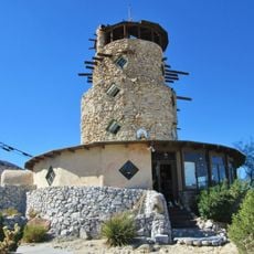
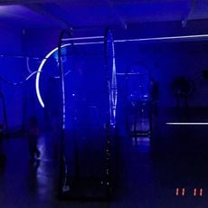
The National Astronomical Observatory operates Mexico's largest optical telescope here, with a diameter of 2.12 meters (6.96 feet). The elevation and clear air create favorable conditions for sky observation, far from city lights.

i
Location
i
Inception
April 26, 1947
i
GPS coordinates
30.90528,-115.50111
i
Latest update
December 5, 2025 22:29

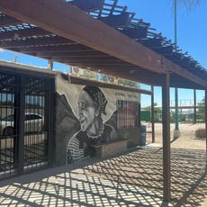
AroundUs brings together thousands of curated places, local tips, and hidden gems, enriched daily by 60,000 contributors worldwide. Discover all places nearby (Baja California).

Landscapes and nature of Baja California

Baja California is a Mexican peninsula that offers striking contrasts in its landscapes. Desert valleys meet sandy beaches, while marine reserves protect coastal waters. The region holds ancient cave paintings, volcanic peaks, and colonial-era buildings that tell stories of human settlement. Canyons...

Reviews

Visited this place? Tap the stars to rate it and share your experience / photos with the community! Try now! You can cancel it anytime.

« Sierra de San Pedro Mártir National Park - Mountain national park in northern Baja California, Mexico » is provided by Around Us (aroundus.com). Images and texts are derived from Wikimedia project under a Creative Commons license. You are allowed to copy, distribute, and modify copies of this page, under the conditions set by the license, as long as this note is clearly visible.

Discover hidden gems everywhere you go!

From secret cafés to breathtaking viewpoints, skip the crowded tourist spots and find places that match your style. Our app makes it easy with voice search, smart filtering, route optimization, and insider tips from travelers worldwide. Download now for the complete mobile experience.

Around Us App Screenshot

A unique approach to discovering new places

Le Figaro

All the places worth exploring

France Info

A tailor-made excursion in just a few clicks

20 Minutes