Chest opened
+${chestReward.xp} XP
Explorer
NOUVEAU ×${chestReward.collectible.quantity}
tapez pour fermer
Chest locked

Open chests in the app

Around Us is built for your phone — chests unlock when you walk, explore and capture nearby places.

Enable Location

We need your location to show you interesting places around you

Discover nearby places

Find interesting locations and hidden gems around you

Precise directions

Get accurate directions and distances to places

Your location is never shared with other users. It's only used when you tap the location button.

Arizona Sun Corridor

Log in to your account

Start exploring — it's free

Trusted by 72,973 travelers worldwide

Continue with Google
Continue with Apple
or

We will send you a code to connect

By continuing, you accept our Terms and Conditions and our Privacy Policy

Check your inbox

We've sent a pincode in your inbox. Please enter the code below.

Arizona Sun Corridor
Discussion Reviews 1 Photos
25.9k Popularity

Arizona Sun Corridor, Megaregion in southern Arizona, United States.

The Arizona Sun Corridor is a megaregion in southern Arizona that connects Phoenix and Tucson across four counties through highways and railways. This network links the two major metropolitan areas and facilitates the movement of people and goods throughout the region.

The region experienced rapid population growth following World War II, transforming agricultural communities into major urban centers. This growth shaped the foundation for what the megaregion is today.

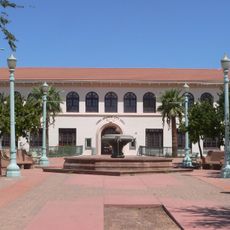
Educational centers like Arizona State University and University of Arizona shape the regional development through research programs and technological innovations.

The area is accessible via Interstate 19, which connects to Mexico and enables cross-border movement and commerce. Travel between the main population centers requires planning due to the distances involved.

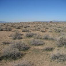
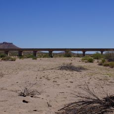
This megaregion holds a large percentage of Arizona's population within a desert landscape. The contrast between dense urban development and the surrounding Sonoran Desert creates an unusual geographic pattern.

The community of curious travelers

AroundUs brings together thousands of curated places, local tips, and hidden gems, enriched daily by 60,000 contributors worldwide.

Start exploring
Location
GPS coordinates
33.00000,-112.00000
Latest update
December 20, 2025 15:54
Around this place
Interstate 10 in Arizona
United States of America

Interstate 10 in Arizona

35.2 km
Basin and Range Province
United States of America

Basin and Range Province

0 m
United States of America

Ahwatukee

38.1 km
Mystery Castle
United States of America

Mystery Castle

40.1 km
South Mountain Park
United States of America

South Mountain Park

38 km
Hohokam Pima National Monument
United States of America

Hohokam Pima National Monument

22 km
Gilbert Arizona Temple
United States of America

Gilbert Arizona Temple

40.7 km
Corona Satellite Calibration Targets
United States of America

Corona Satellite Calibration Targets

34.7 km
Arizona Railway Museum
United States of America

Arizona Railway Museum

33.7 km
House of the Future
United States of America

House of the Future

37.3 km
C.H. Cook Memorial Church
United States of America

C.H. Cook Memorial Church

25.7 km
Casa Grande Stone Church
United States of America

Casa Grande Stone Church

26.6 km
First Baptist Church
United States of America

First Baptist Church

26.8 km
Casa Grande Woman's Club Building
United States of America

Casa Grande Woman's Club Building

26.5 km
Del Monte Market
United States of America

Del Monte Market

41.9 km
Saint Anthony's Church
United States of America

Saint Anthony's Church

27 km
White House
United States of America

White House

27.1 km
McCullough-Price House
United States of America

McCullough-Price House

34.4 km
Valley National Bank
United States of America

Valley National Bank

27.2 km
Cruz Trading Post
United States of America

Cruz Trading Post

26.7 km
Building at 400 East Third Street
United States of America

Building at 400 East Third Street

27.1 km
Henry and Anna Kochsmeier House
United States of America

Henry and Anna Kochsmeier House

26.4 km
Walter Wilbur House
United States of America

Walter Wilbur House

27.4 km
The Domes of Casa Grande
United States of America

The Domes of Casa Grande

29.7 km
Casa Grande City Hall
United States of America

Casa Grande City Hall

27.1 km
Paramount Theatre
United States of America

Paramount Theatre

26.8 km
Rowena Theatre
United States of America

Rowena Theatre

36.7 km
Sacaton Dam Bridge
United States of America

Sacaton Dam Bridge

30.8 km
Show the full map
Reviews
Share your experience

No review yet

Discussions
Start a discussion...

No discussion yet

« Arizona Sun Corridor - Megaregion in southern Arizona, United States » is provided by Around Us (aroundus.com). Images and texts are derived from Wikimedia project under a Creative Commons license. You are allowed to copy, distribute, and modify copies of this page, under the conditions set by the license, as long as this note is clearly visible.

Discover hidden gems everywhere you go!

From secret cafés to breathtaking viewpoints, skip the crowded tourist spots and find places that match your style. Our app makes it easy with voice search, smart filtering, route optimization, and insider tips from travelers worldwide. Download now for the complete mobile experience.

Around Us App Screenshot

A unique approach to discovering new places

Le Figaro

All the places worth exploring

France Info

A tailor-made excursion in just a few clicks

20 Minutes

Around Us
Travel Guide & Maps
Download

Send to your phone

QR Code
1

Open the camera app on your mobile.

2

Point at the QR code with your camera. A notification will appear.

3

Tap the notification to open the link.