Parker, County seat in La Paz County, Arizona, United States.
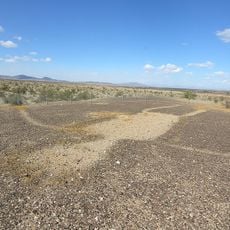
Parker is a town situated on the eastern bank of the Colorado River and serves as a hub for outdoor recreation and lodging in the region. The town offers numerous parks, recreational facilities, and accommodation options that cater to both residents and visitors.
The town began in 1871 as Parkers Landing, initially serving as a supply and transportation point for military and government operations in the area. This early role as a logistical hub helped establish what would become the modern settlement.
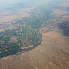
The Colorado River Indian Tribes operate a museum here that displays artifacts and tells the story of the indigenous communities who have lived in this region for centuries. You can see traditional crafts and artwork that remain central to the life and identity of these communities today.
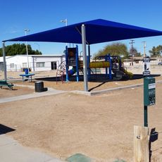
The town offers abundant lodging and recreation options, including RV parks, campgrounds, and public parks with various amenities and facilities. The best time to visit for water activities is during the cooler months when temperatures are more comfortable.
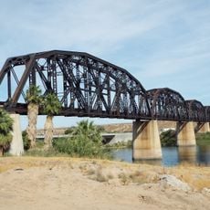
A section of the Colorado River between two dams is accessible year-round for water sports and remains one of the region's most popular recreation zones. This stretch maintains consistent conditions that draw visitors from across the Southwest.
The community of curious travelers
AroundUs brings together thousands of curated places, local tips, and hidden gems, enriched daily by 60,000 contributors worldwide.