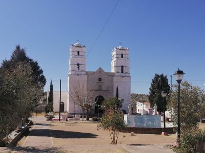
San Francisco de Borja, Administrative municipality in Chihuahua, Mexico.
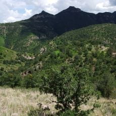
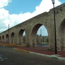
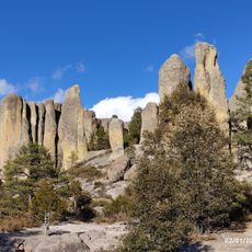
San Francisco de Borja is an administrative municipality in Chihuahua situated among rolling valleys and mountain terrain at around 1,600 meters in elevation. Natural rock outcroppings and geological formations define the landscape and shape how the settlement is distributed across the land.
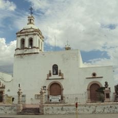
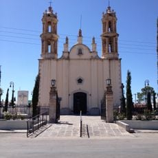
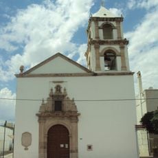
Missionaries founded the settlement in the mid-1600s as a mission outpost to serve local populations, yet faced significant resistance through regional uprisings. These early decades of conflict shaped the area's development and its recovery over time.
The area displays a blend of local traditions rooted in indigenous customs and colonial influences that shape how the community celebrates and gathers. Visitors can observe these traditions in seasonal festivals and the way residents interact with the natural surroundings.
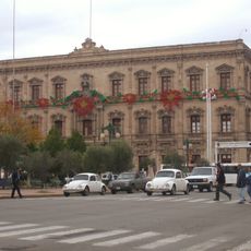
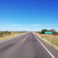
This municipality is located southwest of the state capital and is reached by regional highways connecting to nearby population centers. Visitors should be prepared for rural road conditions and typical mountain weather patterns.
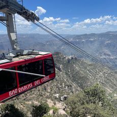
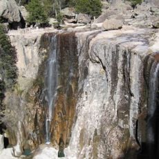
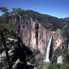
A deep canyon system lies nearby with striking rock structures that define the geological character of the region. This natural landmark draws visitors interested in exploring the dramatic formations that shape the terrain.
Address: San Francisco de Borja, Chihuahua, Mexico
GPS coordinates: 27.89138,-106.74295
Latest update: December 6, 2025 17:46
The Mexican state of Chihuahua extends from desert plains to pine forests in the Sierra Madre Occidental, reaching elevations above 2000 meters. The region preserves a rich cultural and natural heritage that includes pre-Columbian rock art, colonial-era mining facilities, and religious buildings from several centuries. The landscape features deep gorges, natural waterfalls, and extensive mountain ranges. Archaeological sites document the early settlement of the region, while churches and chapels reflect Spanish influence from the 16th century onward. The diverse ecosystems range from arid zones to dense coniferous forests and support varied flora and fauna.
Quinta Gameros
105.4 km
Cathedral of Chihuahua
105.5 km
Copper Canyon Adventure Park
114.7 km
Cumbres de Majalca National Park
104.7 km
Government Palace of Chihuahua
106 km
Puerta de Chihuahua
109.4 km
Cascada de Cusárare
87 km
San Francisco Temple
106.3 km
Santuario de Guadalupe
103.9 km
Acueducto de Chihuahua
103.3 km
Piedra Volada
114.3 km
Museo Semilla
105.2 km
Casa Chihuahua Centro de Patrimonio Cultural
106 km
Mausoleo de Francisco Villa en Chihuahua
105.7 km
Templo de Santa Rita de Casia
104.9 km
Templo del Sagrado Corazón de Jesús
105 km
Estadio Chihuahua
108.1 km
Gymnasio Manuel Bernardo Aguirre
106.5 km
Casa Creel
105.5 km
Quinta Touché
105.6 km
Museo del Mamút
106.6 km
Valley of Mushrooms
88.2 km
City Hall of Chihuahua
105.6 km
Quintas Carolinas
112.5 km
Recowata Hot Springs
92.4 km
Teatro de los Héroes
106.6 km
Casa del Sur
105.6 km
El Faro, Satevó
67.9 kmReviews
Visited this place? Tap the stars to rate it and share your experience / photos with the community! Try now! You can cancel it anytime.
Discover hidden gems everywhere you go!
From secret cafés to breathtaking viewpoints, skip the crowded tourist spots and find places that match your style. Our app makes it easy with voice search, smart filtering, route optimization, and insider tips from travelers worldwide. Download now for the complete mobile experience.
A unique approach to discovering new places❞
— Le Figaro
All the places worth exploring❞
— France Info
A tailor-made excursion in just a few clicks❞
— 20 Minutes