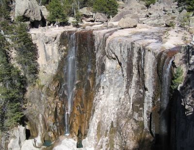
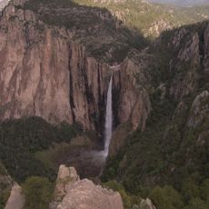
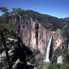
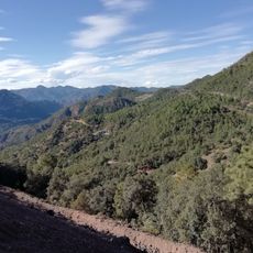
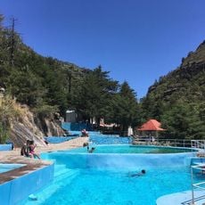
Cascada de Cusárare, Natural waterfall in Sierra Madre Occidental, Guachochi, Mexico.
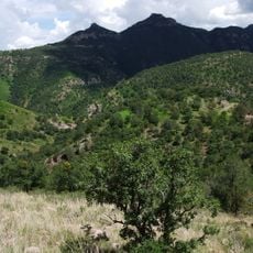
Cascada de Cusárare is a waterfall in the Sierra Madre Occidental, located within a narrow canyon bordered by pine forests and steep rock walls. The water cascades over multiple ledges and forms small pools below that invite swimming and wading.
The waterfall became known to outsiders through the explorer Carl Lumholtz in the 1800s, who recorded details about settlements and inhabitants in this mountain region. His documentation provided early accounts of life in these highlands.
The Tarahumara people maintain their traditions near the falls, including long-distance running and conducting ceremonies that connect with the natural environment.
The waterfall flows most powerfully during the rainy season from June through September. Marked trails from the parking area lead to viewpoints and the base of the falls.
The name comes from the Raramuri language and means Place of Eagles. It refers to Golden Eagles that once lived in this canyon and are rarely spotted by visitors today.
Location: Guachochi
GPS coordinates: 27.62139,-107.57194
Latest update: December 6, 2025 17:40
Ferrocarril Chihuahua al Pacífico
27.8 km
Basaseachic Falls
88.1 km
Copper Canyon Adventure Park
27.7 km
Cumbres de Majalca National Park
169.4 km
Basaseachic Falls National Park
87.7 km
Bacubirito Meteorite
160.3 km
Santuario de Guadalupe
183.6 km
Acueducto de Chihuahua
183.2 km
Piedra Volada
27.3 km
Museo Semilla
184.7 km
Sierra de Alamos - Río Cuchujaqui
111 km
Templo de Santa Rita de Casia
184.8 km
Iglesia de la Purísima Concepción
150.4 km
Museo El Fuerte
169.2 km
Teleférico de las Barrancas del Cobre
27.7 km
Valley of Mushrooms
12.7 km
Álamos city hall
150.5 km
Plaza de Armas of Alamos
150.3 km
Capilla de Zapopan
150.4 km
Área de Protección de Flora y Fauna Tutuaca
107.6 km
Customs Museum of Sonora
150.3 km
Biblioteca Doctor Alfonso Ortiz Tirado
150.4 km
Temple of Saint Joseph
155.2 km
Mirador Cerro de Gallego
56.4 km
Recowata Hot Springs
7.3 km
Historic centre of Alamos
150.4 km
Cerro De La Mask
167.8 km
El Faro, Satevó
147.9 kmVisited this place? Tap the stars to rate it and share your experience / photos with the community! Try now! You can cancel it anytime.
Discover hidden gems everywhere you go!
From secret cafés to breathtaking viewpoints, skip the crowded tourist spots and find places that match your style. Our app makes it easy with voice search, smart filtering, route optimization, and insider tips from travelers worldwide. Download now for the complete mobile experience.
A unique approach to discovering new places❞
— Le Figaro
All the places worth exploring❞
— France Info
A tailor-made excursion in just a few clicks❞
— 20 Minutes