Enable Location

We need your location to show you interesting places around you

Discover nearby places

Find interesting locations and hidden gems around you

Precise directions

Get accurate directions and distances to places

Your location is never shared with other users. It's only used when you tap the location button.

Benson

Log in to your account

Start exploring — it's free

Trusted by 63,227 travelers worldwide

Continue with Google
Continue with Apple
or

We will send you a code to connect

By continuing, you accept our Terms and Conditions and our Privacy Policy

Check your inbox

We've sent a pincode in your inbox. Please enter the code below.

Discussion Reviews 3 Photos
39.2k Popularity

Benson, Desert railroad town in Cochise County, United States.

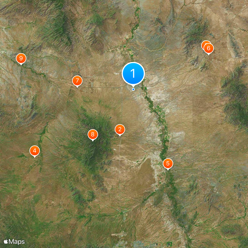
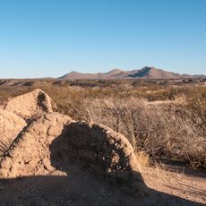
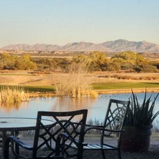
Benson is a desert city in Cochise County, southeastern Arizona, situated at an elevation near 1,100 meters (3,600 feet) close to the San Pedro River. The town occupies a flat, arid landscape with sparse vegetation shaped by its proximity to this river corridor.

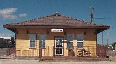
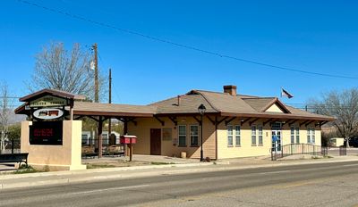
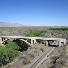
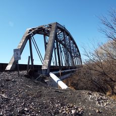
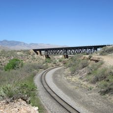
The Southern Pacific Railroad founded the town in 1880, naming it after Judge William S. Benson, and this established it as a critical junction for transporting ore from nearby mining operations. The railroad connection made this location economically vital for the region's metal extraction industry.

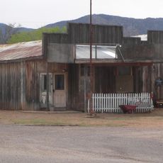
The visitor center occupies a restored train depot that reflects the railroad heritage that shaped the community's identity. This building demonstrates how transportation by rail remained central to how residents thought about their town.

The town sits on Interstate 10, which connects it roughly 45 miles (70 kilometers) northwest to Tucson, while State Routes 80 and 90 provide access to neighboring communities and nearby state parks. These roads form the main network for exploring the surrounding region.

The Apache Nitrogen Products plant, operating since the 1920s, remains one of the largest industrial operations in the area and often goes unnoticed compared to railroad history. This facility represents an economic activity that expanded as rail transport gradually declined.

The community of curious travelers

AroundUs brings together thousands of curated places, local tips, and hidden gems, enriched daily by 60,000 contributors worldwide.

Start exploring
Location
Inception
1880
Elevation above the sea
1,093 m
GPS coordinates
31.95556,-110.30667
Latest update
December 17, 2025 09:15
Around this place
Kartchner Caverns State Park
United States of America

Kartchner Caverns State Park

13.7 km
Texas Canyon
United States of America

Texas Canyon

23.5 km
Las Cienegas National Conservation Area
United States of America

Las Cienegas National Conservation Area

34.1 km
Presidio Santa Cruz de Terrenate
United States of America

Presidio Santa Cruz de Terrenate

24.9 km
Amerind Foundation
United States of America

Amerind Foundation

23.7 km
United States of America

Desert Eagle Observatory

16 km
Apache Peak
United States of America

Apache Peak

18.6 km
Ciénega Bridge
United States of America

Ciénega Bridge

32.8 km
United States of America

Vega–Bray Observatory

5 km
United States of America

Mae West Peaks

23.7 km
J.H. Smith Grocery Store and Filling Station
United States of America

J.H. Smith Grocery Store and Filling Station

26.6 km
United States of America

Lime Peak

26.5 km
United States of America

San Pedro Valley Observatory

5 km
Benson Railroad Historic District
United States of America

Benson Railroad Historic District

1.9 km
Apache Powder Historic Residential District
United States of America

Apache Powder Historic Residential District

1.4 km
San Pedro Golf Course
United States of America

San Pedro Golf Course

3.5 km
United States of America

Fairbanks Park

36.6 km
United States of America

Dragoon Springs Cemetery

27.2 km
United States of America

The Cape

17.3 km
United States of America

Moka Observatory

4.9 km
United States of America

Sonoran Skies observatory

22.3 km
United States of America

North Star Peak

20.2 km
San Pedro River Railroad Bridge
United States of America

San Pedro River Railroad Bridge

2.8 km
Marsh Station Bridge
United States of America

Marsh Station Bridge

32.9 km
Fairbank Railroad Bridge
United States of America

Fairbank Railroad Bridge

27.2 km
United States of America

Turquoise Hills Family Golf Center

2.8 km
United States of America

Amerind Gallery

23.7 km
United States of America

Mountain Viewpoint

13.2 km
Show the full map
Reviews
Share your experience

No review yet

Discussions
Start a discussion...

No discussion yet

« Benson - Desert railroad town in Cochise County, United States » is provided by Around Us (aroundus.com). Images and texts are derived from Wikimedia project under a Creative Commons license. You are allowed to copy, distribute, and modify copies of this page, under the conditions set by the license, as long as this note is clearly visible.

Discover hidden gems everywhere you go!

From secret cafés to breathtaking viewpoints, skip the crowded tourist spots and find places that match your style. Our app makes it easy with voice search, smart filtering, route optimization, and insider tips from travelers worldwide. Download now for the complete mobile experience.

Around Us App Screenshot

A unique approach to discovering new places

Le Figaro

All the places worth exploring

France Info

A tailor-made excursion in just a few clicks

20 Minutes

Around Us
Travel Guide & Maps
Download

Send to your phone

QR Code
1

Open the camera app on your mobile.

2

Point at the QR code with your camera. A notification will appear.

3

Tap the notification to open the link.