Chest opened
+${chestReward.xp} XP
Explorer
NOUVEAU ×${chestReward.collectible.quantity}
tapez pour fermer
Chest locked

Open chests in the app

Around Us is built for your phone — chests unlock when you walk, explore and capture nearby places.

Enable Location

We need your location to show you interesting places around you

Discover nearby places

Find interesting locations and hidden gems around you

Precise directions

Get accurate directions and distances to places

Your location is never shared with other users. It's only used when you tap the location button.

Oracle

Log in to your account

Start exploring — it's free

Trusted by 72,881 travelers worldwide

Continue with Google
Continue with Apple
or

We will send you a code to connect

By continuing, you accept our Terms and Conditions and our Privacy Policy

Check your inbox

We've sent a pincode in your inbox. Please enter the code below.

Discussion Reviews 2 Photos
23.6k Popularity

Oracle, Mountain town in Pinal County, United States

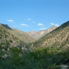
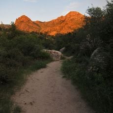
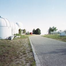
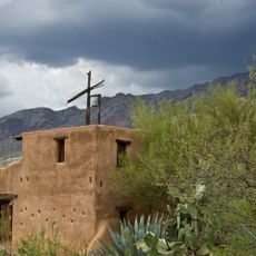
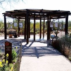
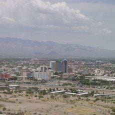
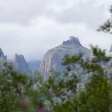
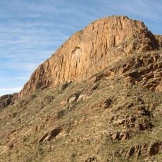
Oracle is a mountain settlement in Pinal County situated at 1,379 meters elevation in the Santa Catalina Mountains foothills. The location provides views across desert and forest landscapes in South Central Arizona, with trails, historic structures, and the Biosphere 2 research facility marking the area.

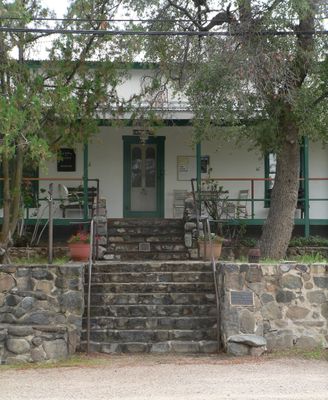
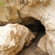
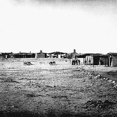
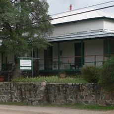
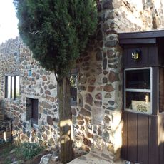
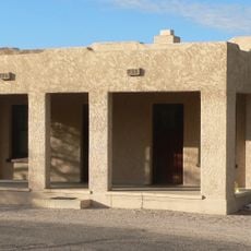
Albert Weldon discovered one of the first mines in 1876 and named the emerging settlement after his uncle's vessel. Mining activity shaped the region for decades, establishing community structures that continued to define the place.

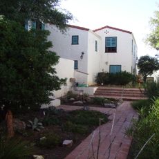
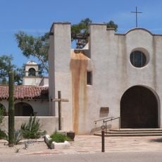
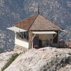
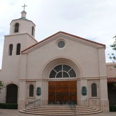
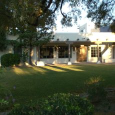
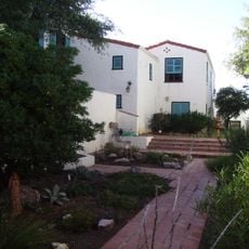
The settlement keeps its mining heritage alive through old buildings and community spaces that reflect the era when ore extraction shaped daily life. Visitors can see how the landscape and local architecture still bear the marks of those early boom days.

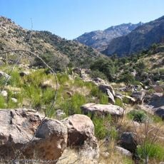
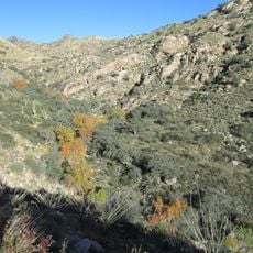
Oracle State Park offers multiple hiking trails and stargazing areas protected under Dark Sky regulations. The settlement is easily accessible by car and works well for day visits as well as longer stays that include walking and exploring nature.

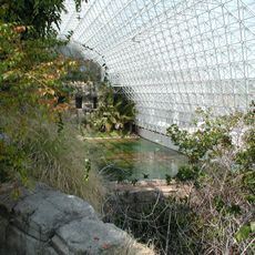
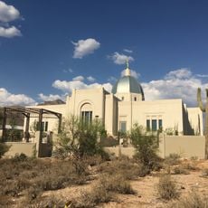
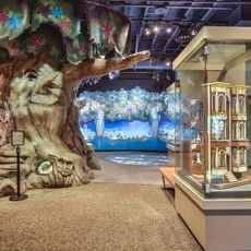
The Biosphere 2 center contains seven artificial ecosystems under glass that enable studies about environmental conditions and human survival in extreme settings. The project was originally designed to explore how people could thrive in completely isolated environments.

The community of curious travelers

AroundUs brings together thousands of curated places, local tips, and hidden gems, enriched daily by 60,000 contributors worldwide.

Start exploring
Location
Elevation above the sea
1,379 m
Part of
South Central Arizona
GPS coordinates
32.61610,-110.78200
Latest update
December 20, 2025 14:04
Around this place
Biosphere 2
United States of America

Biosphere 2

7.7 km
Sabino Canyon
United States of America

Sabino Canyon

33.5 km
Catalina State Park
United States of America

Catalina State Park

23.1 km
Mount Lemmon Observatory
United States of America

Mount Lemmon Observatory

19.4 km
Peppersauce Cave
United States of America

Peppersauce Cave

12.4 km
DeGrazia Gallery in the Sun Historic District
United States of America

DeGrazia Gallery in the Sun Historic District

34.3 km
Tohono Chul
United States of America

Tohono Chul

36 km
Tucson Arizona Temple
United States of America

Tucson Arizona Temple

34.7 km
Camp Grant
United States of America

Camp Grant

25.9 km
Oracle State Park
United States of America

Oracle State Park

19.2 km
United States of America

Bear Canyon

33.4 km
Acadia Ranch
United States of America

Acadia Ranch

1.8 km
Catalina Station
United States of America

Catalina Station

22.7 km
Tohono Chul | Gardens, Galleries, and Bistro
United States of America

Tohono Chul | Gardens, Galleries, and Bistro

36.1 km
Agua Caliente Regional Park
United States of America

Agua Caliente Regional Park

37.5 km
Thimble Peak
United States of America

Thimble Peak

31 km
La Casa del High Jinks
United States of America

La Casa del High Jinks

6.4 km
Romero Canyon
United States of America

Romero Canyon

22.8 km
Molino Canyon
United States of America

Molino Canyon

33.1 km
Pusch Ridge Wilderness Area
United States of America

Pusch Ridge Wilderness Area

27.3 km
St. Philip's in the Hills Episcopal Church
United States of America

St. Philip's in the Hills Episcopal Church

39.4 km
The Mini Time Machine Museum
United States of America

The Mini Time Machine Museum

40.4 km
Lowell Ranger Station
United States of America

Lowell Ranger Station

34.1 km
Lemmon Rock Lookout House
United States of America

Lemmon Rock Lookout House

20.2 km
SaddleBrooke One
United States of America

SaddleBrooke One

12.7 km
Church of Saint Thomas the Apostle in Tucson
United States of America

Church of Saint Thomas the Apostle in Tucson

37.3 km
Drexel House
United States of America

Drexel House

37 km
Kannally Ranch
United States of America

Kannally Ranch

4.6 km
Show the full map
Reviews
Share your experience

No review yet

Discussions
Start a discussion...

No discussion yet

« Oracle - Mountain town in Pinal County, United States » is provided by Around Us (aroundus.com). Images and texts are derived from Wikimedia project under a Creative Commons license. You are allowed to copy, distribute, and modify copies of this page, under the conditions set by the license, as long as this note is clearly visible.

Discover hidden gems everywhere you go!

From secret cafés to breathtaking viewpoints, skip the crowded tourist spots and find places that match your style. Our app makes it easy with voice search, smart filtering, route optimization, and insider tips from travelers worldwide. Download now for the complete mobile experience.

Around Us App Screenshot

A unique approach to discovering new places

Le Figaro

All the places worth exploring

France Info

A tailor-made excursion in just a few clicks

20 Minutes

Around Us
Travel Guide & Maps
Download

Send to your phone

QR Code
1

Open the camera app on your mobile.

2

Point at the QR code with your camera. A notification will appear.

3

Tap the notification to open the link.