Chest opened
+${chestReward.xp} XP
Explorer
NOUVEAU ×${chestReward.collectible.quantity}
tapez pour fermer

See the monuments around you in AR Open chests in the app

Around Us is built for your phone — point your camera at the streets and discover the monuments and places around you in augmented reality. Around Us is built for your phone — chests unlock when you walk, explore and capture nearby places.

Enable Location

We need your location to show you interesting places around you

Discover nearby places

Find interesting locations and hidden gems around you

Precise directions

Get accurate directions and distances to places

Your location is never shared with other users. It's only used when you tap the location button.

Log in to your account

Start exploring — it's free

Trusted by 87,266 travelers worldwide

Continue with Google
Continue with Apple
or

We will send you a code to connect

By continuing, you accept our Terms and Conditions and our Privacy Policy

Check your inbox

We've sent a pincode in your inbox. Please enter the code below.

Plains of San Agustin
Discussion Reviews Photo
8.8k Popularity

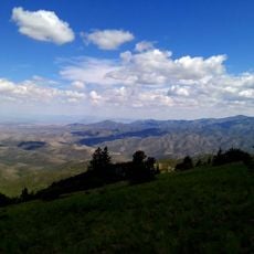
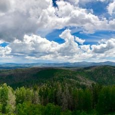
Plains of San Agustin, Vast grassland plains in Catron County, United States.

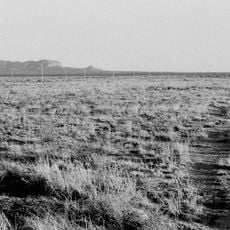
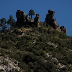
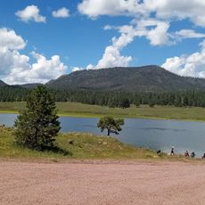
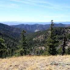
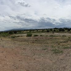
The Plains of San Agustin are a flat grassland basin in southwestern New Mexico, surrounded by mountain ranges on all sides. The floor of the basin sits at roughly 6,900 feet (2,100 m) in elevation and is covered mainly by grasses and low shrubs with few trees.

During the last ice age, a large lake filled this basin before slowly disappearing as the climate changed over thousands of years. The sediments left behind formed the flat floor that gives the plains their character today.

Native American peoples hunted and herded across these plains for centuries, shaping how the land was used. The region still reflects these deep roots through local names and customs.

The area is remote and only reachable by car, with no public transportation serving this part of New Mexico. Winters can be very cold, and the dry conditions throughout the year mean visitors should bring water and dress in layers.

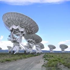
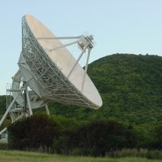
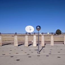
The basin is home to the Very Large Array, a radio telescope made up of 27 large dish antennas that use the flat, open terrain and lack of radio interference for their observations. The facility has appeared in several films and is open to visitors.

The community of curious travelers

AroundUs brings together thousands of curated places, local tips, and hidden gems, enriched daily by 60,000 contributors worldwide.
Start exploring
Location
Elevation above the sea
2,123 m
GPS coordinates
33.87533,-108.25089
Latest update
September 13, 2026 15:11
Around this place
Karl G. Jansky Very Large Array
United States of America

Karl G. Jansky Very Large Array

38.7 mi
Gila Cliff Dwellings National Monument
United States of America

Gila Cliff Dwellings National Monument

44.9 mi
The Lightning Field
United States of America

The Lightning Field

45.1 mi
Gila National Forest
United States of America

Gila National Forest

37.6 mi
Gila Wilderness
United States of America

Gila Wilderness

46.8 mi
Very Long Baseline Array
United States of America

Very Long Baseline Array

38.9 mi
Mogollon
United States of America

Mogollon

45.6 mi
Luna Lake
United States of America

Luna Lake

48.7 mi
Withington Wilderness
United States of America

Withington Wilderness

45.5 mi
Bearwallow Mountain Lookout Cabins and Shed
United States of America

Bearwallow Mountain Lookout Cabins and Shed

38 mi
Black Mountain Lookout Cabin
United States of America

Black Mountain Lookout Cabin

34.4 mi
Mogollon Baldy Lookout Cabin
United States of America

Mogollon Baldy Lookout Cabin

46.2 mi
Gallo Mountains
United States of America

Gallo Mountains

24.6 mi
Cosmic Campground
United States of America

Cosmic Campground

47.4 mi
Gila Cliff Dwellings Bookstore Western National Parks Association
United States of America

Gila Cliff Dwellings Bookstore Western National Parks Association

44.7 mi
United States of America

Pie Town VLBA station

30.4 mi
Shiva:Shiwana
United States of America

Shiva:Shiwana

38.6 mi
Bracewell Radio Sundial
United States of America

Bracewell Radio Sundial

38.6 mi
Mogollon Baldy Lookout
United States of America

Mogollon Baldy Lookout

46.2 mi
Bearwallow Lookout
United States of America

Bearwallow Lookout

38 mi
United States of America

Mogollon Theater Historic Site

45.6 mi
United States of America

Lightning Field

45.3 mi
United States of America

Scenic viewpoint

42.8 mi
United States of America

Waterfall

46.4 mi
United States of America

Waterfall

46.1 mi
United States of America

Waterfall

45.8 mi
United States of America

Waterfall

46.2 mi
United States of America

Waterfall

45.4 mi
Show the full map
Reviews
Share your experience

No review yet

Discussions
Start a discussion...

No discussion yet

« Plains of San Agustin - Vast grassland plains in Catron County, United States » is provided by Around Us (aroundus.com). Images and texts are derived from Wikimedia project under a Creative Commons license. You are allowed to copy, distribute, and modify copies of this page, under the conditions set by the license, as long as this note is clearly visible.

Discover hidden gems everywhere you go!

From secret cafés to breathtaking viewpoints, skip the crowded tourist spots and find places that match your style. Our app makes it easy with voice search, smart filtering, route optimization, and insider tips from travelers worldwide. Download now for the complete mobile experience.

Around Us App Screenshot

A unique approach to discovering new places

Le Figaro

All the places worth exploring

France Info

A tailor-made excursion in just a few clicks

20 Minutes

Around Us
Travel Guide & Maps
Download

Send to your phone

QR Code
1

Open the camera app on your mobile.

2

Point at the QR code with your camera. A notification will appear.

3

Tap the notification to open the link.