Chest opened
+${chestReward.xp} XP
Explorer
NOUVEAU ×${chestReward.collectible.quantity}
tapez pour fermer
Chest locked

Open chests in the app

Around Us is built for your phone — chests unlock when you walk, explore and capture nearby places.

Enable Location

We need your location to show you interesting places around you

Discover nearby places

Find interesting locations and hidden gems around you

Precise directions

Get accurate directions and distances to places

Your location is never shared with other users. It's only used when you tap the location button.

Log in to your account

Start exploring — it's free

Trusted by 73,017 travelers worldwide

Continue with Google
Continue with Apple
or

We will send you a code to connect

By continuing, you accept our Terms and Conditions and our Privacy Policy

Check your inbox

We've sent a pincode in your inbox. Please enter the code below.

San Elizario Salt War
Discussion Reviews Photo
12.8k Popularity

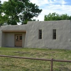
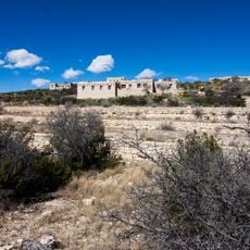
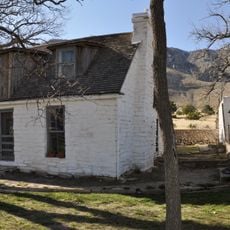
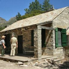
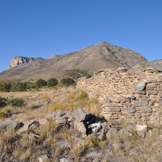
San Elizario Salt War, Historical conflict site in San Elizario, Texas

The San Elizario Salt War was a territorial dispute over salt deposits near the Texas-Mexico border where Mexican-American residents clashed with Anglo-American politicians seeking to control mineral rights. The salt from these deposits served essential roles in food preservation, leather tanning, and silver mining operations across the border region.

The conflict began in 1877 when local authorities attempted to privatize control over traditional salt access. This effort sparked tensions that escalated into armed clashes between Mexican-American residents and government forces.

The conflict shows how Mexican-American communities fought to keep their traditional shared access to salt resources against private ownership claims. Local residents saw this as a struggle for their established rights to the land and its resources.

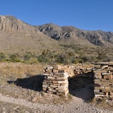
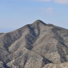
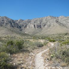
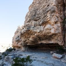
This historic site is located in the border region and is most accessible during drier months when conditions are most manageable. Visitors should prepare for an arid climate and seek out local guides or information centers to locate the actual historical sites across the landscape.

The arrival of the 9th Cavalry, an African-American regiment, ended direct confrontations and prompted many local residents to relocate to Mexico. This shift in military presence changed the dynamics and caused families to leave their homes behind.

The community of curious travelers

AroundUs brings together thousands of curated places, local tips, and hidden gems, enriched daily by 60,000 contributors worldwide.

Start exploring
Location
GPS coordinates
31.74330,-105.07700
Latest update
December 7, 2025 20:43
Around this place
Carlsbad Caverns National Park
United States of America

Carlsbad Caverns National Park

76.7 km
Guadalupe Peak
United States of America

Guadalupe Peak

26.3 km
Lechuguilla Cave
United States of America

Lechuguilla Cave

73.6 km
Sitting Bull Falls
United States of America

Sitting Bull Falls

66.5 km
McKittrick Canyon
United States of America

McKittrick Canyon

40.2 km
Rattlesnake Springs Historic District
United States of America

Rattlesnake Springs Historic District

70.6 km
Wallace E. Pratt House
United States of America

Wallace E. Pratt House

38.4 km
The Caverns Historic District
United States of America

The Caverns Historic District

77 km
Frijole Ranch
United States of America

Frijole Ranch

31.9 km
Wallace Pratt Lodge
United States of America

Wallace Pratt Lodge

38.7 km
Pinery Station
United States of America

Pinery Station

29.8 km
First Presbyterian Church
United States of America

First Presbyterian Church

81.3 km
Hudspeth County Courthouse
United States of America

Hudspeth County Courthouse

68.1 km
Bat Flight Amphitheater
United States of America

Bat Flight Amphitheater

77 km
Carlsbad Cavern
United States of America

Carlsbad Cavern

77.1 km
Guadalupe Mountains Wilderness
United States of America

Guadalupe Mountains Wilderness

31.7 km
Smith Spring Trail
United States of America

Smith Spring Trail

32.4 km
Indian Rock Shelter
United States of America

Indian Rock Shelter

79.2 km
Butterfield Overland Mail Corridor
United States of America

Butterfield Overland Mail Corridor

29.8 km
Rattlesnake Springs Pump House
United States of America

Rattlesnake Springs Pump House

70.3 km
Pine Springs Visitor Center
United States of America

Pine Springs Visitor Center

29.4 km
State Theater
United States of America

State Theater

69.5 km
Pine Springs Trailhead
United States of America

Pine Springs Trailhead

29.1 km
Pine Springs Campground
United States of America

Pine Springs Campground

29.1 km
Devils Hall
United States of America

Devils Hall

28.3 km
Frijole Ranch Picnic Area
United States of America

Frijole Ranch Picnic Area

31.7 km
El Capitan Lookout
United States of America

El Capitan Lookout

25.2 km
Williams Ranch
United States of America

Williams Ranch

23.9 km
Show the full map
Reviews
Share your experience

No review yet

Discussions
Start a discussion...

No discussion yet

« San Elizario Salt War - Historical conflict site in San Elizario, Texas » is provided by Around Us (aroundus.com). Images and texts are derived from Wikimedia project under a Creative Commons license. You are allowed to copy, distribute, and modify copies of this page, under the conditions set by the license, as long as this note is clearly visible.

Discover hidden gems everywhere you go!

From secret cafés to breathtaking viewpoints, skip the crowded tourist spots and find places that match your style. Our app makes it easy with voice search, smart filtering, route optimization, and insider tips from travelers worldwide. Download now for the complete mobile experience.

Around Us App Screenshot

A unique approach to discovering new places

Le Figaro

All the places worth exploring

France Info

A tailor-made excursion in just a few clicks

20 Minutes

Around Us
Travel Guide & Maps
Download

Send to your phone

QR Code
1

Open the camera app on your mobile.

2

Point at the QR code with your camera. A notification will appear.

3

Tap the notification to open the link.