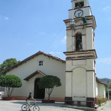
Celaque National Park, National park in Lempira Department, Honduras.
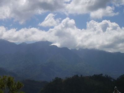
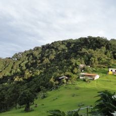
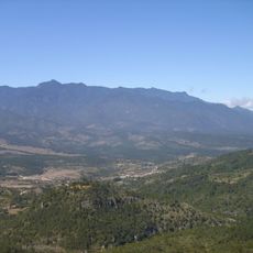
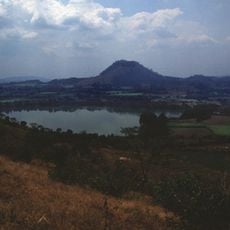
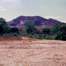
Celaque National Park is a protected area in Lempira Department in western Honduras, covering 26,378 hectares of cloud forest and steep mountain slopes. The highest point in the country rises here at 2,849 meters (9,347 feet), towering above dense forests.
The Honduran government established the park in 1987 to protect the region from growing population pressure and deforestation. The creation aimed to safeguard the rainforest that supplies water to many surrounding communities.
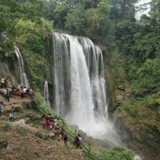
The name comes from the Lenca language and means water container, a reference to the eleven rivers that begin here. Hikers often meet clouds hanging between the trees, giving the place its special character.
Five marked trails lead through the grounds to three camping areas, and a visitor center offers information and basic facilities. The hikes require good fitness, as the paths are steep and weather can change quickly.
The endemic salamander Bolitoglossa celaque lives here, found only in these mountains. Nineteen varieties of wild mushrooms grow in the forest and are gathered and eaten by nearby villagers.
Location: Lempira Department
Inception: 1987
Address: Montaña de Celaque, Lempira, Honduras
GPS coordinates: 14.53556,-88.70722
Latest update: December 5, 2025 22:30
Honduras holds a range of natural sites and archaeological locations along its Caribbean coastline and mountainous interior. The Copán ruins stand among the most important remnants of the Mayan civilization, displaying intricate stonework and the Hieroglyphic Stairway. Several islands in the Bay Islands, including Roatán, Utila, and Guanaja, offer sandy shores and access to coral reefs. National parks such as Pico Bonito, La Tigra, and Celaque protect rainforests and mountain ecosystems with trails through dense vegetation. Lake Yojoa sits between forested hills and serves as a habitat for migratory birds. The capital city of Tegucigalpa contains the 18th-century cathedral, along with the Museum for National Identity and the Garífuna Cultural Center, which provide insight into the country's history and culture. The Christ of Picacho statue overlooks the city from a hilltop. Along the northern coast, the Lancetilla Botanical Garden in Tela holds collections of tropical plants. Protected areas like the Río Plátano Biosphere Reserve and the Moskitia region in the east preserve remote rainforests and wetlands. Cayos Cochinos consists of small islands with clear waters off the coast near La Ceiba.
Copán
57.7 km
Quiriguá
89.2 km
Cerro El Pital
48.5 km
Pulhapanzak
93.4 km
Montecristo National Park
74.8 km
Cihuatán
79 km
Cerro Las Minas
2.9 km
San Cristóbal fortress
14.5 km
Los Naranjos
86.4 km
St. Rose Cathedral, Santa Rosa de Copán
26.9 km
Estadio José Gregorio Martínez
61.7 km
Estadio Jorge Calero Suárez
83.1 km
Museum of the Revolution
87 km
Santa Bárbara Central Park
66.3 km
Iglesia de San Pedro Apóstol
82.9 km
Área de Uso Múltiple Lago de Yojoa
81.6 km
Potonico
66.6 km
Apastepeque
91.4 km
St. John the Baptist Cathedral
60.4 km
Cinotepeque
82.6 km
La Esperanza, Intibucá
62.4 km
Agua Blanca
70.9 km
Macaw mountain bird park
59.8 km
Museo
89.7 km
Luna Jaguar Spa Oficina de informacion
58.9 km
Iglesia del Calvario
82.9 km
Museo Fernando Llort
55.8 km
Cueva El Gigante
78 kmReviews
Visited this place? Tap the stars to rate it and share your experience / photos with the community! Try now! You can cancel it anytime.
Discover hidden gems everywhere you go!
From secret cafés to breathtaking viewpoints, skip the crowded tourist spots and find places that match your style. Our app makes it easy with voice search, smart filtering, route optimization, and insider tips from travelers worldwide. Download now for the complete mobile experience.
A unique approach to discovering new places❞
— Le Figaro
All the places worth exploring❞
— France Info
A tailor-made excursion in just a few clicks❞
— 20 Minutes