
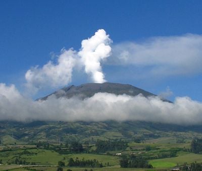
Galeras, Active stratovolcano in Nariño Department, Colombia
The Galeras volcano rises 4,276 meters above sea level, featuring a cone-shaped structure with its western section partially destroyed by past eruptions.
The first documented eruption of Galeras occurred on December 7, 1580, marking the beginning of recorded volcanic activity during the Spanish colonial period.
Indigenous Quillacinga people named this mountain Urcunina, meaning Mountain of Fire, before Spanish colonizers renamed it after Mediterranean sailing vessels.
A 23-kilometer road connects the city of San Juan de Pasto to the summit, while a 117-kilometer circular route surrounds the entire volcanic structure.
The Galeras Flora and Fauna Sanctuary, established in 1985, protects 8,600 hectares of land encompassing the volcanic edifice and upper regions of several municipalities.
Location: Nariño Department
Elevation above the sea: 4,276 m
Made from material: andesite
Website: http://volcano.si.edu/volcano.cfm?vn=351080
GPS coordinates: 1.22153,-77.35896
Latest update: May 26, 2025 21:28
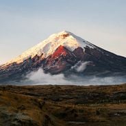
These volcanoes document Earth's geological forces. From Ecuador to Japan, they display various forms of volcanic activity. The selection includes Cotopaxi in Ecuador, Mount St. Helens in the USA, and Mount Fuji in Japan. Each volcano features distinct geological characteristics and historical eruptions
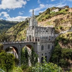
Las Lajas Sanctuary
52.8 km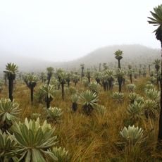
El Ángel Ecological Reserve
80 km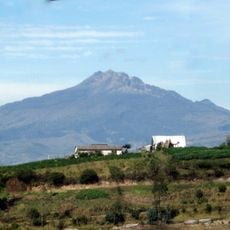
Chiles volcano
78.6 km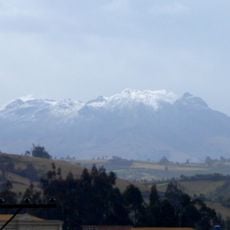
Cumbal
65.8 km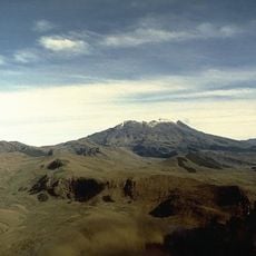
Volcán Azufral
42.8 km
La Corota Island Flora Sanctuary
25.4 km
Estadio Departamental Libertad
9.4 km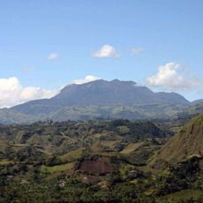
Doña Juana
56.4 km
Sotará
130.6 km
Imbabura UNESCO Global Geopark
134.9 km
Doña Juana-Cascabel Volcanic Complex
66.2 km
Unidad Educativa "Bolívar"
58.8 km
Alto Fragua - Indi Wasi National Natural Park
137.7 km
Laguna Verde (Nariño)
42.7 km
Sagrado Corazón, Pasto
8.8 km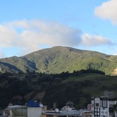
Cerro Morazurco
14.3 km
Petacas
67.9 km
Nuestra Señora de la Merced
9.1 km
Santiago
8.6 km
Cristo Rey
9.2 km
San Felipe Neri
8.9 km
Brigada 27 Mocoa
79.6 km
San Andrés
8.6 km
Galeras Fauna and Flora Sanctuary
2.4 km
Torres de Santa Lucia
30.5 km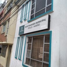
Registraduría Nacional Del Estado Civil
53.8 km
Parque Infantil
8.6 km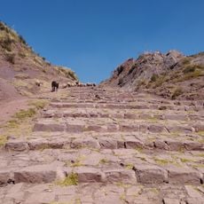
Qhapaq Ñan, Andean Road System
108.9 kmReviews
Visited this place? Tap the stars to rate it and share your experience / photos with the community! Try now! You can cancel it anytime.
Discover hidden gems everywhere you go!
From secret cafés to breathtaking viewpoints, skip the crowded tourist spots and find places that match your style. Our app makes it easy with voice search, smart filtering, route optimization, and insider tips from travelers worldwide. Download now for the complete mobile experience.

A unique approach to discovering new places❞
— Le Figaro
All the places worth exploring❞
— France Info
A tailor-made excursion in just a few clicks❞
— 20 Minutes