Sotará, Stratovolcano in Sotará, Cauca, Colombia
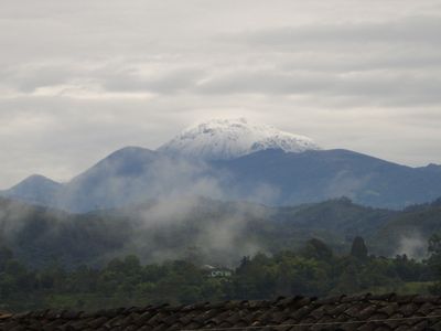
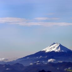
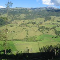
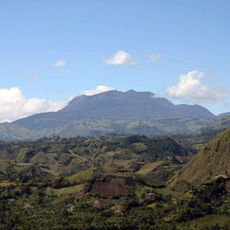
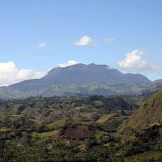
Sotará is a stratovolcano in Cauca Department that rises to 4,580 meters and is built from alternating layers of lava and volcanic ash. Its elongated cone shape reflects the typical structure of a volcano that grew through repeated eruptions over a long period.
The volcano took shape during the Holocene through several eruption cycles that formed the current landscape. The last recorded volcanic activity dates to 1885, and the mountain has remained quiet since then.
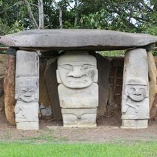
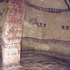
Local communities view this volcano as a sacred natural element woven into their spiritual practices and oral traditions. The mountain holds deep meaning in the daily lives and beliefs of the people who live in its shadow.
The approach to this volcano requires travel through rural roads starting from El Cajibío, and visitors should prepare for high altitude conditions. Proper gear and acclimatization are important for anyone planning to explore the mountain.
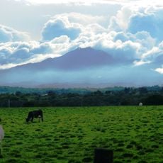
Hot springs on the mountain reach temperatures around 80 degrees Celsius, and fumaroles release gas mixtures from deep below the surface. These geothermal features reveal that volcanic processes remain active beneath the mountain.
Location: Cauca Department
Elevation above the sea: 4,400 m
Made from material: andesite
GPS coordinates: 2.10885,-76.59155
Latest update: December 10, 2025 16:30
San Agustin archeological park
45.2 km
Nevado del Huila
110.8 km
Tierradentro
81.5 km
Puracé
31.6 km
Puracé National Natural Park
28.7 kmCueva de los Guácharos National Natural Park
80.4 km
Lake Salvajina
86.6 km
Morro del Tulcán
37.4 km
Santo Ecce Homo de Popayán
36.8 km
Doña Juana
77.8 km
Munchique National Natural Park
85.6 km
Saint Francis of Assisi Church
37.3 km
Cathedral Basilica of Our Lady of the Assumption, Popayán
37.1 km
Parque Caldas
37.1 km
Salto de Bordones
48.2 km
Doña Juana-Cascabel Volcanic Complex
75.7 km
Alto Fragua - Indi Wasi National Natural Park
95 kmPopayán Archdiocesan Museum of Religious Art
37.1 km
Ermita de Jesús Nazareno
37.3 km
Estadio Ciro López
38.5 km
Iglesia de San José
37.1 km
Petacas
67.1 km
Salto de Mortiño
50.1 km
Amo Jesús de Puelenje
36.5 km
Puelenje
36.5 km
Plaza de toros de Santo Domingo
120 km
Capilla Paéz San Andrés de Pisimbalá
80.5 km
Brigada 27 Mocoa
108 kmVisited this place? Tap the stars to rate it and share your experience / photos with the community! Try now! You can cancel it anytime.
Discover hidden gems everywhere you go!
From secret cafés to breathtaking viewpoints, skip the crowded tourist spots and find places that match your style. Our app makes it easy with voice search, smart filtering, route optimization, and insider tips from travelers worldwide. Download now for the complete mobile experience.
A unique approach to discovering new places❞
— Le Figaro
All the places worth exploring❞
— France Info
A tailor-made excursion in just a few clicks❞
— 20 Minutes