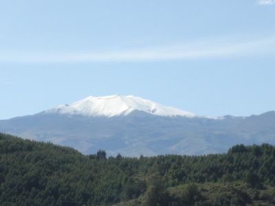
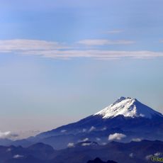
Puracé, Stratovolcano in Cauca Department, Colombia
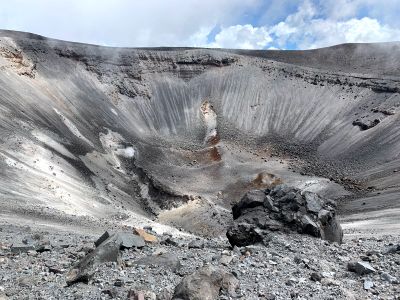
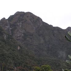
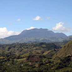
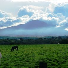
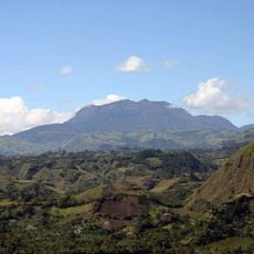
Puracé is an andesite stratovolcano in Cauca Department that rises to 4646 meters above sea level. The summit area shows several craters and vents that continue to steam and cover the upper part of the mountain with yellowish deposits.
The last major eruption took place in March 1977 and spread ash across the surrounding valleys. Earlier eruptions in the 20th century forced residents to evacuate their villages temporarily on several occasions.
The name comes from the local indigenous language and means mountain of fire and snow. Visitors today see the white sulfur crust around the active fumaroles, which release smoke in many places and create a sulfurous atmosphere.
Accessing the summit requires a permit from the national park and accompaniment by a certified mountain guide. The hike usually begins in the early morning hours to take advantage of the clearest visibility and return before afternoon fog.
Two geological faults cross directly beneath the volcano and amplify the geothermal activity. This intersection creates a network of hot springs that spread over several kilometers around the summit.
Location: Cauca Department
Elevation above the sea: 4,756 m
Made from material: andesite
Address: Puracé, Purace, Cauca, Colombia
GPS coordinates: 2.31383,-76.39492
Latest update: December 5, 2025 22:29
San Agustin archeological park
47.7 km
Nevado del Huila
79.7 km
Tierradentro
50.2 km
Puracé National Natural Park
13.6 km
Lake Betania
114 km
Farallones de Cali National Natural Park
108 km
Lake Salvajina
71.4 km
Morro del Tulcán
27.1 km
Santo Ecce Homo de Popayán
26.7 km
Doña Juana
108.8 km
Munchique National Natural Park
87.8 km
Saint Francis of Assisi Church
27.8 km
Cathedral Basilica of Our Lady of the Assumption, Popayán
27.5 km
Parque Caldas
27.5 km
Sotará
31.6 km
Salto de Bordones
41.8 km
Doña Juana-Cascabel Volcanic Complex
105.3 km
Alto Fragua - Indi Wasi National Natural Park
107 km
Ermita de Jesús Nazareno
27.8 km
Estadio Ciro López
26.9 km
Iglesia de San José
27.6 km
Petacas
97.7 km
Salto de Mortiño
52.9 km
Amo Jesús de Puelenje
29 km
Puelenje
29 km
House of Adoration North of Cauca
97.4 km
Plaza de toros de Santo Domingo
115.8 km
Capilla Paéz San Andrés de Pisimbalá
49.1 kmVisited this place? Tap the stars to rate it and share your experience / photos with the community! Try now! You can cancel it anytime.
Discover hidden gems everywhere you go!
From secret cafés to breathtaking viewpoints, skip the crowded tourist spots and find places that match your style. Our app makes it easy with voice search, smart filtering, route optimization, and insider tips from travelers worldwide. Download now for the complete mobile experience.
A unique approach to discovering new places❞
— Le Figaro
All the places worth exploring❞
— France Info
A tailor-made excursion in just a few clicks❞
— 20 Minutes