Chest opened
+${chestReward.xp} XP
Explorer
NOUVEAU ×${chestReward.collectible.quantity}
tapez pour fermer
Chest locked

Open chests in the app

Around Us is built for your phone — chests unlock when you walk, explore and capture nearby places.

Enable Location

We need your location to show you interesting places around you

Discover nearby places

Find interesting locations and hidden gems around you

Precise directions

Get accurate directions and distances to places

Your location is never shared with other users. It's only used when you tap the location button.

Aguadulce District

Log in to your account

Start exploring — it's free

Trusted by 72,879 travelers worldwide

Continue with Google
Continue with Apple
or

We will send you a code to connect

By continuing, you accept our Terms and Conditions and our Privacy Policy

Check your inbox

We've sent a pincode in your inbox. Please enter the code below.

Aguadulce District
Discussion Reviews 1 Photos
10.8k Popularity

Aguadulce District, Agricultural district near Bahia de Parita, Panama.

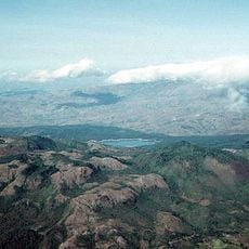
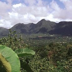
Aguadulce District is a district in Coclé Province, Panama, covering flat plains that reach toward the Pacific coast. The landscape is shaped by rice paddies, sugar cane fields, and salt production areas that spread across much of the territory.

The district was formed in 1848 when it separated from Natá de los Caballeros and over time grew into one of Panama's main agricultural centers. That founding split set the course for a local economy built around food and commodity production.

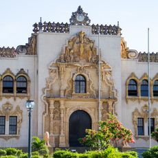
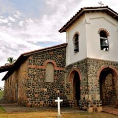
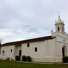
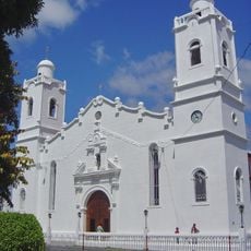
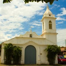
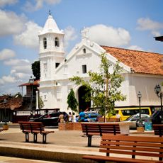
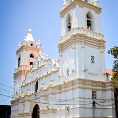
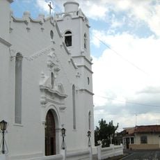
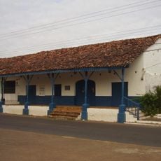
The Church of Saint John the Baptist draws the local community together for religious celebrations and festivals throughout the year. These gatherings are a visible part of everyday life and reflect the faith traditions that shape how people in the district mark the seasons.

The Pan-American Highway passes through the district and makes it easy to reach from Panama City or nearby towns. The drier months of the year tend to offer the most comfortable conditions for visiting the surrounding agricultural areas.

Salt production in the district relies on large open ponds where seawater evaporates slowly under the sun, leaving behind salt crystals. These ponds have worked the same way for many decades and are visible from the roads that cross the coastal flats.

The community of curious travelers

AroundUs brings together thousands of curated places, local tips, and hidden gems, enriched daily by 60,000 contributors worldwide.

Start exploring
Location
GPS coordinates
8.24000,-80.54000
Latest update
March 3, 2026 08:21
Reviews
Share your experience

No review yet

Discussions
Start a discussion...

No discussion yet

« Aguadulce District - Agricultural district near Bahia de Parita, Panama » is provided by Around Us (aroundus.com). Images and texts are derived from Wikimedia project under a Creative Commons license. You are allowed to copy, distribute, and modify copies of this page, under the conditions set by the license, as long as this note is clearly visible.

Discover hidden gems everywhere you go!

From secret cafés to breathtaking viewpoints, skip the crowded tourist spots and find places that match your style. Our app makes it easy with voice search, smart filtering, route optimization, and insider tips from travelers worldwide. Download now for the complete mobile experience.

Around Us App Screenshot

A unique approach to discovering new places

Le Figaro

All the places worth exploring

France Info

A tailor-made excursion in just a few clicks

20 Minutes

Around Us
Travel Guide & Maps
Download

Send to your phone

QR Code
1

Open the camera app on your mobile.

2

Point at the QR code with your camera. A notification will appear.

3

Tap the notification to open the link.