Chest opened
+${chestReward.xp} XP
Explorer
NOUVEAU ×${chestReward.collectible.quantity}
tapez pour fermer
Chest locked

Open chests in the app

Around Us is built for your phone — chests unlock when you walk, explore and capture nearby places.

Enable Location

We need your location to show you interesting places around you

Discover nearby places

Find interesting locations and hidden gems around you

Precise directions

Get accurate directions and distances to places

Your location is never shared with other users. It's only used when you tap the location button.

Orito

Log in to your account

Start exploring — it's free

Trusted by 72,985 travelers worldwide

Continue with Google
Continue with Apple
or

We will send you a code to connect

By continuing, you accept our Terms and Conditions and our Privacy Policy

Check your inbox

We've sent a pincode in your inbox. Please enter the code below.

Discussion Reviews 1 Photos
13.8k Popularity

Orito, Administrative municipality in Putumayo Department, Colombia

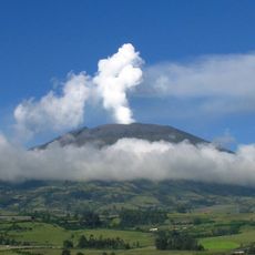
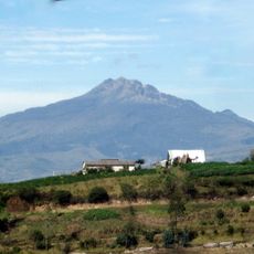
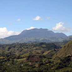
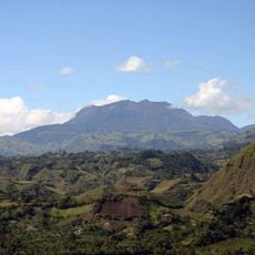
Orito is a municipality in Putumayo Department, Colombia, nestled in the Amazon rainforest region at roughly 680 meters elevation. The area spans about 1,860 square kilometers and features river valleys that cut through the terrain.

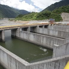
This settlement grew from oil exploration camps in the Amazon foothills during the early 1960s. It gained official municipal status roughly a decade later as the area developed around these operations.

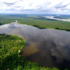
Life here centers on the rivers Quebradón and Orito, which shape how people move, trade, and gather. Communities blend farming traditions with rhythms tied to the Amazon rainforest and waterways.

The driest months offer better conditions for travel and river crossings in the area. Visitors should expect challenging road conditions and benefit from local guidance when exploring beyond main routes.

The region unusually mixes oil extraction with farming, where crops like bananas, cassava, and maize grow alongside industrial operations. This blend of resource industries and traditional agriculture shapes local identity in distinctive ways.

The community of curious travelers

AroundUs brings together thousands of curated places, local tips, and hidden gems, enriched daily by 60,000 contributors worldwide.

Start exploring
Inception
1963
Elevation above the sea
682 m
GPS coordinates
0.66611,-76.87083
Latest update
December 7, 2025 20:24
Reviews
Share your experience

No review yet

Discussions
Start a discussion...

No discussion yet

« Orito - Administrative municipality in Putumayo Department, Colombia » is provided by Around Us (aroundus.com). Images and texts are derived from Wikimedia project under a Creative Commons license. You are allowed to copy, distribute, and modify copies of this page, under the conditions set by the license, as long as this note is clearly visible.

Discover hidden gems everywhere you go!

From secret cafés to breathtaking viewpoints, skip the crowded tourist spots and find places that match your style. Our app makes it easy with voice search, smart filtering, route optimization, and insider tips from travelers worldwide. Download now for the complete mobile experience.

Around Us App Screenshot

A unique approach to discovering new places

Le Figaro

All the places worth exploring

France Info

A tailor-made excursion in just a few clicks

20 Minutes

Around Us
Travel Guide & Maps
Download

Send to your phone

QR Code
1

Open the camera app on your mobile.

2

Point at the QR code with your camera. A notification will appear.

3

Tap the notification to open the link.