North Caribbean Coast Autonomous Region
North Caribbean Coast Autonomous Region, Autonomous region in northeastern Nicaragua
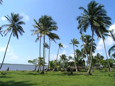
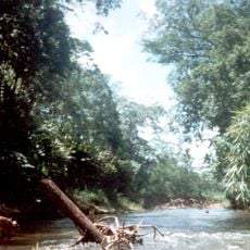
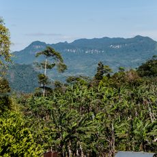
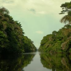
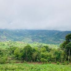
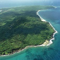
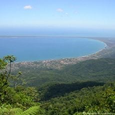
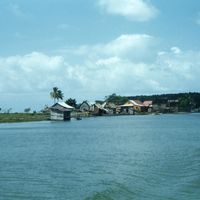
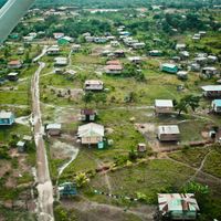
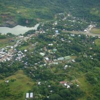
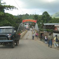
The North Caribbean Coast Autonomous Region occupies the northeastern part of the country, covered mostly by tropical rainforest, swamps, and coastline. This area is made up of eight municipalities with Puerto Cabezas as the main urban center, and it includes river systems and wetlands throughout.
This territory was once part of the larger Zelaya Department before becoming autonomous in 1987 through a special law granting self-rule. The change recognized the rights of local people to manage their own affairs.
The Miskito, Mayangna, and Creole communities speak their own languages and practice distinct customs that shape daily life in villages and towns. These groups maintain separate traditions and ways of living that visitors can observe firsthand.
Visiting is best during the drier months when roads and waterways are more passable, as heavy rain can make travel difficult. Getting around requires boats or planes since the terrain is covered in forest and waterways, with limited road connections.
The regional government operates in five official languages including Miskito Coast Creole, Garifuna, and others alongside Spanish. This multilingual approach is unusual in the region and grew from the different groups that settled and stayed in this area.
Location: Nicaragua
Inception: October 30, 1987
Capital city: Puerto Cabezas
Shares border with: Gracias a Dios Department, South Caribbean Coast Autonomous Region
GPS coordinates: 14.02941,-83.38313
Latest update: December 6, 2025 16:02
Río Plátano Biosphere Reserve
198.8 km
Reserva de la Biosfera Bosawás
174.7 km
Talgua caves
286 km
Hacienda San Jacinto
342.3 km
Solentiname Archipelago National Monument
362.4 km
La laguna fortificada de aooot raiti bocay
352.7 km
Our Lady of the Assumption Cathedral, Granada
363.8 km
Santa Bárbara fortress
347.4 km
Old Providence McBean Lagoon National Natural Park
232.8 km
Morgan's Cave
243.9 km
Sierra de Agalta National Park
287.6 km
Cayo Acuario
246 km
Barra del Colorado Wildlife Refuge
363.4 km
Our Lady of the Most Holy Rosary Cathedral, Estelí
338.1 km
Paisaje Terrestre Protegido Mesas de Miraflor-Moropotente
325.5 km
St. John Cathedral
302 km
St. John the Baptist Cathedral, Trujillo
347.3 km
Catedral de Nuestra Señora de la Asunción
303.3 km
National Shrine of Our Lady of Cuapa
292.4 km
Big Corn Island
210 km
Puebla
319 km
Reserva de la biosfera de Río San Juan
328.2 km
Nature Reserve Tepesomoto-Pataste
361.3 km
Indio Maíz Biological Reserve
334.9 km
Punta Caxinas Lighthouse
359.2 km
Parroquia San Rafael Arcángel
308.7 km
Iglesia Ciudad Antigua
319 km
Letras de Catacamas
286.1 kmVisited this place? Tap the stars to rate it and share your experience / photos with the community! Try now! You can cancel it anytime.
Discover hidden gems everywhere you go!
From secret cafés to breathtaking viewpoints, skip the crowded tourist spots and find places that match your style. Our app makes it easy with voice search, smart filtering, route optimization, and insider tips from travelers worldwide. Download now for the complete mobile experience.
A unique approach to discovering new places❞
— Le Figaro
All the places worth exploring❞
— France Info
A tailor-made excursion in just a few clicks❞
— 20 Minutes