Chest opened
+${chestReward.xp} XP
Explorer
NOUVEAU ×${chestReward.collectible.quantity}
tapez pour fermer
Chest locked

Open chests in the app

Around Us is built for your phone — chests unlock when you walk, explore and capture nearby places.

Enable Location

We need your location to show you interesting places around you

Discover nearby places

Find interesting locations and hidden gems around you

Precise directions

Get accurate directions and distances to places

Your location is never shared with other users. It's only used when you tap the location button.

Pico El Águila

Log in to your account

Start exploring — it's free

Trusted by 72,971 travelers worldwide

Continue with Google
Continue with Apple
or

We will send you a code to connect

By continuing, you accept our Terms and Conditions and our Privacy Policy

Check your inbox

We've sent a pincode in your inbox. Please enter the code below.

Pico El Águila
Discussion Reviews 1 Photos
12.5k Popularity

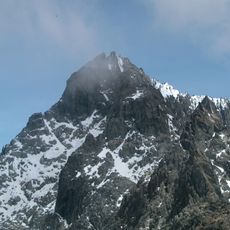
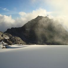
Pico El Águila, Mountain peak in Sierra de la Culata, Venezuela.

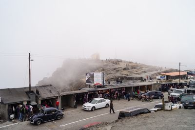
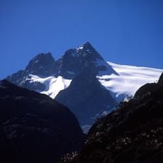
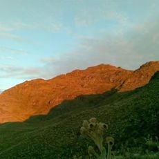
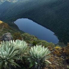
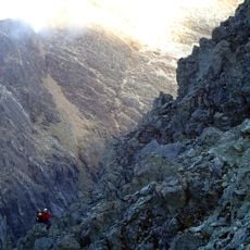
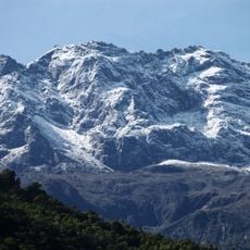
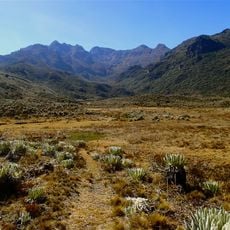
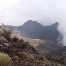
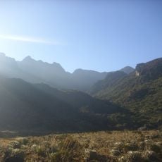
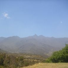
Pico El Águila is a mountain peak in the Sierra de la Culata reaching 4,118 meters and standing among the highest points in the Venezuelan Andes. The highway that crosses over the mountain offers continuously changing views across the surrounding ranges and valleys.

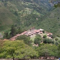
The mountain pass was opened up in the 20th century through the construction of the Transandean Highway, connecting different regions of the country. This road became a milestone in linking the Venezuelan Andes with other parts of the continent.

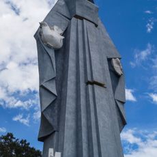
The condor sculpture by Colombian artist Marcos León Mariño at the peak commemorates an important location linked to Simón Bolívar's campaigns. The statue serves as a symbolic landmark where visitors can reflect on this historical connection.

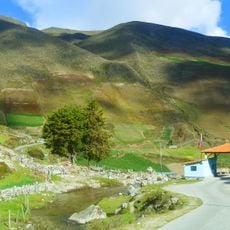
The best time to visit is during drier months, as weather conditions can change quickly at this elevation. The drive across the pass is well-established on the Transandean Highway with several spots for rest and photography.

The mountain peak is the highest point of the Transandean Highway and forms a section of the broader Pan-American Highway system. This location makes it a key junction for travelers moving between North and South American regions.

The community of curious travelers

AroundUs brings together thousands of curated places, local tips, and hidden gems, enriched daily by 60,000 contributors worldwide.

Start exploring
Location
Part of
Sierra de la Culata
GPS coordinates
8.85000,-70.81667
Latest update
December 7, 2025 20:44
Reviews
Share your experience

No review yet

Discussions
Start a discussion...

No discussion yet

« Pico El Águila - Mountain peak in Sierra de la Culata, Venezuela » is provided by Around Us (aroundus.com). Images and texts are derived from Wikimedia project under a Creative Commons license. You are allowed to copy, distribute, and modify copies of this page, under the conditions set by the license, as long as this note is clearly visible.

Discover hidden gems everywhere you go!

From secret cafés to breathtaking viewpoints, skip the crowded tourist spots and find places that match your style. Our app makes it easy with voice search, smart filtering, route optimization, and insider tips from travelers worldwide. Download now for the complete mobile experience.

Around Us App Screenshot

A unique approach to discovering new places

Le Figaro

All the places worth exploring

France Info

A tailor-made excursion in just a few clicks

20 Minutes

Around Us
Travel Guide & Maps
Download

Send to your phone

QR Code
1

Open the camera app on your mobile.

2

Point at the QR code with your camera. A notification will appear.

3

Tap the notification to open the link.