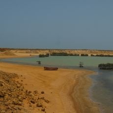
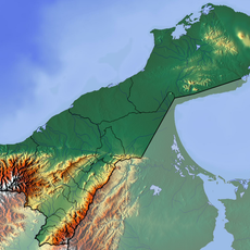
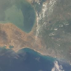
Médanos de Zapara, Desert dunes in Zulia, Venezuela
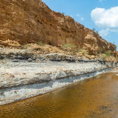
Médanos de Zapara are sand dunes located on an island positioned between the Gulf of Venezuela and Lake Maracaibo, featuring rolling formations of varying heights. The landscape consists of expansive sandy terrain interspersed with coastal vegetation and backed by water on multiple sides.
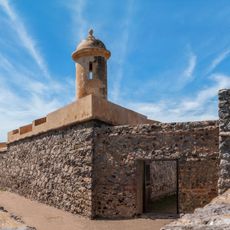
The area served as a coastal outpost during the Spanish colonial period, evidenced by the ruins of a defensive tower still visible nearby. Later, local fishing communities settled in the region and established practices that continue to shape the landscape today.
Local fishing communities have long depended on these coastal lands for their livelihoods, making the dunes an integral part of their daily connection to the sea and the resources it provides. This relationship between people and the landscape remains central to how residents understand their place in the region.
Access to the dunes requires boat transportation from the mainland, as the formations are situated on an island without road connections. It is helpful to check tide conditions and weather patterns before planning a visit to this coastal location.
During rainy seasons, these sand formations transform into temporary lagoons, creating an unusual landscape where water temporarily pools across the dunes. This seasonal shift makes the area a dynamic place where the face of the land changes with the weather patterns throughout the year.
The community of curious travelers
AroundUs brings together thousands of curated places, local tips, and hidden gems, enriched daily by 60,000 contributors worldwide.