Enable Location

We need your location to show you interesting places around you

Discover nearby places

Find interesting locations and hidden gems around you

Precise directions

Get accurate directions and distances to places

Your location is never shared with other users. It's only used when you tap the location button.

San Pedro de los Pinos

Log in to your account

Start exploring — it's free

Trusted by 62,121 travelers worldwide

Continue with Google
Continue with Apple
or

We will send you a code to connect

By continuing, you accept our Terms and Conditions and our Privacy Policy

Check your inbox

We've sent a pincode in your inbox. Please enter the code below.

San Pedro de los Pinos

San Pedro de los Pinos, Residential neighborhood in Benito Juárez, Mexico City.

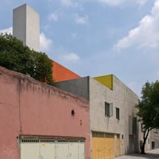
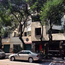
San Pedro de los Pinos is a residential neighborhood in Benito Juárez with a mix of homes, shops, restaurants, and hotels throughout the streets. The area sits between the Anillo Periférico highway on the west and the Río Becerra on the south and east, with two public parks—Parque Pombo and Parque Miraflores—serving as local gathering spaces.

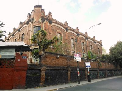
The neighborhood developed from farmland that belonged to various haciendas before becoming an urban area during the early 20th century. This shift reflects Mexico City's southward expansion as the metropolis grew beyond its colonial core.

The name comes from the pine groves that once covered the land and shaped the character of the place. Today, the mix of homes and local shops creates a neighborhood rhythm where residents naturally gather in parks and along tree-lined streets.

The neighborhood is easy to navigate with multiple entry points from surrounding streets and the highway. The two public parks are free to visit and make good spots to stop and get a feel for daily life in the area.

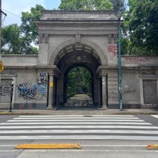
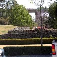
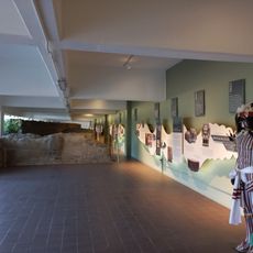
The southern section contains the Mixcoac archaeological zone, where remnants of Mesoamerican postclassic settlements remain visible in the urban landscape. This heritage site is now paired with La Pirámide cultural center, creating a bridge between ancient history and contemporary use.

The community of curious travelers

AroundUs brings together thousands of curated places, local tips, and hidden gems, enriched daily by 60,000 contributors worldwide.

Start exploring
Location
GPS coordinates
19.38804,-99.18588
Latest update
December 7, 2025 20:22
« San Pedro de los Pinos - Residential neighborhood in Benito Juárez, Mexico City » is provided by Around Us (aroundus.com). Images and texts are derived from Wikimedia project under a Creative Commons license. You are allowed to copy, distribute, and modify copies of this page, under the conditions set by the license, as long as this note is clearly visible.

Discover hidden gems everywhere you go!

From secret cafés to breathtaking viewpoints, skip the crowded tourist spots and find places that match your style. Our app makes it easy with voice search, smart filtering, route optimization, and insider tips from travelers worldwide. Download now for the complete mobile experience.

Around Us App Screenshot

A unique approach to discovering new places

Le Figaro

All the places worth exploring

France Info

A tailor-made excursion in just a few clicks

20 Minutes

Around Us
Travel Guide & Maps
Download

Send to your phone

QR Code
1

Open the camera app on your mobile.

2

Point at the QR code with your camera. A notification will appear.

3

Tap the notification to open the link.