Actopan, Administrative division in Hidalgo, Mexico
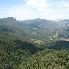
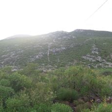
Actopan is an administrative division in Hidalgo state and extends across the Mezquital Valley at an elevation of 2,000 meters. The region features mountainous terrain and contains multiple settlements alongside agricultural areas.
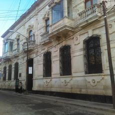
The territory was originally settled by the Otomi people and later came under Tepanec rule until its formal establishment as a village in 1575 under Spanish administration. This transformation marked the beginning of the colonial era in the region.
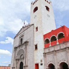
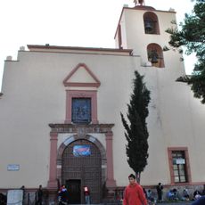
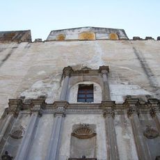
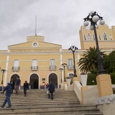
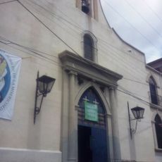
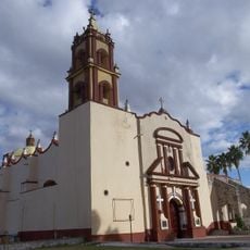
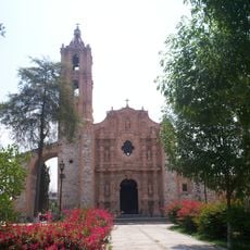
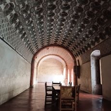
The Church of San Nicolás de Tolentino displays Gothic and Plateresque architectural elements with interior frescoes that blend religious scenes and indigenous Mexican imagery. Visitors can see how European and native artistic traditions merged in the decoration of this sacred space.
The region connects to Mexico City through a road network of about 120 kilometers, while Pachuca de Soto is approximately 37 kilometers away. Visitors should expect mountainous terrain and variable weather conditions at this elevation.
The area is known for growing crops adapted to the semi-arid climate that support traditional dishes such as barbacoa and ximbo. These agricultural practices rely on long-standing local knowledge and continue to shape the region's food culture today.
GPS coordinates: 20.30888,-98.87566
Latest update: December 7, 2025 20:22
Monumental Clock of Pachuca
25.2 km
El Chico National Park
18.9 km
San Nicolás Tolentino Temple and Ex-Monastery
8.4 km
Cristo Rey de Pachuca
25.6 km
Basílica Menor de Nuestra Señora de Guadalupe
25.3 km
Historic Archive and Museum of Mining in Pachuca
25.4 km
Plaza Juárez
25.3 km
Grutas Xoxafi
18.2 km
Municipal Hall of Pachuca de Soto
25.3 km
La Asuncion Parish, Pachuca
25.1 km
Bioparque de Convivencia en Pachuca, Hidalgo
25.3 km
Templo y exconvento de San Agustín
21.8 km
Plaza Constitución
25.1 km
Teatro Hidalgo Bartolomé de Medina
25.3 km
La Maestranza
24.7 km
Edificio de las Cajas Reales
25 km
Centro Cultural El Ferrocarril
25.1 km
Museo de Mineralogía de la UAEH
24.9 km
Parroquia de Nuestra Señora del Carmen, Pachuca
25.1 km
San Antonio mine
17.6 km
Foro Cultural Efrén Rebolledo, Pachuca
25 km
San Bartolomé Parish
8.4 km
San Miguel Arcangel Parish
8.4 km
Centro Cultural Universitario Víctor Manuel Ballesteros
25.6 km
Santiago Apóstol Parish
8.4 km
Parroquia de San Nicolas Tolentino
22.1 km
Mundo Tuzo
25.8 km
Ex convento de Actopan
8.3 kmVisited this place? Tap the stars to rate it and share your experience / photos with the community! Try now! You can cancel it anytime.
Discover hidden gems everywhere you go!
From secret cafés to breathtaking viewpoints, skip the crowded tourist spots and find places that match your style. Our app makes it easy with voice search, smart filtering, route optimization, and insider tips from travelers worldwide. Download now for the complete mobile experience.
A unique approach to discovering new places❞
— Le Figaro
All the places worth exploring❞
— France Info
A tailor-made excursion in just a few clicks❞
— 20 Minutes