Chest opened
+${chestReward.xp} XP
Explorer
NOUVEAU ×${chestReward.collectible.quantity}
tapez pour fermer
Chest locked

Open chests in the app

Around Us is built for your phone — chests unlock when you walk, explore and capture nearby places.

Enable Location

We need your location to show you interesting places around you

Discover nearby places

Find interesting locations and hidden gems around you

Precise directions

Get accurate directions and distances to places

Your location is never shared with other users. It's only used when you tap the location button.

Pantanos de Centla

Log in to your account

Start exploring — it's free

Trusted by 72,957 travelers worldwide

Continue with Google
Continue with Apple
or

We will send you a code to connect

By continuing, you accept our Terms and Conditions and our Privacy Policy

Check your inbox

We've sent a pincode in your inbox. Please enter the code below.

Pantanos de Centla
Discussion Reviews 3 Photos
26k Popularity

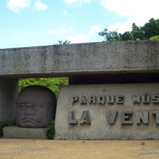
Pantanos de Centla, Protected wetland system in Tabasco, Mexico

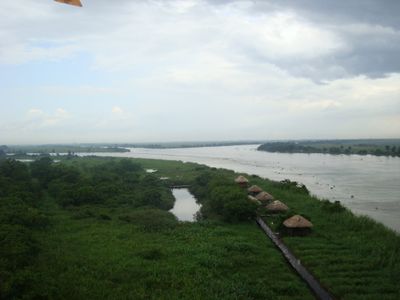
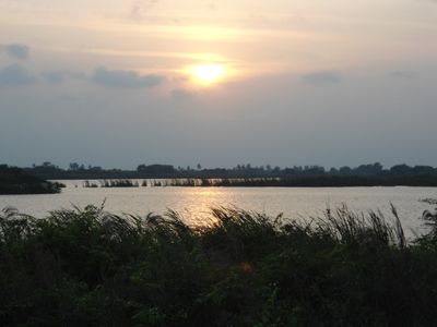
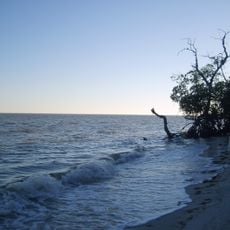
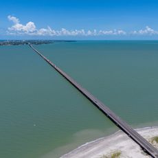
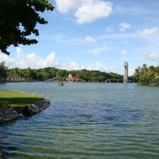
Pantanos de Centla is a wetland system in the Usumacinta and Grijalva river delta, composed of interconnected lagoons, waterways, and swamps. The reserve features varying water depths and different types of vegetation across its expansive terrain.

The government designated this site as a biosphere reserve in 1992 to protect the largest wetland system in the region. This decision reflected growing international recognition of the importance of preserving major wetland ecosystems.

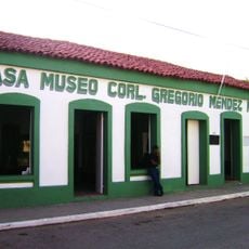
The Chontales and Maya peoples have inhabited these wetlands for centuries, relying on traditional fishing and hunting practices that remain visible in daily life. Their connection to the land shapes how communities use the waterways and islands.

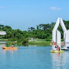
Visitors reach the site best through organized boat tours from Villahermosa, where guides help with wildlife viewing and photography. The drier months offer the easiest access, as lower water levels make navigation simpler across different areas.

The reserve contains red, black, and white mangroves specially adapted to salty and brackish conditions. These mangrove forests act as natural flood barriers and provide shelter and breeding grounds for countless animals.

The community of curious travelers

AroundUs brings together thousands of curated places, local tips, and hidden gems, enriched daily by 60,000 contributors worldwide.

Start exploring
Location
GPS coordinates
18.33333,-92.50000
Latest update
March 5, 2026 18:55
Reviews
Share your experience

No review yet

Discussions
Start a discussion...

No discussion yet

« Pantanos de Centla - Protected wetland system in Tabasco, Mexico » is provided by Around Us (aroundus.com). Images and texts are derived from Wikimedia project under a Creative Commons license. You are allowed to copy, distribute, and modify copies of this page, under the conditions set by the license, as long as this note is clearly visible.

Discover hidden gems everywhere you go!

From secret cafés to breathtaking viewpoints, skip the crowded tourist spots and find places that match your style. Our app makes it easy with voice search, smart filtering, route optimization, and insider tips from travelers worldwide. Download now for the complete mobile experience.

Around Us App Screenshot

A unique approach to discovering new places

Le Figaro

All the places worth exploring

France Info

A tailor-made excursion in just a few clicks

20 Minutes

Around Us
Travel Guide & Maps
Download

Send to your phone

QR Code
1

Open the camera app on your mobile.

2

Point at the QR code with your camera. A notification will appear.

3

Tap the notification to open the link.