Enable Location

We need your location to show you interesting places around you

Discover nearby places

Find interesting locations and hidden gems around you

Precise directions

Get accurate directions and distances to places

Your location is never shared with other users. It's only used when you tap the location button.

Ring of cenotes

Log in to your account

Start exploring — it's free

Trusted by 65,164 travelers worldwide

Continue with Google
Continue with Apple
or

We will send you a code to connect

By continuing, you accept our Terms and Conditions and our Privacy Policy

Check your inbox

We've sent a pincode in your inbox. Please enter the code below.

Ring of cenotes
Discussion 5.0 1 Reviews 1 Photos
4.6k Popularity

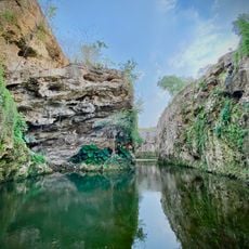
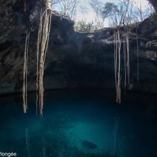
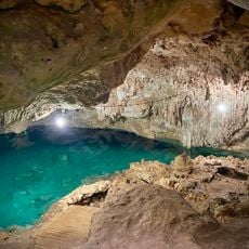
Ring of cenotes, Natural sinkholes formation in Yucatán, Mexico

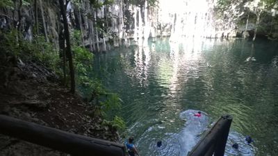
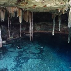
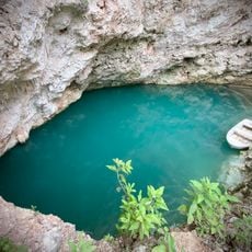
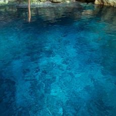
The Ring of Cenotes is a curved chain of water-filled limestone sinkholes across the Yucatán Peninsula, connected beneath the surface by a network of underground rivers. Some are open pools exposed to the sky, while others are partly or fully enclosed within caves, giving each one a different character.

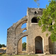
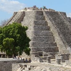
The sinkholes trace their origin to the asteroid impact about 66 million years ago that left the Chicxulub crater, creating a circular fault line where limestone slowly gave way over time. Maya communities then built settlements along this arc because the water sources it provided were among the most reliable in the region.

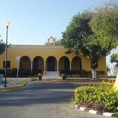
The word cenote comes from the Maya term "dz'onot," which referred to these water sources and was later adopted into Spanish. In some villages around the ring, local families still gather at cenotes for community events, treating them as shared spaces rather than just tourist stops.

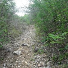
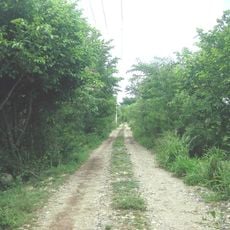
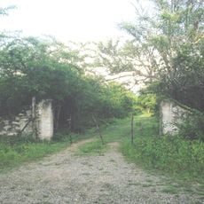
The sinkholes are spread across a wide area, so planning a route from Mérida or a nearby town is a practical starting point, and having access to a vehicle makes visiting several spots in one day much easier. Paths leading down to the water can be uneven or slippery, so solid footwear is a good idea.

Many of the sinkholes sit directly on the rim of the Chicxulub crater, formed by the same impact linked to the extinction of the dinosaurs. This means that swimmers are dipping into water that traces the outline of one of the most consequential events in the history of life on Earth.

The community of curious travelers

AroundUs brings together thousands of curated places, local tips, and hidden gems, enriched daily by 60,000 contributors worldwide.

Start exploring
Location
GPS coordinates
20.72250,-89.32306
Latest update
March 3, 2026 10:05
Reviews

Real people, real opinions — but not verified.

Share your experience
francoise26
francoise26 · May 6, 2025
Discussions
Start a discussion...

No discussion yet

« Ring of cenotes - Natural sinkholes formation in Yucatán, Mexico » is provided by Around Us (aroundus.com). Images and texts are derived from Wikimedia project under a Creative Commons license. You are allowed to copy, distribute, and modify copies of this page, under the conditions set by the license, as long as this note is clearly visible.

Discover hidden gems everywhere you go!

From secret cafés to breathtaking viewpoints, skip the crowded tourist spots and find places that match your style. Our app makes it easy with voice search, smart filtering, route optimization, and insider tips from travelers worldwide. Download now for the complete mobile experience.

Around Us App Screenshot

A unique approach to discovering new places

Le Figaro

All the places worth exploring

France Info

A tailor-made excursion in just a few clicks

20 Minutes

Around Us
Travel Guide & Maps
Download

Send to your phone

QR Code
1

Open the camera app on your mobile.

2

Point at the QR code with your camera. A notification will appear.

3

Tap the notification to open the link.