Enable Location

We need your location to show you interesting places around you

Discover nearby places

Find interesting locations and hidden gems around you

Precise directions

Get accurate directions and distances to places

Your location is never shared with other users. It's only used when you tap the location button.

Allende

Log in to your account

Start exploring — it's free

Trusted by 67,566 travelers worldwide

Continue with Google
Continue with Apple
or

We will send you a code to connect

By continuing, you accept our Terms and Conditions and our Privacy Policy

Check your inbox

We've sent a pincode in your inbox. Please enter the code below.

Allende
Discussion Reviews 1 Photos
25.4k Popularity

Allende, Municipality in Coahuila, Mexico

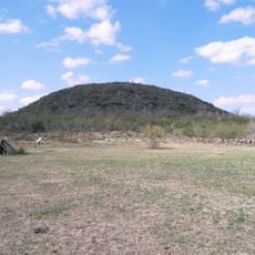
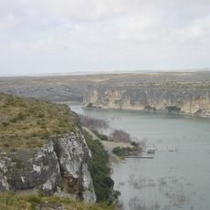
Allende is a municipality in Mexico's Coahuila state, located in the northeastern region close to the United States border. The terrain sits at roughly 378 meters in elevation and consists of flat to rolling land used mainly for farming.

The municipality was founded in 1826 during a period when Mexico's northern region was being newly developed and settled. This founding period marked an important phase of territorial expansion in Coahuila.

The town preserves local traditions through annual celebrations and shared meals where residents enjoy regional dishes together. These gatherings form the backbone of community life and bring neighbors closer throughout the year.

The municipality is accessible via Federal Highway 57, which links it to larger cities across the north. Road access works well for visitors planning to drive.

The geographical position creates special conditions for growing regional crops and raising livestock. These natural advantages have shaped the economic foundation since the settlement's start.

The community of curious travelers

AroundUs brings together thousands of curated places, local tips, and hidden gems, enriched daily by 60,000 contributors worldwide.

Start exploring
Location
Inception
1826
GPS coordinates
28.34722,-100.85417
Latest update
December 7, 2025 09:27
Around this place
Amistad Reservoir
Mexico

Amistad Reservoir

124.4 km
Fort Clark
United States of America

Fort Clark

114.8 km
Sleeping Spring Draw
United States of America

Sleeping Spring Draw

117.7 km
Seminole Canyon State Park and Historic Site
United States of America

Seminole Canyon State Park and Historic Site

155.4 km
Amistad National Recreation Area
United States of America

Amistad National Recreation Area

122.8 km
Fort Inge
United States of America

Fort Inge

141 km
Fort Duncan
United States of America

Fort Duncan

52.1 km
Eagle Pass – Piedras Negras International Bridge
United States of America

Eagle Pass – Piedras Negras International Bridge

52.1 km
John Nance Garner House
United States of America

John Nance Garner House

141.5 km
Lake Amistad Dam International Crossing
United States of America

Lake Amistad Dam International Crossing

124.3 km
Camino Real International Bridge
United States of America

Camino Real International Bridge

51.5 km
Whitehead Memorial Museum
United States of America

Whitehead Memorial Museum

111.9 km
Estadio Nuevo Laredo
Mexico

Estadio Nuevo Laredo

157.3 km
Grand Opera House
United States of America

Grand Opera House

141.7 km
Mexico

Rio San Rodrigo

65.6 km
Martyrs of Christ the King Cathedral, Piedras Negras
Mexico

Martyrs of Christ the King Cathedral, Piedras Negras

47.4 km
Asher and Mary Isabelle Richardson House
United States of America

Asher and Mary Isabelle Richardson House

107.4 km
Fate Bell Shelter
United States of America

Fate Bell Shelter

157 km
State Highway 3 Bridge at the Nueces River
United States of America

State Highway 3 Bridge at the Nueces River

133.3 km
Lower Pecos Canyonlands Archeological District
United States of America

Lower Pecos Canyonlands Archeological District

157 km
Uvalde Downtown Historic District
United States of America

Uvalde Downtown Historic District

141.7 km
Seminole Canyon District
United States of America

Seminole Canyon District

157 km
La Salle County Courthouse
United States of America

La Salle County Courthouse

158.7 km
Popeye statue in Crystal City
United States of America

Popeye statue in Crystal City

106.9 km
St. Philip's Episcopal Church
United States of America

St. Philip's Episcopal Church

141.8 km
Aztec Theatre
United States of America

Aztec Theatre

52.9 km
Pecos River Boat Dock
United States of America

Pecos River Boat Dock

158.9 km
Nicolas Street School
United States of America

Nicolas Street School

140.6 km
Show the full map
Reviews
Share your experience

No review yet

Discussions
Start a discussion...

No discussion yet

« Allende - Municipality in Coahuila, Mexico » is provided by Around Us (aroundus.com). Images and texts are derived from Wikimedia project under a Creative Commons license. You are allowed to copy, distribute, and modify copies of this page, under the conditions set by the license, as long as this note is clearly visible.

Discover hidden gems everywhere you go!

From secret cafés to breathtaking viewpoints, skip the crowded tourist spots and find places that match your style. Our app makes it easy with voice search, smart filtering, route optimization, and insider tips from travelers worldwide. Download now for the complete mobile experience.

Around Us App Screenshot

A unique approach to discovering new places

Le Figaro

All the places worth exploring

France Info

A tailor-made excursion in just a few clicks

20 Minutes

Around Us
Travel Guide & Maps
Download

Send to your phone

QR Code
1

Open the camera app on your mobile.

2

Point at the QR code with your camera. A notification will appear.

3

Tap the notification to open the link.