Chest opened
+${chestReward.xp} XP
Explorer
NOUVEAU ×${chestReward.collectible.quantity}
tapez pour fermer
Chest locked

Open chests in the app

Around Us is built for your phone — chests unlock when you walk, explore and capture nearby places.

Enable Location

We need your location to show you interesting places around you

Discover nearby places

Find interesting locations and hidden gems around you

Precise directions

Get accurate directions and distances to places

Your location is never shared with other users. It's only used when you tap the location button.

Bonnet Carré Spillway

Log in to your account

Start exploring — it's free

Trusted by 72,995 travelers worldwide

Continue with Google
Continue with Apple
or

We will send you a code to connect

By continuing, you accept our Terms and Conditions and our Privacy Policy

Check your inbox

We've sent a pincode in your inbox. Please enter the code below.

Bonnet Carré Spillway
Discussion Reviews 1 Photos
30.8k Popularity

Bonnet Carré Spillway, Flood control structure in St. Charles Parish, Louisiana, United States.

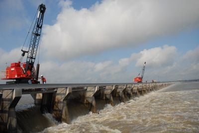
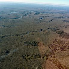
The Bonnet Carré Spillway is a flood control structure along the Mississippi River with 350 bays that manage water flow. The system directs excess river water into Lake Pontchartrain during periods of high flow.

The U.S. Army Corps of Engineers built this flood management system between 1929 and 1931 in response to the devastating 1927 Mississippi River flood. The project emerged from the urgent need to better control river water flow.

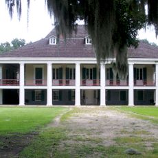
The land around the spillway contains historical cemeteries with remains of enslaved people and free African Americans from the 1700s through the 1900s. These burial grounds tell the stories of those who lived and died in this region.

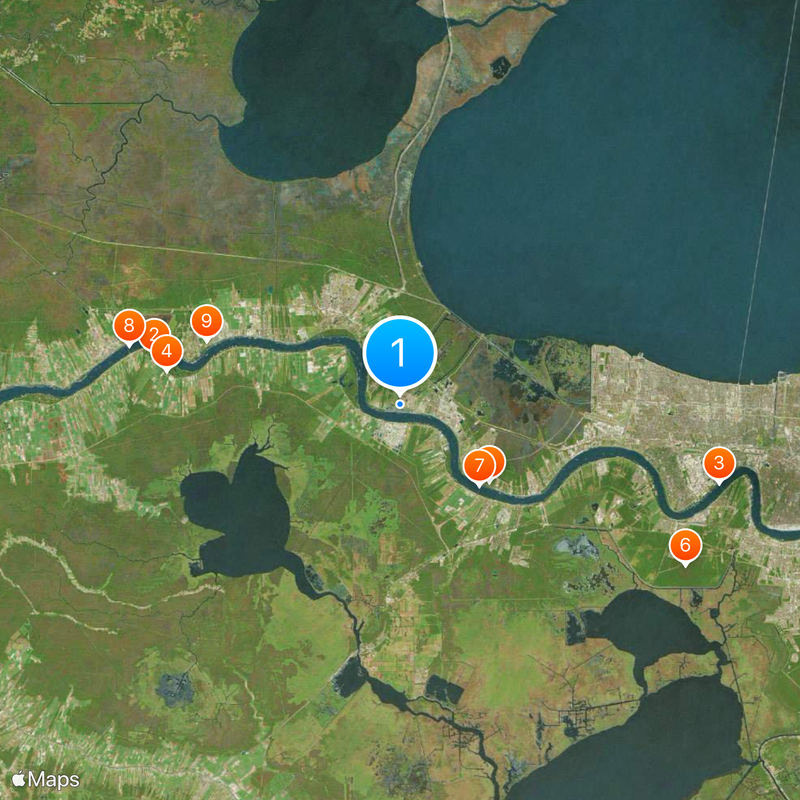
The spillway is accessible by taking Highway 61 to Highway 48, then turning onto River Road in Norco. The final approach is a short drive of about one mile from this main road.

Mobile electric cranes mounted on narrow-gauge tracks remove wooden timbers from the bays to release water during flooding. This hand-operated system allows workers to adjust flow precisely by adding or removing timbers as needed.

The community of curious travelers

AroundUs brings together thousands of curated places, local tips, and hidden gems, enriched daily by 60,000 contributors worldwide.

Start exploring
Location
Elevation above the sea
3 m
GPS coordinates
30.00220,-90.44140
Latest update
December 20, 2025 01:59
Around this place
Whitney Plantation Historic District
United States of America

Whitney Plantation Historic District

20.6 km
Huey P. Long Bridge
United States of America

Huey P. Long Bridge

27.1 km
Evergreen Plantation
United States of America

Evergreen Plantation

19.4 km
Destrehan Plantation
United States of America

Destrehan Plantation

9.7 km
NOLA Motorsports Park
United States of America

NOLA Motorsports Park

27 km
Hale Boggs Memorial Bridge
United States of America

Hale Boggs Memorial Bridge

9.3 km
Gramercy Bridge
United States of America

Gramercy Bridge

22.8 km
San Francisco Plantation House
United States of America

San Francisco Plantation House

16.7 km
Ormond Plantation House
United States of America

Ormond Plantation House

7.5 km
Cajun Pride Swamp Tours
United States of America

Cajun Pride Swamp Tours

10.4 km
Homeplace Plantation House
United States of America

Homeplace Plantation House

4.8 km
Congregation Beth Israel
United States of America

Congregation Beth Israel

25.7 km
LaBranche Plantation Dependency
United States of America

LaBranche Plantation Dependency

13.4 km
Laura Plantation
United States of America

Laura Plantation

27.4 km
Godchaux–Reserve Plantation
United States of America

Godchaux–Reserve Plantation

13.2 km
Desire Plantation House
United States of America

Desire Plantation House

25 km
Maurepas Swamp Wildlife Management Area
United States of America

Maurepas Swamp Wildlife Management Area

17.6 km
Wildcat Stadium
United States of America

Wildcat Stadium

7 km
Olive Jeanette
United States of America

Olive Jeanette

25 km
Bayou Boeuf Elementary School
United States of America

Bayou Boeuf Elementary School

20.8 km
Emilie Plantation
United States of America

Emilie Plantation

16.9 km
Raziano House
United States of America

Raziano House

19 km
Our Lady of Grace Church
United States of America

Our Lady of Grace Church

13.6 km
Kenner Town Hall
United States of America

Kenner Town Hall

18.9 km
Dorvin House
United States of America

Dorvin House

2.5 km
San Francisco Plantation
United States of America

San Francisco Plantation

16.4 km
Hope Plantation (Louisiana)
United States of America

Hope Plantation (Louisiana)

17.7 km
Executive Tower One
United States of America

Executive Tower One

27.4 km
Show the full map
Reviews
Share your experience

No review yet

Discussions
Start a discussion...

No discussion yet

« Bonnet Carré Spillway - Flood control structure in St. Charles Parish, Louisiana, United States » is provided by Around Us (aroundus.com). Images and texts are derived from Wikimedia project under a Creative Commons license. You are allowed to copy, distribute, and modify copies of this page, under the conditions set by the license, as long as this note is clearly visible.

Discover hidden gems everywhere you go!

From secret cafés to breathtaking viewpoints, skip the crowded tourist spots and find places that match your style. Our app makes it easy with voice search, smart filtering, route optimization, and insider tips from travelers worldwide. Download now for the complete mobile experience.

Around Us App Screenshot

A unique approach to discovering new places

Le Figaro

All the places worth exploring

France Info

A tailor-made excursion in just a few clicks

20 Minutes

Around Us
Travel Guide & Maps
Download

Send to your phone

QR Code
1

Open the camera app on your mobile.

2

Point at the QR code with your camera. A notification will appear.

3

Tap the notification to open the link.