Enable Location

We need your location to show you interesting places around you

Discover nearby places

Find interesting locations and hidden gems around you

Precise directions

Get accurate directions and distances to places

Your location is never shared with other users. It's only used when you tap the location button.

Donaldsonville

Log in to your account

Start exploring — it's free

Trusted by 65,859 travelers worldwide

Continue with Google
Continue with Apple
or

We will send you a code to connect

By continuing, you accept our Terms and Conditions and our Privacy Policy

Check your inbox

We've sent a pincode in your inbox. Please enter the code below.

Discussion Reviews 2 Photos
21.9k Popularity

Donaldsonville, city in Louisiana, United States

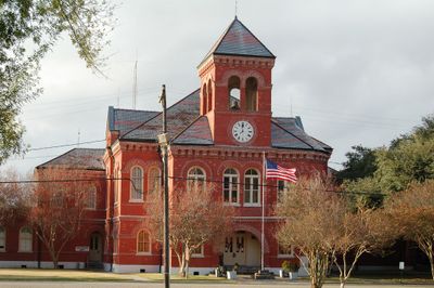
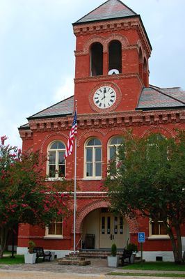
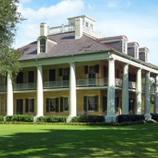
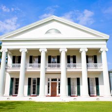
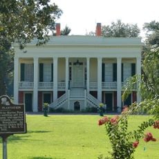
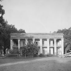
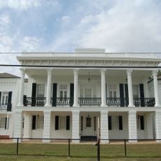
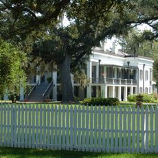
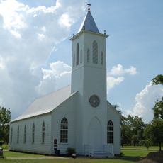
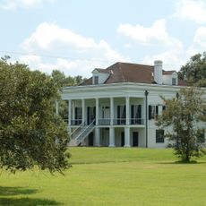
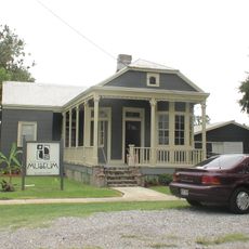
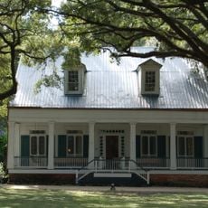
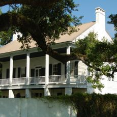
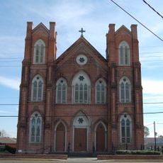
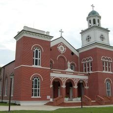
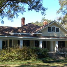
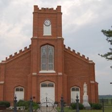
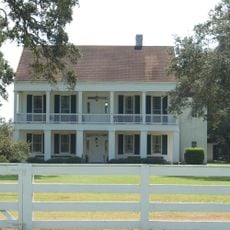
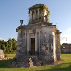
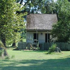
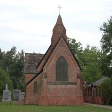
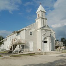
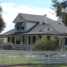
Donaldsonville is the county seat of Ascension Parish situated along the Mississippi River in Louisiana. The town features historic structures dating from the 1800s, such as a classical courthouse and residences displaying Southern architectural details.

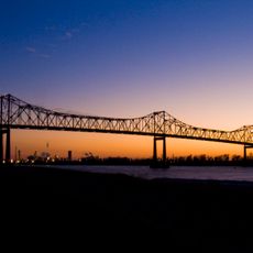
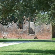
The town developed in the early 1800s as a trading post along the Mississippi River. As river commerce evolved, its economic importance shifted, though it maintained its status as the administrative center of the parish.

The town takes its name from early settler James Donaldson. The buildings and local traditions show how French, Spanish, and African cultures have mixed and shaped daily life here over generations.

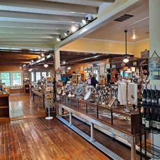
The town is easy to reach by car and small enough to explore on foot around the main areas. Starting at the riverfront or downtown core gives visitors access to local restaurants and small shops nearby.

The town once rivaled Baton Rouge in economic importance before trade shifted away to other centers. Original buildings from that prosperous era still stand as reminders of when this riverside location commanded regional commerce.

The community of curious travelers

AroundUs brings together thousands of curated places, local tips, and hidden gems, enriched daily by 60,000 contributors worldwide.

Start exploring
Location
Inception
1806
Elevation above the sea
8 m
GPS coordinates
30.10000,-90.99417
Latest update
March 2, 2026 22:17
Around this place
Oak Alley Plantation
United States of America

Oak Alley Plantation

23.6 km
Bayou Corne sinkhole
United States of America

Bayou Corne sinkhole

17.5 km
The Houmas
United States of America

The Houmas

7.4 km
Sunshine Bridge
United States of America

Sunshine Bridge

7.9 km
Madewood Plantation House
United States of America

Madewood Plantation House

19.4 km
Bocage Plantation
United States of America

Bocage Plantation

4.6 km
Ashland Plantation
United States of America

Ashland Plantation

8.5 km
St. Joseph Plantation
United States of America

St. Joseph Plantation

23.8 km
Carville Historic District
United States of America

Carville Historic District

16.7 km
Belle Alliance Plantation
United States of America

Belle Alliance Plantation

6.2 km
Evan Hall
United States of America

Evan Hall

5.2 km
St. Gabriel Roman Catholic Church
United States of America

St. Gabriel Roman Catholic Church

20.1 km
Laura Plantation
United States of America

Laura Plantation

27.8 km
St. Emma Plantation
United States of America

St. Emma Plantation

3.9 km
Blue Bayou Water Park
United States of America

Blue Bayou Water Park

27.5 km
River Road African American Museum
United States of America

River Road African American Museum

419 m
Palo Alto Plantation
United States of America

Palo Alto Plantation

3.7 km
Tally-Ho Plantation House
United States of America

Tally-Ho Plantation House

21 km
St. Elizabeth Catholic Church
United States of America

St. Elizabeth Catholic Church

13.3 km
St. Anne Catholic Church
United States of America

St. Anne Catholic Church

18.3 km
Robert Penn Warren House
United States of America

Robert Penn Warren House

23.2 km
Church of the Assumption of the Blessed Virgin Mary
United States of America

Church of the Assumption of the Blessed Virgin Mary

12.6 km
Mulberry Grove
United States of America

Mulberry Grove

11.1 km
Landry Tomb
United States of America

Landry Tomb

811 m
Mather House
United States of America

Mather House

20.9 km
Christ Episcopal Church and Cemetery
United States of America

Christ Episcopal Church and Cemetery

17.9 km
St. John Baptist Church
United States of America

St. John Baptist Church

18.2 km
LaBarre House
United States of America

LaBarre House

19.3 km
Show the full map
Reviews
Share your experience

No review yet

Discussions
Start a discussion...

No discussion yet

« Donaldsonville - city in Louisiana, United States » is provided by Around Us (aroundus.com). Images and texts are derived from Wikimedia project under a Creative Commons license. You are allowed to copy, distribute, and modify copies of this page, under the conditions set by the license, as long as this note is clearly visible.

Discover hidden gems everywhere you go!

From secret cafés to breathtaking viewpoints, skip the crowded tourist spots and find places that match your style. Our app makes it easy with voice search, smart filtering, route optimization, and insider tips from travelers worldwide. Download now for the complete mobile experience.

Around Us App Screenshot

A unique approach to discovering new places

Le Figaro

All the places worth exploring

France Info

A tailor-made excursion in just a few clicks

20 Minutes

Around Us
Travel Guide & Maps
Download

Send to your phone

QR Code
1

Open the camera app on your mobile.

2

Point at the QR code with your camera. A notification will appear.

3

Tap the notification to open the link.