Madison Parish

Log in to your account

AroundUs is a community-driven map of interesting places, built by curious explorers like you. It grows with every review, story, and photo you share.
Connect to save your favorite spots, contribute locations, and create personalized routes.
By continuing, you accept our Terms and Conditions and our Privacy Policy
Add to collection
Map
Suggest a change
Share

Madison Parish, Administrative parish in northeastern Louisiana, US

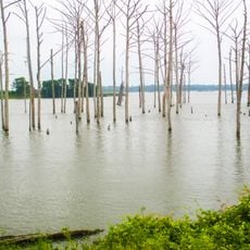
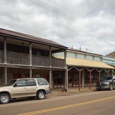
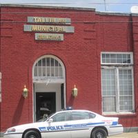
Madison Parish is an administrative area in northeastern Louisiana situated across delta flatlands along the Mississippi River. Tallulah functions as the parish seat and central hub for local government operations.

The parish was established in 1838 and named after President James Madison, with development driven by cotton plantations and pecan farms. Agricultural activity formed the foundation of the local economy for generations.

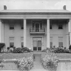
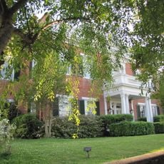
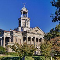
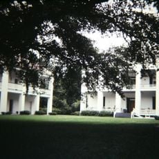
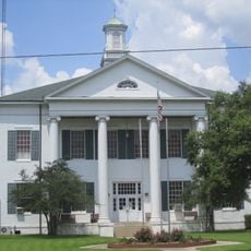
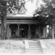
The courthouse stands at the center with white columns, surrounded by oaks, magnolias, and flowering trees that locals use as gathering spaces. The natural landscape has shaped how the community meets and spends time together over the years.

The area is accessible via Interstate 20 and US Highways 65 and 80, which connect it well to neighboring regions. Local services include emergency preparedness and fire protection for residents.

The parish leads the state in corn production and contributes substantially to the region's agricultural output. This distinction sets it apart economically from many other rural areas.

Location: Louisiana

Inception: 1838

Capital city: Tallulah

Shares border with: East Carroll Parish, Warren County, Tensas Parish, Franklin Parish, Richland Parish

Website: http://madisonparish.org

GPS coordinates: 32.37000,-91.24000

Latest update: December 7, 2025 19:28

Photos
Around this place
Show the full map
USS Cairo
United States of America

USS Cairo

35.1 km
McRaven House
United States of America

McRaven House

34.7 km
Vicksburg Bridge
United States of America

Vicksburg Bridge

31.8 km
Old Vicksburg Bridge
United States of America

Old Vicksburg Bridge

32 km
Waterways Experiment Station
United States of America

Waterways Experiment Station

35.8 km
Poverty Point Reservoir State Park
United States of America

Poverty Point Reservoir State Park

27 km
Anchuca
United States of America

Anchuca

34.1 km
5th United States Colored Heavy Artillery Regiment
United States of America

5th United States Colored Heavy Artillery Regiment

15.3 km
Balfour House
United States of America

Balfour House

34.1 km
Pemberton's Headquarters
United States of America

Pemberton's Headquarters

34.2 km
Old Warren County Courthouse
United States of America

Old Warren County Courthouse

34 km
Fitzhugh Mounds
United States of America

Fitzhugh Mounds

16 km
Mott Archaeological Preserve
United States of America

Mott Archaeological Preserve

25.9 km
Crescent Plantation
United States of America

Crescent Plantation

7.1 km
Uptown Vicksburg Historic District
United States of America

Uptown Vicksburg Historic District

34 km
Lower Mississippi River Museum
United States of America

Lower Mississippi River Museum

33.7 km
Hermione
United States of America

Hermione

6.8 km
Linwood Plantation Manager's House
United States of America

Linwood Plantation Manager's House

38.5 km
Scottland Plantation House
United States of America

Scottland Plantation House

5.5 km
Montrose Plantation House
United States of America

Montrose Plantation House

10.8 km
Yokena Presbyterian Church
United States of America

Yokena Presbyterian Church

35.6 km
Raffman Site
United States of America

Raffman Site

15.2 km
Madison Parish Courthouse
United States of America

Madison Parish Courthouse

6.5 km
Planters Hall
United States of America

Planters Hall

34 km
Main Street Historic District
United States of America

Main Street Historic District

34.3 km
Grove Street-Jackson Historic District
United States of America

Grove Street-Jackson Historic District

34.3 km
Confederate Avenue Brick Arch Bridge
United States of America

Confederate Avenue Brick Arch Bridge

34.5 km
Biedenharn Coca-Cola Museum
United States of America

Biedenharn Coca-Cola Museum

33.8 km
Show the full map
Reviews

Visited this place? Tap the stars to rate it and share your experience / photos with the community! Try now! You can cancel it anytime.

Administrative divisions
« Madison Parish - Administrative parish in northeastern Louisiana, US » is provided by Around Us (aroundus.com). Images and texts are derived from Wikimedia project under a Creative Commons license. You are allowed to copy, distribute, and modify copies of this page, under the conditions set by the license, as long as this note is clearly visible.

Discover hidden gems everywhere you go!

From secret cafés to breathtaking viewpoints, skip the crowded tourist spots and find places that match your style. Our app makes it easy with voice search, smart filtering, route optimization, and insider tips from travelers worldwide. Download now for the complete mobile experience.

Around Us App Screenshot

A unique approach to discovering new places

Le Figaro

All the places worth exploring

France Info

A tailor-made excursion in just a few clicks

20 Minutes