Enable Location

We need your location to show you interesting places around you

Discover nearby places

Find interesting locations and hidden gems around you

Precise directions

Get accurate directions and distances to places

Your location is never shared with other users. It's only used when you tap the location button.

Log in to your account

Start exploring — it's free

Trusted by 65,829 travelers worldwide

Continue with Google
Continue with Apple
or

We will send you a code to connect

By continuing, you accept our Terms and Conditions and our Privacy Policy

Check your inbox

We've sent a pincode in your inbox. Please enter the code below.

Norfolk Southern Lake Pontchartrain Bridge
Discussion Reviews Photo
5.7k Popularity

Norfolk Southern Lake Pontchartrain Bridge, Railway bridge over Lake Pontchartrain, New Orleans, United States

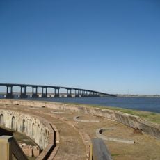
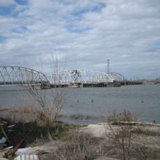
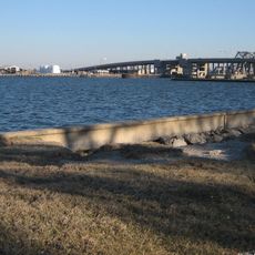
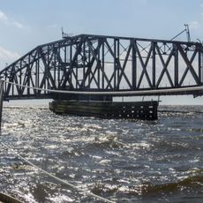
The Norfolk Southern Lake Pontchartrain Bridge is a single-track railway bridge that crosses Lake Pontchartrain in Louisiana, connecting the south shore near New Orleans to the north shore near Slidell. The bridge runs over open water and wetland areas for most of its length.

The bridge was built in 1884 by the New Orleans and Northeastern Railroad, making it one of the earliest rail crossings over Lake Pontchartrain. Over time, it passed through several railroad companies before becoming part of the Norfolk Southern network.

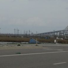
The bridge is part of the main rail corridor linking New Orleans to the northeastern United States, and freight trains cross it daily. From the shores near Slidell, visitors can watch trains move slowly across the open water.

The bridge is not open to pedestrians or vehicles, so the best views come from the lake shores near Slidell or from aboard a train crossing it. Travelers on the passenger rail service between New Orleans and the northeast pass directly over the water.

After Hurricane Katrina struck in 2005, the bridge suffered serious damage and had to be repaired quickly to restore freight movement across the lake. This made it one of the few rail structures in the region to be fully returned to service after such a storm.

The community of curious travelers

AroundUs brings together thousands of curated places, local tips, and hidden gems, enriched daily by 60,000 contributors worldwide.

Start exploring
GPS coordinates
30.18333,-89.85222
Latest update
March 3, 2026 08:16
Around this place
Six Flags New Orleans
United States of America

Six Flags New Orleans

16.7 km
I-10 Twin Span Bridge
United States of America

I-10 Twin Span Bridge

2.6 km
Fort Macomb
United States of America

Fort Macomb

14 km
IHNC Lake Borgne Surge Barrier
United States of America

IHNC Lake Borgne Surge Barrier

20.3 km
Fort Pike
United States of America

Fort Pike

11.3 km
The Jester
United States of America

The Jester

16.5 km
Mega Zeph
United States of America

Mega Zeph

16.7 km
Maestri Bridge
United States of America

Maestri Bridge

983 m
Zydeco Scream
United States of America

Zydeco Scream

16.8 km
Fort Pike Bridge
United States of America

Fort Pike Bridge

11.5 km
Muskrat Scrambler
United States of America

Muskrat Scrambler

16.7 km
Big Branch Marsh National Wildlife Refuge
United States of America

Big Branch Marsh National Wildlife Refuge

15.7 km
Chef Menteur Bridge
United States of America

Chef Menteur Bridge

13.7 km
Seabrook Bridge
United States of America

Seabrook Bridge

24.3 km
Francois Cousin House
United States of America

Francois Cousin House

9.9 km
CSX Rigolets Pass Bridge
United States of America

CSX Rigolets Pass Bridge

21.5 km
National Weather Service New Orleans/Baton Rouge, Louisiana
United States of America

National Weather Service New Orleans/Baton Rouge, Louisiana

17.3 km
Bayou Sauvage National Wildlife Refuge
United States of America

Bayou Sauvage National Wildlife Refuge

11.3 km
Camp Salmen House
United States of America

Camp Salmen House

12.2 km
West Rigolets Light
United States of America

West Rigolets Light

10.6 km
CSX Chef Menteur Pass Bridge
United States of America

CSX Chef Menteur Pass Bridge

14.1 km
East Rigolets Light
United States of America

East Rigolets Light

19.7 km
Francois Cousin House
United States of America

Francois Cousin House

16.2 km
Green Bridge
United States of America

Green Bridge

21.5 km
Versailles Arms
United States of America

Versailles Arms

16.8 km
Arcade Theatre
United States of America

Arcade Theatre

12 km
Thánh đường Các thánh tử đạo Việt Nam
United States of America

Thánh đường Các thánh tử đạo Việt Nam

17.1 km
Rigolets Bridge
United States of America

Rigolets Bridge

11.5 km
Show the full map
Reviews
Share your experience

No review yet

Discussions
Start a discussion...

No discussion yet

« Norfolk Southern Lake Pontchartrain Bridge - Railway bridge over Lake Pontchartrain, New Orleans, United States » is provided by Around Us (aroundus.com). Images and texts are derived from Wikimedia project under a Creative Commons license. You are allowed to copy, distribute, and modify copies of this page, under the conditions set by the license, as long as this note is clearly visible.

Discover hidden gems everywhere you go!

From secret cafés to breathtaking viewpoints, skip the crowded tourist spots and find places that match your style. Our app makes it easy with voice search, smart filtering, route optimization, and insider tips from travelers worldwide. Download now for the complete mobile experience.

Around Us App Screenshot

A unique approach to discovering new places

Le Figaro

All the places worth exploring

France Info

A tailor-made excursion in just a few clicks

20 Minutes

Around Us
Travel Guide & Maps
Download

Send to your phone

QR Code
1

Open the camera app on your mobile.

2

Point at the QR code with your camera. A notification will appear.

3

Tap the notification to open the link.