Chest opened
+${chestReward.xp} XP
Explorer
NOUVEAU ×${chestReward.collectible.quantity}
tapez pour fermer
Chest locked

Open chests in the app

Around Us is built for your phone — chests unlock when you walk, explore and capture nearby places.

Enable Location

We need your location to show you interesting places around you

Discover nearby places

Find interesting locations and hidden gems around you

Precise directions

Get accurate directions and distances to places

Your location is never shared with other users. It's only used when you tap the location button.

Log in to your account

Start exploring — it's free

Trusted by 72,874 travelers worldwide

Continue with Google
Continue with Apple
or

We will send you a code to connect

By continuing, you accept our Terms and Conditions and our Privacy Policy

Check your inbox

We've sent a pincode in your inbox. Please enter the code below.

Discussion Reviews Photo
12.1k Popularity

Sells, Tribal administrative center in Pima County, United States

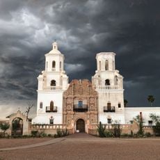
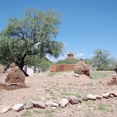
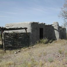
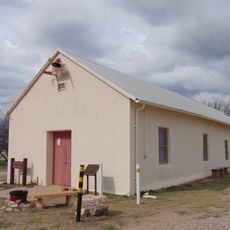
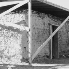
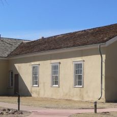
Sells is the administrative center of the Tohono O'odham Nation situated in the southern Arizona desert at about 730 meters elevation. The settlement blends traditional adobe structures with modern administrative buildings across the dry terrain.

The settlement became important in the early 20th century when the US government named it as the administrative seat of the Tohono O'odham Nation. This designation transformed it into the center for tribal governance and public affairs.

The Tohono O'odham people have kept their way of life visible here through daily practices and crafts that visitors can observe in the community. Basket weaving, pottery, and traditional songs remain woven into how people live and gather together.

Arizona State Route 86 provides direct access to Sells and connects the community with nearby towns and services. Visitors should know that the remote desert location means services are limited, so planning ahead for supplies is helpful.

The Tohono O'odham Nation operates its own government system from here and manages tribal affairs independently from county or state oversight. This right to self-governance on tribal lands is a cornerstone of the nation's sovereignty.

The community of curious travelers

AroundUs brings together thousands of curated places, local tips, and hidden gems, enriched daily by 60,000 contributors worldwide.

Start exploring
Location
Elevation above the sea
729 m
GPS coordinates
31.91202,-111.88123
Latest update
December 7, 2025 20:47
Around this place
Mission San Xavier del Bac
United States of America

Mission San Xavier del Bac

85.2 km
Titan Missile Museum
United States of America

Titan Missile Museum

83.4 km
Kitt Peak National Observatory
United States of America

Kitt Peak National Observatory

27.4 km
Arizona-Sonora Desert Museum
United States of America

Arizona-Sonora Desert Museum

76.7 km
Baboquivari Peak Wilderness
United States of America

Baboquivari Peak Wilderness

31.9 km
Dark Energy Spectroscopic Instrument
United States of America

Dark Energy Spectroscopic Instrument

27.4 km
Kitt Peak
United States of America

Kitt Peak

27.3 km
McMath–Pierce Solar Telescope
United States of America

McMath–Pierce Solar Telescope

27.5 km
Buenos Aires National Wildlife Refuge
United States of America

Buenos Aires National Wildlife Refuge

50.6 km
Nicholas U. Mayall Telescope
United States of America

Nicholas U. Mayall Telescope

27.2 km
Tubac Presidio State Historic Park
United States of America

Tubac Presidio State Historic Park

85.8 km
Ventana Cave
United States of America

Ventana Cave

59 km
Tubac Presidio
United States of America

Tubac Presidio

85.8 km
WIYN Telescope
United States of America

WIYN Telescope

27 km
ARO 12m Radio Telescope
United States of America

ARO 12m Radio Telescope

25.6 km
Michigan-Dartmouth-MIT Observatory
United States of America

Michigan-Dartmouth-MIT Observatory

25.4 km
Black Mountain
United States of America

Black Mountain

80.3 km
Bok Telescope
United States of America

Bok Telescope

27.2 km
Dos Lomitas Ranch
United States of America

Dos Lomitas Ranch

81.4 km
United States of America

Gu Achi Peak

48.5 km
Arivaca Schoolhouse
United States of America

Arivaca Schoolhouse

64.2 km
Gachado Well and Line Camp
United States of America

Gachado Well and Line Camp

85.6 km
Old Tubac Schoolhouse
United States of America

Old Tubac Schoolhouse

85.8 km
San Ignacio Golf Club
United States of America

San Ignacio Golf Club

82.5 km
Terror In The Corn
United States of America

Terror In The Corn

79.9 km
McGraw-Hill Telescope
United States of America

McGraw-Hill Telescope

25.4 km
Hiltner 2.4m Telescope
United States of America

Hiltner 2.4m Telescope

25.5 km
Red Hills Visitor Center
United States of America

Red Hills Visitor Center

74.9 km
Show the full map
Reviews
Share your experience

No review yet

Discussions
Start a discussion...

No discussion yet

« Sells - Tribal administrative center in Pima County, United States » is provided by Around Us (aroundus.com). Images and texts are derived from Wikimedia project under a Creative Commons license. You are allowed to copy, distribute, and modify copies of this page, under the conditions set by the license, as long as this note is clearly visible.

Discover hidden gems everywhere you go!

From secret cafés to breathtaking viewpoints, skip the crowded tourist spots and find places that match your style. Our app makes it easy with voice search, smart filtering, route optimization, and insider tips from travelers worldwide. Download now for the complete mobile experience.

Around Us App Screenshot

A unique approach to discovering new places

Le Figaro

All the places worth exploring

France Info

A tailor-made excursion in just a few clicks

20 Minutes

Around Us
Travel Guide & Maps
Download

Send to your phone

QR Code
1

Open the camera app on your mobile.

2

Point at the QR code with your camera. A notification will appear.

3

Tap the notification to open the link.