Chest opened
+${chestReward.xp} XP
Explorer
NOUVEAU ×${chestReward.collectible.quantity}
tapez pour fermer
Chest locked

Open chests in the app

Around Us is built for your phone — chests unlock when you walk, explore and capture nearby places.

Enable Location

We need your location to show you interesting places around you

Discover nearby places

Find interesting locations and hidden gems around you

Precise directions

Get accurate directions and distances to places

Your location is never shared with other users. It's only used when you tap the location button.

Log in to your account

Start exploring — it's free

Trusted by 73,005 travelers worldwide

Continue with Google
Continue with Apple
or

We will send you a code to connect

By continuing, you accept our Terms and Conditions and our Privacy Policy

Check your inbox

We've sent a pincode in your inbox. Please enter the code below.

Dade-Collier Training and Transition Airport
Discussion Reviews Photo
17.8k Popularity

Dade-Collier Training and Transition Airport, airport in Florida, United States of America

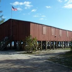
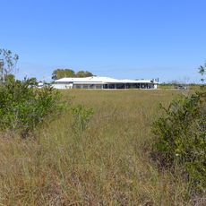
Dade-Collier Training and Transition Airport is a large aerodrome in Collier County, Florida, featuring a runway over 10,000 feet long with parallel taxiway infrastructure. The facility includes a small administration building but lacks on-site hangars and fuel storage for permanent aircraft basing.

Built in the 1970s as the Everglades Jetport to serve as a backup runway for Miami International Airport, the site was redirected in the late 1970s and early 1980s when environmental concerns halted expansion. It was then repurposed as a training and transition facility, a role it continues today.

Aircraft require prior permission before landing and must contact the control tower or use radio frequencies for communication. The facility operates daily from early morning until evening with weather information available through the on-site AWOS station.

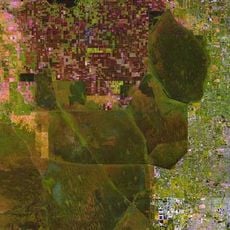
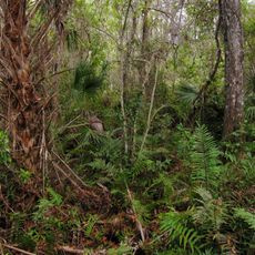
The facility spans nearly 25,000 acres of land, with only about 900 acres developed for current activities. The remaining land is managed by the Florida Game and Freshwater Fish Commission and preserved for natural use and potential future development.

The community of curious travelers

AroundUs brings together thousands of curated places, local tips, and hidden gems, enriched daily by 60,000 contributors worldwide.

Start exploring
Location
GPS coordinates
25.86317,-80.89846
Latest update
February 17, 2026 00:20
Around this place
Pitbull Stadium
United States of America

Pitbull Stadium

53.6 km
Trump National Doral Miami
United States of America

Trump National Doral Miami

55.9 km
Zoo Miami
United States of America

Zoo Miami

57.5 km
Draining and development of the Everglades
United States of America

Draining and development of the Everglades

25 km
Ferdinand Magellan
United States of America

Ferdinand Magellan

57 km
Monkey Jungle
United States of America

Monkey Jungle

57.3 km
Frost Art Museum
United States of America

Frost Art Museum

54 km
Fakahatchee Strand Preserve State Park
United States of America

Fakahatchee Strand Preserve State Park

54.1 km
Gold Coast Railroad Museum
United States of America

Gold Coast Railroad Museum

56.9 km
Ted Smallwood Store
United States of America

Ted Smallwood Store

46.9 km
Wilderness Waterway
United States of America

Wilderness Waterway

35.4 km
Fruit and Spice Park
United States of America

Fruit and Spice Park

54.5 km
Florida East Coast Railway 153
United States of America

Florida East Coast Railway 153

56.9 km
Old Collier County Courthouse
United States of America

Old Collier County Courthouse

48.7 km
Everglades Laundry
United States of America

Everglades Laundry

48.8 km
Bank of Everglades Building
United States of America

Bank of Everglades Building

48.9 km
Silver Palm Schoolhouse
United States of America

Silver Palm Schoolhouse

57.2 km
Ah-Tah_Thi-Ki Museum
United States of America

Ah-Tah_Thi-Ki Museum

52.4 km
Pa-hay-okee Trail
United States of America

Pa-hay-okee Trail

48.4 km
Pinelands Trail
United States of America

Pinelands Trail

53.4 km
Shark Valley Observation Tower
United States of America

Shark Valley Observation Tower

26.6 km
Shark Valley Visitor Center
United States of America

Shark Valley Visitor Center

17.8 km
Oasis Visitor Center
United States of America

Oasis Visitor Center

13.5 km
Shark Valley Tram Road
United States of America

Shark Valley Tram Road

22.4 km
Gulf Coast Visitor Center
United States of America

Gulf Coast Visitor Center

49 km
Miami-Dade Military Museum
United States of America

Miami-Dade Military Museum

57.1 km
Shark Valley Tower Trail
United States of America

Shark Valley Tower Trail

26.5 km
Long Pine Key Campground
United States of America

Long Pine Key Campground

57.1 km
Show the full map
Reviews
Share your experience

No review yet

Discussions
Start a discussion...

No discussion yet

« Dade-Collier Training and Transition Airport - airport in Florida, United States of America » is provided by Around Us (aroundus.com). Images and texts are derived from Wikimedia project under a Creative Commons license. You are allowed to copy, distribute, and modify copies of this page, under the conditions set by the license, as long as this note is clearly visible.

Discover hidden gems everywhere you go!

From secret cafés to breathtaking viewpoints, skip the crowded tourist spots and find places that match your style. Our app makes it easy with voice search, smart filtering, route optimization, and insider tips from travelers worldwide. Download now for the complete mobile experience.

Around Us App Screenshot

A unique approach to discovering new places

Le Figaro

All the places worth exploring

France Info

A tailor-made excursion in just a few clicks

20 Minutes

Around Us
Travel Guide & Maps
Download

Send to your phone

QR Code
1

Open the camera app on your mobile.

2

Point at the QR code with your camera. A notification will appear.

3

Tap the notification to open the link.