Enable Location

We need your location to show you interesting places around you

Discover nearby places

Find interesting locations and hidden gems around you

Precise directions

Get accurate directions and distances to places

Your location is never shared with other users. It's only used when you tap the location button.

Collier County

Log in to your account

Start exploring — it's free

Trusted by 62,117 travelers worldwide

Continue with Google
Continue with Apple
or

We will send you a code to connect

By continuing, you accept our Terms and Conditions and our Privacy Policy

Check your inbox

We've sent a pincode in your inbox. Please enter the code below.

Collier County, County in Florida, United States

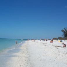
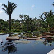
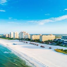
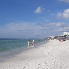
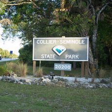
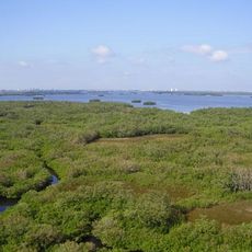
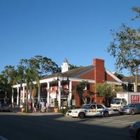
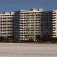
Collier County is an administrative district in southwestern Florida that stretches along the Gulf of Mexico coast and includes the northern parts of the Everglades. The region covers cities such as Naples and Marco Island along with wide conservation areas featuring wetlands and cypress groves.

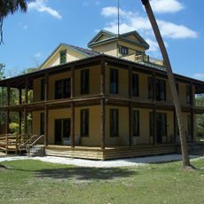
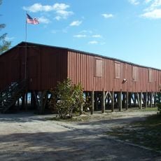
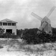
The district was founded in 1923 when it separated from Lee County and was named after Barron Collier, a New York businessman who promoted development of the region. Over the following decades the initially sparse area transformed through road construction and tourism into a growing coastal region.

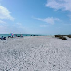
Residents in coastal communities depend on tourism and boating, while further inland agriculture and conservation shape daily routines. Spanish is heard often in shops and public buildings, as more than a quarter of the people have Latin American roots.

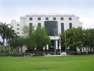
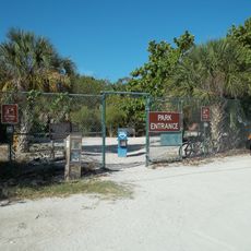
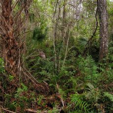
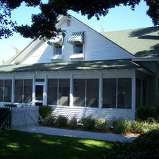
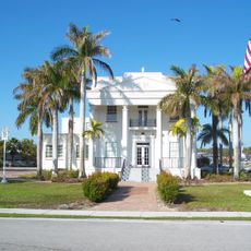
The administration is based in East Naples, where offices, libraries and schools can be reached. Those wishing to visit the conservation areas in the east should bring insect protection and water, as the trails often pass through wet landscapes.

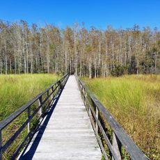
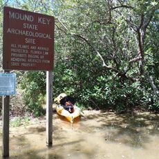
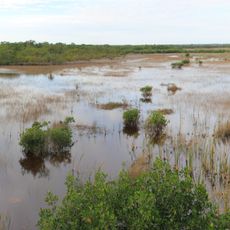
Big Cypress National Preserve in the southeast protects rare orchids and Florida panthers, which now occur in only a few areas of the peninsula. Visitors can walk on raised wooden boardwalks through the wetland without disturbing the delicate ground.

The community of curious travelers

AroundUs brings together thousands of curated places, local tips, and hidden gems, enriched daily by 60,000 contributors worldwide.

Start exploring
Location
Inception
May 8, 1923
Capital city
East Naples
Reference
12-021
Shares border with
Hendry County, Broward County, Miami-Dade County, Monroe County, Lee County
GPS coordinates
26.08000,-81.40000
Latest update
December 14, 2025 03:19
Around this place
Cape Romano Dome House
United States of America

Cape Romano Dome House

38.4 km
Corkscrew Swamp Sanctuary
United States of America

Corkscrew Swamp Sanctuary

38.7 km
Lovers Key State Park
United States of America

Lovers Key State Park

59.2 km
Koreshan State Historic Site
United States of America

Koreshan State Historic Site

57.2 km
Delnor-Wiggins Pass State Park
United States of America

Delnor-Wiggins Pass State Park

48.3 km
Naples Zoo
United States of America

Naples Zoo

40.3 km
Florida Panther National Wildlife Refuge
United States of America

Florida Panther National Wildlife Refuge

10.5 km
Fakahatchee Strand Preserve State Park
United States of America

Fakahatchee Strand Preserve State Park

9.1 km
Picayune Strand State Forest
United States of America

Picayune Strand State Forest

10.8 km
Naples Botanical Garden
United States of America

Naples Botanical Garden

37.2 km
United States of America

Mound Key Archeological State Park

60.1 km
Marriott Beach
United States of America

Marriott Beach

37.1 km
Lowdermilk Beach
United States of America

Lowdermilk Beach

42.1 km
Collier-Seminole State Park
United States of America

Collier-Seminole State Park

23.4 km
Ted Smallwood Store
United States of America

Ted Smallwood Store

30.3 km
Palm Cottage
United States of America

Palm Cottage

40.8 km
Ten Thousand Islands National Wildlife Refuge
United States of America

Ten Thousand Islands National Wildlife Refuge

24.8 km
United States of America

Teddy Bear Museum of Naples

39.5 km
United States of America

Ah-Tah-Thi-Ki Seminole Indian Museum

49.2 km
United States of America

Bonita Beach Causeway

60.1 km
United States of America

S.S. Jolley Bridge

33.6 km
United States of America

Estero Bay Preserve State Park

57.9 km
United States of America

Vanderbilt Beach

46.4 km
Keewaydin Club
United States of America

Keewaydin Club

40.1 km
Old Collier County Courthouse
United States of America

Old Collier County Courthouse

24.8 km
Tigertail Beach
United States of America

Tigertail Beach

37.3 km
United States of America

FGCU Soccer Complex

56.5 km
The Baker Museum
United States of America

The Baker Museum

43.2 km
Show the full map
Administrative divisions
« Collier County - County in Florida, United States » is provided by Around Us (aroundus.com). Images and texts are derived from Wikimedia project under a Creative Commons license. You are allowed to copy, distribute, and modify copies of this page, under the conditions set by the license, as long as this note is clearly visible.

Discover hidden gems everywhere you go!

From secret cafés to breathtaking viewpoints, skip the crowded tourist spots and find places that match your style. Our app makes it easy with voice search, smart filtering, route optimization, and insider tips from travelers worldwide. Download now for the complete mobile experience.

Around Us App Screenshot

A unique approach to discovering new places

Le Figaro

All the places worth exploring

France Info

A tailor-made excursion in just a few clicks

20 Minutes

Around Us
Travel Guide & Maps
Download

Send to your phone

QR Code
1

Open the camera app on your mobile.

2

Point at the QR code with your camera. A notification will appear.

3

Tap the notification to open the link.