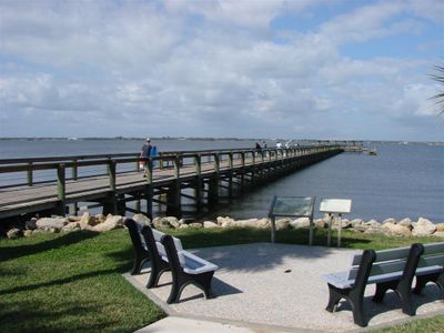
Melbourne Beach Pier
Melbourne Beach Pier is a wooden structure dating to the late 1800s that extends over the Indian River Lagoon at the corner of Ocean Avenue and Riverside Drive. Built from wooden planks and pilings, the pier remains an open walkway offering views of the water and surrounding landscape to all who visit.
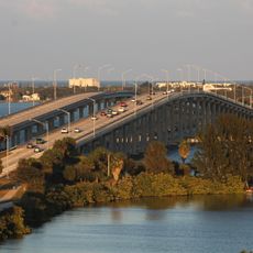
The pier was built in 1888 and 1889 by the Indian River and Atlantic Railway Company to connect the island with the mainland and enable the transport of goods and travelers. Its transportation role was eventually replaced by a toll bridge built in 1921 between Melbourne and Indialantic, after which the pier shifted toward recreational use.
The pier served as the heart of community life in Melbourne Beach, functioning as a gathering place where residents and visitors connected beyond its role as a transportation hub. Today, this social tradition continues as people gather here to share the water views and reflect on the area's past.
The pier is located at the corner of Ocean Avenue and Riverside Drive in central Melbourne Beach and remains accessible year-round. A nearby park called Ryckman Park provides picnic tables and playground equipment, making the area convenient for families and visitors of all kinds.
The pier housed the community's first post office at its eastern end beginning in 1894, demonstrating its central role in daily life and communication for early residents. A ferry service operated from the pier between 1889 and 1923, connecting the community in ways that were eventually replaced by modern infrastructure.
The community of curious travelers
AroundUs brings together thousands of curated places, local tips, and hidden gems, enriched daily by 60,000 contributors worldwide.